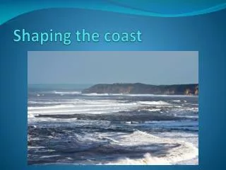
The Coast
This comprehensive overview explores the dynamic nature of coastal zones, focusing on the characteristics and functions of barrier beaches and islands. It covers the types of coasts, including primary and secondary formations, and discusses the processes of sediment transport, wave action, and storm impacts. The text examines the ecological and geological significance of barrier systems, their protective roles, and their vulnerability to sea-level rise and human activities. Key features include types of barriers, origins, and evolution, emphasizing their importance for coastal ecosystems and communities. ###

The Coast
E N D
Presentation Transcript
Coast Shore Beach Moraine Delta Alluvial Plain Sea stack Berm Tombolo Accretion Jetty Groin Chapter 11 Homework Questions pg 307 2,4,7,9,12,14
Major Zone • Coastal zone: The area that is changed by the processes of the sea from the breaker zone to the uplands of the shore. • Shore: Outer limits of the waves down to the area that the waves directly influence
Types of Coast • Primary Coasts -Glaciers -Sea level rise -River runoff erosion -Tectonic plate moving
Types of Coast Cont. • Secondary Coast: formed by marine processes. -Wave Action -Storms -Currents
Barrier Beaches • Characteristics of Barrier Beaches A. Elongated narrow landforms B. Composed of sand and other loose sediments transported by waves, currents, storm surges, and wind. C. Dynamic (Eroding or accreting) D. Low land masses
Barrier Beaches Cont. • Functions of Barrier Beaches A. Protect mainland, sounds, salt marshes, sand, and mud flats from ocean energies (wave attack) B. Locations for lighthouses, fishing communities, Coast Guard stations and ports. C. Aesthetic Value D. Valuable habitat for mammals, waterfowl, fish, and shellfish
Barrier Beaches Cont. E. Development/Tourism Leads to research to determine their geologic and ecologic characteristics to define barrier carrying capacities and susceptibility to storm damage
Barrier Beaches Cont. • Location of Barriers A. Found from the rocky headlands of Maine to the salt flats of south Texas B. Protect 2700 miles of shoreline
Barrier Island Types • Barrier Spit- barrier beaches that are attached at one end to a source of sediment and extend into open water. • Caused by long shore currents moving abundant sand and gravel from eroding cliffs. • Types of Spits • Simple • Double • Recurved • Complex
Barrier Island Types Cont. • Location of barrier spit • Maine • New Jersey • Massachusetts • Virginia
Barrier Island Types Cont. • Barrier Island- barrier beaches not connected to source of sediment (most commonly recognized offshore structure) • Classified according to • Tide- Microtidal- less than 6 feet and Mesotidal- 6-12 feet • Sand supply- Transgressive- sand deficiency and Regressive- accretion- multiple dune ridges)
Barrier Island Types Cont. • Types of Barrier Islands • Microtidal Transgressive- Outer Banks • Microtidal Regressive- Bogue and Shackleford Banks • Mesotidal Transgressive- Morris and Caper Islands in SC • Mesotidal Regressive- Bulls Island in SC • Capes- Barrier islands that project in to the sea to form a right-angled shoreline. Hatteras, Lookout, Fear
Barrier Island Types Cont. • Bay Barriers- barrier beaches that are connected at both ends to headlands- Northern New England • Types of bay barriers • Baymouth Barriers- connect head lands together- Martha’s Vineyard, Mass. and RI shoreline • Tombolo- Island attached to headland (glacial or volcanic in origin) EX California Coast
Origin of Barrier Beaches • Ridge submergence • As sea level rose, dune ridges on seaward edge of mainland became barrier islands. • Lower areas behind these ridges were flooded, creating lagoons (sounds). • Major means of barrier formation along the Southeast Atlantic USA
Origin of Barrier Beaches Cont. • Submarine bar upbuilding • Material from the nearshore bottom is transported landward by waves to form an offshore bar • Eventually builds above sea level as barrier beach • Some small Gulf Coast barrier islands have originated this way.
Origin of Barrier Beaches Cont. • Spit Accretion • Sand is transported by littoral drift (longshore currents) and builds up to form a spit • If inlets form the spit may become an island • Example- Barrier island system of Cape Cod and south shore of Long Island
Origin of Barrier Beaches Cont. • Delta sediment changes • Small barriers form on deltas through wave action and reworking of river sediments • Example- Mississippi Delta and along the coast of Maine
Barrier Evolution- “The Sand Sharing System" Cont. • Causes of evolution of barriers • Rate of sea level rise- If sea level rises 1 ft, the barrier must move 100-1,000 ft or it will drown • Sand supply- from offshore and from other barriers • Sea Energy-storms • Littoral drift- average 500,000 cubic yards per year. 1,000,000 cubic yards at Cape Hatteras
Barrier Evolution- “The Sand Sharing System" Cont. • Inlet Dynamics • Overwash • Dune migration • Human Intervention
Barrier Evolution- “The Sand Sharing System" Cont. • Examples of barrier evolution • Storm erosion and natural beach repair • During storms sand is carried offshore to submerged ridges (storm bars) • Gentle waves cause these bars and runnels (troughs) to migrate landward and rejoin beach • A change in any factor may result in a changed beach
Barrier Evolution- “The Sand Sharing System" Cont. • Landward migration • This is often called erosion, but the term retreat is more accurate. • Barriers have been migrating landward since their creation. Have moved 20-70 miles landward • Transported sand buries backbarrier environments. New marshes develop farther landward on leading edge of new sediment.
Barrier Evolution- “The Sand Sharing System" Cont. • Evidence 1) Core samples of beaches show marsh peat under dunes. 2) Salt marsh peat, oyster and tree stumps exposed on beach after storm • Migration speed varies 1) Nauset Island, Mass. Has rapid migration. 2) Hatteras Is. Has remained static and is eroding on ocean and sound side
Barrier Evolution- “The Sand Sharing System" Cont. • Causes of sand transportation to back barrier environments • Storms- Major amount of sand transport occurs during 1) Northeasters 2) Hurricanes • Inlet dynamics • During a storm, waves wash over at low places in dune • High water blown by winds create inlet • Creation of flood tidal delta in bay
Barrier Evolution- “The Sand Sharing System" Cont. • Delta grows • Longshore currents cause inlets to migrate southward- delta grows more • Water path becomes long and tortuous • Inlet closes and marsh grows on old flood tidal delta • Barrier beach is widened
Barrier Evolution- “The Sand Sharing System" Cont. • Overwash Processes • Storm surges allow waves to wash over beach and push sand from beach and dune zone. • Often viewed as a disaster, however it is a continuous process. It enables barrier island to migrate landward (roll over • Overwash fans eventually bury marsh, new marsh develops • Barrier beach is displaced land ward, but ecological units retained. • Overwash process depends on barrier exposure, orientation, storm frequency, tidal range, and vegetation species.
Barrier Evolution- “The Sand Sharing System" Cont. • Dune migration • Principle means of landward migration along some barriers (Mass.) can be accelerated by human intervention. • Aeolian transport (wind) results in dune formation using sand from beach or overwash fan into areas with fences or vegetation to anchor sand. • Dunes can migrate and bury salt marshes and maritime forests. (Jockey’s Ridge)