Download
1 / 13
130 likes | 162 Vues
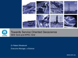
This presentation showcases the SEEGrid Roadshow 2005 Demonstrator project, which features the Web Map Composer tool that enables real-time access to spatial data. Participants can query and retrieve GML-based data, format it into reports, or use it in any enabled application. The benefits include ground truthing existing maps and data samples, analyzing data in the field, reducing the burden of managing survey data, and increasing efficiency for mining and exploration companies.

E N D
Demonstrator Stuart Girvan – Geoscience Australia
Disclaimer • Participants should only act on the information and advice in these presentations after independent consideration of their circumstances SEEGrid Roadshow 2005
Demonstrator Project Participants SEEGrid Roadshow 2005
Web Map Composer GA DOIR PIRSA
Web Feature Services (OGC) Web Map Composer GA PIRSA XML - GML\XMML DOIR
WEB MAP COMPOSER DEMO GA REPORTS DEMO SEEGrid Roadshow 2005
Spatial Data Accessed via WFS Rendered into a map AND queried by a user or…. A user makes a request and gets back GML based data which can be …. … formatted into a report or …. … read and used by any enabled application SEEGrid Roadshow 2005
Questions that real time services can help answer • How much publicly available data is there in the area we’ve targeted? • What kind of sample data is there in the area we’ve targeted? • Do the kinds of geochemical anomalies we’re looking for show up in existing data? • What is the quality of the data that we could use? • All without going to the surveys • All based on the latest available data – no checking for “releases” SEEGrid Roadshow 2005
Practical scenarios and benefits for companies • Ground truthing existing maps and data samples in real time • Analysis in the field - find something interesting – wanted x data set to compare but left it back at the office • WFS is queryable so that most recent data for any given area can be acquired without having to download entire data sets – useful over limited bandwidth capacity • Burden on companies to manage survey data reduced, if not removed • Re-use of any tools and techniques between jurisdictions – increases efficiency of both mining and exploration companies and software developed by SMEs SEEGrid Roadshow 2005
Now – Different formats and standards Proprietary Software Versions of Software Client Data Structures SEEGrid Roadshow 2005
WFS – Same format and standards Client XML GML/XMML SEEGrid Roadshow 2005
Benefits for providers • All agencies get to retain their back end database structures SEEGrid Roadshow 2005
GA Reports Application WebMap Composer CLIENT APPLICATIONS Common Interface Binding – GML/XMML DOIR Web Feature Service (WFS) GA Web Feature Service (WFS) DATA ACCESS SERVICES Translation to standards here PIRSA Web Feature Service (WFS) Geoserver (Open Source) GA Geochemistry Feature Data Source DOIR Geochemistry Feature Data Source PIRSA Geochemistry Feature Data Source DATA SOURCES Little or no change required here Oracle PostGIS (Open Source) PostGIS (Open Source)