Download
1 / 23
230 likes | 374 Vues
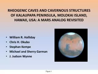
RHEOGENIC CAVES AND CAVERNOUS STRUCTURES OF KALAUPAPA PENINSULA, MOLOKAI ISLAND, HAWAII, USA: A MARS ANALOG REVISITED. William R. Halliday Chris H. Okubo Stephan Kempe Michael and Sherry Garman J. Judson Wynne. Figure 1.

E N D
RHEOGENIC CAVES AND CAVERNOUS STRUCTURES OF KALAUPAPA PENINSULA, MOLOKAI ISLAND, HAWAII, USA: A MARS ANALOG REVISITED • William R. Halliday • Chris H. Okubo • Stephan Kempe • Michael and Sherry Garman • J. Judson Wynne Figure 1.
Figure 2.Comparison of braided lava tube systems on Hualalai Volcano, Hawaii and Olympus Mons, Mars. At upper left is the Poikahe system of Hualalai volcano. Its uppermost hundred meters has the form of a narrow braided complex. It is on private land and still is unmapped. Oblique aerial photo by W.H. At lower right is an unnamed lava tube system on Olympus Mons (NASA PIA06935) of about the same diameter. A short braid is present near the right end of the photographed segment, and a longer, uncollapsed example may be present near its center. Image credit: NASA/JPL/Malin Space Science Systems.
Figure 3.A terrestrial analog of use of Martian lava tube caves as habitations: car camping in Malheur Cave, a privately owned “drive-in” lava tube cave in east-central Oregon. Unfortunately few such “drive-in” lava tube caves are known on Earth. Photo by W.H.
Figure 4. Hi-RISE image of Arsia Mons, Mars, showing “the Seven Sisters”. Image credit: NASA/JPL/University of Arizona.
“Pit Crater” Comparison Jeanne, northern flank,Arsia Mons Volcano,Tharsis Region, Mars “THEMIS visual image, Cushing et al. (2007), GRL L17201” Kau Desert Pit Crater,Kilauea Volcano, Hawaii Figure 5.Low angle view of Kau Desert Pit Craters, Hawaii, with one of “the Seven Sisters” at approximately the same scale. Photo by Gerald Favre and image credit NASA/JPL/University of Arizona.
Figure 6.Looking down one of the KauDeserr Pit Craters, showing solid termination. Photo by Gerald Favre.
Figure 7.Looking up shaft of Wood Valley Pit Crater, Kilauea Volcano, Hawaii (inset). Its diameter is similar to those of “the Seven Sisters”. Photo by Gerald Favre.
Figure 8. Diagram of subterranean system of Wood Valley Pit Crater, Kilauea Volcano, Hawaii. This is the only recorded example of a pit crater as the orifice of an extensive subterranean system on Earth. From Favre, 1993 (by permission).
Figure 9.Caver on rope in HapaiMamo Pit, Mauna Loa Volcano, Hawaii, another pit crater with a diameter similar to those of ”the Seven Sisters”.Photo by W.H.
Parrot Pit Figure 10.Parrot Pit (upper) and Kaupulehu Crater (lower),northwest rift zone of Hualalai Volcano, Hawaii. Parrot Pit is a pit crater with a diameter similar to those of “the Seven Sisters”. Kaupulehu Crater contains a small example of an open vertical volcanic conduit somewhat comparable to that of Kauhako Crater. Aerial photo by W.H.
Na One Pit,Hualalai Volcano, HI Figure 11. Vertical aerial view of Na One Pit, a pit crater on the southeast rift zone of Hualalai Volcano, Hawaii, with a diameter comparable to those of “the Seven Sisters”. The localized elevation of the rim is an accumulation of tephra. Aerial photo by W.H.
Figure 12.Looking down into Na One Pit from the rim. The vertical orifice of the inner pit leading to a total depth of 263 meters below the spillover point of the rim is on the left. Photo by W.H.
Figure 13.Caver on Tyrolean traverse, preparing to lower a 250 meter rope into the inner pit of Na One Pit for its first exploration. Photo by Carol Vesely.
Figure 14.Oblique aerial view of Kalaupapa Peninsula, showing Kauhako Crater and trench. Aerial phto by W.H.
Figure 15.Preliminary geological map of Kalaupapa Peninsula, by C.O.
Figure 16.View across Kauhako Crater, showing Kauhako Lake in center right. Photo by W.H.
Figure 18. Vertical and horizontal diagrams of Kauhako Pit and Lake, from Maciolek, 1982. Divers (M.G. and S.G.) have confirmed the sketched theoretical pattern of the pit to a depth of 122 meters. Note that the vertical section shows the pit to have a level bottom. This has not been confirmed.
Fe-S minerals at 12m Diatom in Fe-S matrix at 12m Calcium carbonate precipitates at 24m Calcium carbonate precipitates at 40m Figure 19. Photomicrographs of biogenic deposits at various depths on the walls of Kauhako Pit, behind bacterial mats and strands, by M.G. and S.G.
Figure 20.Upper end of the Kaupikiawa Cave System, Kalaupapa Peninsula, Hawaii. Photo by W.H.
Figure 21.Lower orifice of Old Ladies’ Cave, on a sea cliff of Kalaupapa Peninsula upslope from the Kaupikiawa system. Note that the entire cross-section of the lava tube can be observed here. Photo by W.H.
Figure 22.Kauhako Trench, downslope from Kauhako Crater. This structure previously has been described as a collapsed lava tube cave, but its diameter is several orders of magnitude larger than the largest terrestrial lava tube cave on record and it instead appears to be an elevated primary lava trench. Coombs et al identified it as an analog of lunar rilles. W.H. photo.
Distances below surface in feet Figure 23.Extended longitudinal section of Ka Lua o Kahoalii. This structure previously has been described as a lava tube cave, but its parameters are unlike those of any terrestrial lava tube cave on record and it appears instead to be a drained part of the feeder system for a lava lake. Its orifice (upper right) is on the surface of this lava lake, about 3 meters from the edge of the inner pit of Kauhako Crater above Kauhako Lake. Its course is immediately beneath the sloping, talus-covered slope of the inner pit above the lake (not shown in Figure 18).