Special Purpose Maps
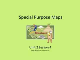
Special Purpose Maps. Unit 2 Lesson 4 www.citizenshipcurriculum.org. Content Expectations 4 - G1.0.5: Use maps to describe elevation, climate, and patterns of population density in the United States. Graphic Organizer. Height above sea level. Precipitation. Factors Influencing Climate.

Special Purpose Maps
E N D
Presentation Transcript
Special Purpose Maps Unit 2 Lesson 4 www.citizenshipcurriculum.org
Content Expectations 4 - G1.0.5: Use maps to describe elevation, climate, and patterns of population density in the United States.
Graphic Organizer Height above sea level Precipitation Factors Influencing Climate Elevation Climate SPECIAL PURPOSE MAPS Temperature Population Density People per square mile
Word Cards • Word Cards from previous lessons needed for this lesson: • Physical Characteristics – Word Card #2 From Lesson 2 • Human Characteristics – Word Card #1 from Lesson 3
The topography of a place refers to both human and natural characteristics. “special purpose map” Special purpose maps help geographers focus on a particular aspect of the topography.
Look at the elevation map. Think about what specific data or information the map shows.
Geographers use special purpose maps to help them learn more about places, allowing them to focus often on a single theme or topic about a place’s topography. This lesson will relate to three different special purpose maps.
Elevation is a physical characteristic of a place and refers to how high a place is above sea level.
Map makers often use color to show elevation. Turn and talk with a partner to draw conclusions about the United States.
Possible conclusions include: • The western part of the U.S. has more areas of high elevation than the east. • The mountains in the western part of the U.S. are higher than those in the eastern part. • There is an area of low elevation between the mountains in California. • Coastal areas in the eastern part are of lower elevation than coastal areas in the Western Part. • Some states like Florida have very low elevation.
Answer the following question in your learning log: How might elevation impact a place?
Possible answers include: • Farming would be difficult in an area of high elevation. • It is hard to build roads in areas of high elevation. • Areas of low elevation are prone to flooding. • Cities are easier to build in areas of low elevation.
<http://maps.howstuffworks.com/united-states-elevation-map.htm<http://maps.howstuffworks.com/united-states-elevation-map.htm
How is color used in this map? What appears to happen to temperature as you move further to the north?
Why do Rocky Mountains and the Appalachian Mountains areas appear to have lower average temperatures than other places that are about the same distance from the equator?
Look at northern Washington. Why does this area have milder temperatures than other southern areas?
Being near large bodies of water like the ocean can affect temperature. This is like the lake effect studied about the climate of Michigan in third grade.
Latitude affects climate.Elevation affects ClimateLarge bodies of water affect climate.
Alaska and Hawaii Annual Mean Daily Temperature Maps Describe the general pattern of temperature for Alaska and for Hawaii. Source: Annual Mean Daily Average Temperature Map for Alaska. 22 Sept. 2008 <http://cdo.ncdc.noaa.gov/climaps/akt0313.pdf>. Source: Annual Mean Daily Average Temperature Map for Hawaii. 22 Sept. 2008 <http://cdo.ncdc.noaa.gov/climaps/hitmp0313.pdf>.
Alaska and Hawaii Annual Mean Daily Temperature Maps Predict what the elevation and land features of various islands are by using the temperature map. Compare predictions to the relief map of Hawaii located at this website: <http://www.hawaii-map.org/relief-map.htm>. Source: Annual Mean Daily Average Temperature Map for Alaska. 22 Sept. 2008 <http://cdo.ncdc.noaa.gov/climaps/akt0313.pdf>. Source: Annual Mean Daily Average Temperature Map for Hawaii. 22 Sept. 2008 <http://cdo.ncdc.noaa.gov/climaps/hitmp0313.pdf>.
Alaska and Hawaii Annual Mean Daily Temperature Maps In general, where are the wettest places in the United States? In general, where are the driest places? How does precipitation west of the Mississippi River compare with that east of the River? What patterns of precipitation exist in the United States? What patterns of precipitation exist on the Hawaiian Islands? Source: Annual Mean Daily Average Temperature Map for Alaska. 22 Sept. 2008 <http://cdo.ncdc.noaa.gov/climaps/akt0313.pdf>. Source: Annual Mean Daily Average Temperature Map for Hawaii. 22 Sept. 2008 <http://cdo.ncdc.noaa.gov/climaps/hitmp0313.pdf>.
Climate Climate refers to weather over a long period of time. Temperature and precipitation maps help geographers to understand about climate in the United States
Climate Data for Selected Cities (Data rounded to nearest whole number)
Charts and graphs are also used by geographers to understand climate. •How does the climate of Albuquerque, New Mexico differ from that of Detroit? •What two cities have very similar climates? •What appears to be the coldest city? •What appears to be the hottest city? Order the given set of data, find the median, and specify the range of values.
What they think this special purpose map represents? ADCDCDGGCCDVBBNNNNNNNNNNVVVVVVN
The bright areas on the map relate to where lights are shining in the United States at night.
There are usually more lights in urban areas than rural areas. What population patterns can be seen on the map?
Possible answers include: •Coastal areas tend to have a lot of people. •The U.S. has several large cities and metropolitan areas. •There are fewer people in the western part of the United States. •There is a huge population center in the Northeast. •Alaska does not have many people. •One of the Hawaiian Islands has a lot more people than the others.
Compare the Metropolitan Map with this map? Locate specific cities on both maps.
Population Density This term refers to the number of people living in a certain area, usually a square mile. The average population density of the United States is about 80 people per square mile, but as the two maps show, there are great differences in population density across the country.
Historians are also interested in population-based maps. Draw conclusions based on map. Exploration and Settlement 1800-1820
Draw conclusions about the population of the United States during this time period. Exploration and Settlement 1800-1820
Possible answers include: •People lived mainly east of the Mississippi River. •In some areas like Florida there were very few settlers. •There were not many cities. •Only the area around Detroit had been settled in Michigan.
What differences they notice from the previous map? EXPLORATION AND SETTLEMENT 1835-1850
•The areas of settlement had grown a lot. •People had moved westward. •People had settled along the Pacific coast. •People were not settled in the southern part of the Lower Peninsula of Michigan. •People had begun to settle in Florida, but most of Florida still had few settlers. •There were more cities now.
• How do the various maps help us better understand the geography of the United States? • How are the maps alike and different? • In what ways are the maps related?
Assessment What are three conclusions you can draw from this map?
Student Resource Interactive United States Elevation Map. 7 October 2008 <http://maps.howstuffworks.com/united-states-elevation-map.htm>. Relief Map of Hawaii. 7 October 2008 <http://www.hawaii-map.org/relief-map.htm>. Teacher Resource Climate Data For Selected Cities. 7 October 2008 <http://www.infoplease.com/ipa/A0762183.html>. Climate Maps of the United States. 7 October 2008 <http://cdo.ncdc.noaa.gov/cgi-bin/climaps/climaps.pl?directive=quick_search&subrnum=>. Egbo, Carol. Supplemental Materials (Unit 2, Lesson 4).Teacher-made material. Michigan Citizenship Collaborative, 2008. Exploration and Settlement:1800-1820 Map. 7 October 2008 <http://www.lib.utexas.edu/maps/united_states/exploration_1800.jpg>. Exploration and Settlement:1835-1850 Map. 7 October 2008 <http://www.lib.utexas.edu/maps/united_states/exploration_1835.jpg>. The Geographic Face of the Nation: Elevation. 7 October 2008 <http://education.usgs.gov/common/resources/mapcatalog/images/topography/Elevation_11x14.pdf>. The Geographic Fact of the Nation: Elevation 56” X 36” Poster. Product ID Number 114587. $7.00. Can be ordered online at: <http://store.usgs.gov/b2c_usgs/b2c/start.do> or by calling 1-888-ASK-USGS. Metropolitan Areas of the United States Map. 7 October 2008 <http://www.lib.utexas.edu/maps/united_states/us_metro_area_99.pdf>. Population Density Map. 7 October 2008 <http://www.census.gov/geo/www/mapGallery/images/2k_night.jpg>. Population Density Map High Resolution Version. 7 October 2008 <http://www.census.gov/geo/www/mapGallery/images/2k_night.pdf>. United States Population Density Map and Information. 7 October 2008 <http://earthobservatory.nasa.gov/Newsroom/NewImages/images.php3?img_id=17439>.