Dive into Oceanography: Explore Earth's Watery World
750 likes | 781 Vues
Discover the wonders of our ocean planet, from marine life to deep sea mysteries. Learn about the vastness and importance of the oceans, their history, and formation. Explore subdisciplines like marine geology, biology, and engineering.

Dive into Oceanography: Explore Earth's Watery World
E N D
Presentation Transcript
MAR 105 - Introduction to Oceanography Professor Pamela Lynch
Why Are You Here? • Long Island is an ISLAND • The Ocean is your backyard
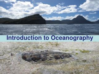
A synthetic view of our ocean planet © digitalife/ShutterStock, Inc.
…and fables… Aug. 1, 2008: “The Montauk Monster”
Important Facts • 81% of the Southern Hemisphere is covered by Ocean (remember that! It’ll become really important later…); while only 61% of the Northern Hemisphere is covered – WHY? • The Oceans are 4X as deep as the Continents are high (average depth = 2.5 miles). • The Pacific (Ocean) is so huge that it covers almost ½ of the Earth’s surface; it is also the Earth’s largest collection of water. • We have 100X more “aquatic” habitats available on earth than terrestrial habitats (1.4 billion cubic kilometers).
The Ocean • EARTH: The only planet w/ Oceans (or liquid water) • Covers 71% of earth’s surface • “Divided” into 4 large basins • Pacific (largest, deepest) • Atlantic • Indian • Arctic (smallest, shallowest) • (sometimes people add a 5th: the Antarctic, “Southern Ocean”)
The Ocean > Covers 71% of the earth’s surface (197 million square miles) • Accounts for 97% of the water on earth (rest in land ice, ground/freshwater, lakes & rivers) • Average depth = 3,796 meters (12,451 feet) (deepest = Mariana trench 11,022 m or 36,163 ft) • Average temp = 3.9oC (only 39oF)
Oceanography: What Is It? • Oceanography is the scientific study of the ocean by applying traditional sciences, such as physics, chemistry, geology, biology, and engineering, to all aspects of the ocean.
Subdisciplines of Oceanography • Marine Geology- • Composition of ocean floor and the earth • Physical oceanography- • Movement of water (waves, currents…) • Chemical Oceanography- • Ocean’s dissolved solids and gases • Marine biology- • marine organisms, the impact of human activities on these organisms • Marine Engineers- • Design and build oil platforms, ships, harbors etc. that enable us to use the ocean wisely
History of Marine Biology/Oceanography • Ocean explored for food, as trade routes, wars, and for voyaging • Mediterranean Sea: 1st voyages then the Atlantic Ocean was explored (900-700 BC). Cartographers (chart makers) on board. • Alexander the Great: (Egypt) Lib. of Alexandria • Christopher Columbus (1492): “new world” discovered by accident. Followed by Magellan (1500’s, Port. navigator) and Cook (1768, comm. of Endeavour voyage) • Charles DarwinNaturalist on HMS Beagle (1831)
History of Marine Biology/Oceanography • First Voyages ever to specifically study the ocean (19 yrs. to publish, 50 volumes) • Challenger Expedition (1872-1876): measuring systems used, species samples • Marine Laboratories • Stazione Zooligica – Naples Italy (1872) • MBL & Woods Hole Oceanograohic Institution– Massachussets • Scripps Institution of Oceanography, CA • Friday Harbor Marine Lab, Washington • Allowed long term observation of living organisms
Capt. James Cook, Royal Navy
HMS Challenger’s track from December 1872 to May 1876. The Challenger expedition remains the longest continuous oceanographic survey on record.
Oceanography… • Then….and Now…
Then… Ben Franklin 1769 Gulf Stream chart
Figure 1.11 NOW: “Aquarius” FL Keyes underwater lab
Us??? • How did WE form? • The earth…continent…US…NY…Long Island…Atlantic Ocean…Long Island Sound
Formation of The Atlantic Coast of North America • Break-up of Pangea (180 mya) • Formation of Atlantic Ocean • Erosion of Appalachian Mountains
PANGEA (the super continent)Formation of The Atlantic Coast of North America • 180 million yrs. ago – all continents were attached together and have slowly moved apart over time • Discovered (S. F. Bacon, 1600’s) “Coasts of continents fit together like a puzzle.” • Lead to theory of continental drift and plate tectonics.
Pangea (reptile fossils) fnft
Formation of Long Island • River erosion carving out the coastal plain to form Long Island Sound Basin (<3 mya) • Glaciers reshaped the area (beginning 3 mya) • The last ice advance (Wisconsinan) ended about 21,000 years ago - deposited terminal moraine in middle of Long Island • Recessional moraines (along North Shore) were left as glacier receded
Formation of Long Island Sound • Glacial Lake Connecticut, which drained (15,000 years ago) • Sea-level rose and ocean entered Long Island Sound Basin • Sea-level rise slowed and marshes began to develop along the margins of the estuary (5,000 - 3,000 years ago) • became what we know as the Long Island Sound
The Formation of Glacial-Marine Sediments Fnft Ice Rafting Glaciers form land and alter sedimentation
Waterbodies of Long Island • East River, Atlantic Ocean • 3 South Shore “Bays:” Great South Bay, Moriches & Shinnecock • “Fork Bays:” The Peconics (& others) • Inputs from Rivers (Conn. + LI) • Long Island Sound
If time permits • 2 “Waterbody” Case Studies • LIS • Shinnecock Bay
Long Island Sound • Important economically and recreationally • 8 million people in watershed, 21 million w/i 50 mile radius “impact area!” • Local residents are the main contributors to the Sound’s degradation • runoff from lawn fertilizing leads to increased nutrients and hypoxia • pathogens enter the food web of the Sound through poor sewage treatment & pet wastes • improper garbage disposal leads to floatable debris
Long Island Sound • 110 miles long (from East River to the Race) • 21 miles wide (Conn. River) • 60-300’ deep (thus SHALLOW - average = 65’; Statue of Liberty is 151’!) • temp. 32-75 degrees F • 1300 square miles • Estuary with two openings to the ocean • 1200 invertebrate and 170 fish species associated (w/ mammals/birds too!)
Long Island Sound • Estuary w/ “salt” water from Atlantic Ocean and 90% of “fresh” water from 3 rivers (Thames, Housatonic, Connecticut) w/ remaining 10% from LI Rivers and groundwater/other sources • Semidiurnal tides influence salinity • Local major Carbon dioxide “sponge” on North Shore • Local area of interest: Port Jefferson Harbor