Download
1 / 7
70 likes | 176 Vues
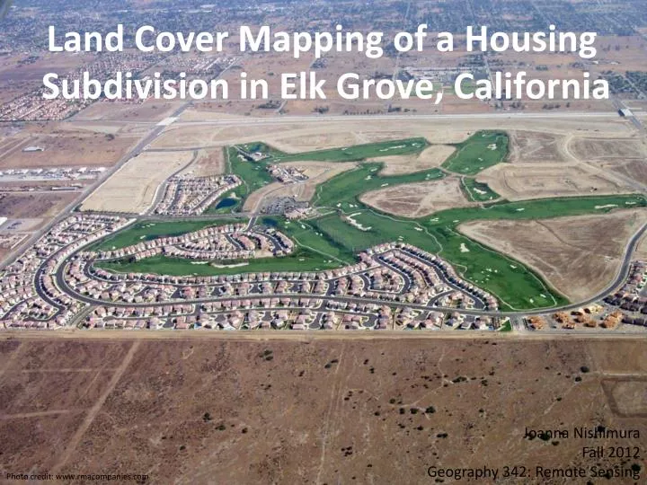
Land Cover Mapping of a Housing Subdivision in Elk Grove, California. Joanna Nishimura Fall 2012 Geography 342: Remote Sensing. Photo credit: www.rmacompanies.com. Study Site. Housing subdivision developed between 2002 and 2010 Southern region of city of Elk Grove 2959 Acres. Imagery.

E N D
Land Cover Mapping of a Housing Subdivision in Elk Grove, California Joanna Nishimura Fall 2012 Geography 342: Remote Sensing Photo credit: www.rmacompanies.com
Study Site • Housing subdivision developed between 2002 and 2010 • Southern region of city of Elk Grove • 2959 Acres
Imagery 2002 2011 • Downloaded from EarthExplorer • High resolution orthorectified aerial photography • 2-foot resolution • Classifications: urban, water, vegetation, shadow, bare earth
Training sites in ArcGIS ArcGIS Interactive Supervised Classification ENVI Supervised Classification
Results Excluding shadows: 14.9% impervious cover in 2002 to 55% impervious cover in 2011 Excluding shadows: 7.4% impervious cover in 2002 to 58% impervious cover in 2011
ENVI 2002 ArcGIS 2002 ENVI 2011 ArcGIS 2011