Download
1 / 21
220 likes | 400 Vues
The Subdivision of Land. Part 3. Conforming the Plat Map. The plat map must conform to the Official Map So, where the Official Map shows roads or canals, the plat map must also show roads or canals, with nothing encroaching on them.

E N D
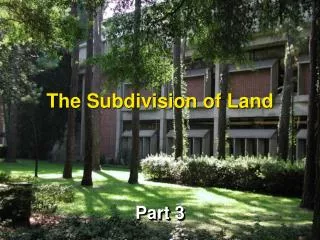
The Subdivision of Land Part 3
Conforming the Plat Map • The plat map must conform to the Official Map • So, where the Official Map shows roads or canals, the plat map must also show roads or canals, with nothing encroaching on them
This plat map shows the development going to the rights of way for the abutting significant features • US 41 – the Tamiami Trail • Krome Avenue • The C-4 Canal • Note that there is no encroachment.
Palm Beach County v. Wright, 641 So.2d 50 (Fla 1994) • A “reservation” • Sort of like reserving a table at a restaurant. • Palm Beach County reserved certain properties for future roadways and nobody could use that property for anything that would impede that future use. • Hey, we’re gonna build a road there! Reserved for future expansion of Southern Blvd Existing Road – Southern Blvd
This is the right of way that was reserved
Well, wouldn’t a “reservation” be a taking because the owner couldn’t use the land? • That’s what Joint Ventures was about. • “Maps of reservation” were invalid because of a violation of due process – • No hearings • No opportunity to present evidence • Etc.
Joint Ventures v Dept of Transportation, 641 So.2d 50 (Fla. 1994) • The Florida Department of Transportation planned for the expansion of state roads in Hillsborough County. • These plans included rights of way acquisitions • The DOT then filed “rights of way reservations” meaning, among other things, that property owners could not encroach on these rights of way (reservations).
At issue in Joint Ventures was a prohibition on “development” – read as plat or site plan approval – if that plat or plan encroached on a reserved right of way. • From the property owner’s perspective, this is a denial of use – all use – and therefore a regulatory taking or inverse condemnation. • In Joint Ventures the Supreme Court found that practice illegal.
Would not Palm Beach County’s “thoroughfare plan” be the same thing? • Any plat or site plan had to confirm to the thoroughfare plan and • Could not encroach on a “thoroughfare.”
What is a “thoroughfare map?” • 163.3177(6)(b) . . . A Comprehensive Plan must have a traffic circulation element consisting of • the types, locations, and extent of existing and proposed major thoroughfares . . .. • Transportation corridors . . . may be designated in the traffic circulation element . . .. • If the transportation corridors are designated, the local government may adopt a transportation corridor management ordinance. [which is what Palm Beach County did]
The claim in Joint Ventures and Wright is that net effect of a “reservation” or a “thoroughfare map” was to prohibit development of land designated for future roadway improvements. • Such prohibition would thus be a per se taking. • i.e., the private property would be taken with the filing of either, so it was just a matter of filing a claim in order to be compensated.
Opinion . . . • By Grimes • “[W]e hold that the adoption of a thoroughfare map is the proper subject of the county’s police power which substantially advances a legitimate state interest. • In fact, the county’s ability to plan for future growth would be seriously impeded without the thoroughfare map.”
Does this mean . . . • . . . that Wight’s property was not taken? • No! • Wight’s facial attack failed. • The simple act of including a thoroughfare map in a comprehensive plan did not constitute a taking of private properties located within the designated corridors. • Wright would have to • apply for development, • be denied, and • then attack the regulations as applied.
But what if Wright was approved with a condition of non-encroachment? • Could this be a denial of a beneficial use? • Denominator Issue