
Uploaded by
yanka
1 SLIDES
117 VUES
10LIKES
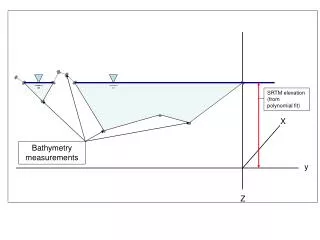
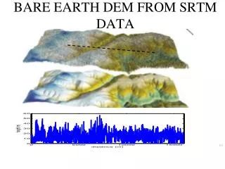
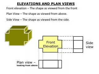
SRTM Elevation Data and Bathymetry Measurements Analysis
DESCRIPTION
Explore the analysis of SRTM elevation data extracted from a polynomial fit and bathymetry measurements. Understand the terrain and water features with advanced mapping tools. Dive deep into the topographic details and underwater landscapes. Enhance your geographical research and planning with accurate elevation and bathymetry data. Discover valuable insights for scientific studies, environmental assessments, and marine explorations.
Download
1 / 1
Télécharger la présentation 
SRTM Elevation Data and Bathymetry Measurements Analysis
An Image/Link below is provided (as is) to download presentation
Download Policy: Content on the Website is provided to you AS IS for your information and personal use and may not be sold / licensed / shared on other websites without getting consent from its author.
Content is provided to you AS IS for your information and personal use only.
Download presentation by click this link.
While downloading, if for some reason you are not able to download a presentation, the publisher may have deleted the file from their server.
During download, if you can't get a presentation, the file might be deleted by the publisher.
E N D


More Related