Download
1 / 17
180 likes | 377 Vues
Modeling of Urban Expansion of Greater Hyderabad Metropolitan Region in India – Scenarios for 2030. Objectives. Development of a spatially explicit urbanization model - based on socio-economic & topographical characteristics.

E N D
Modeling of Urban Expansion of Greater Hyderabad Metropolitan Region in India – Scenarios for 2030
Objectives • Development of a spatially explicit urbanization model - based on socio-economic & topographical characteristics. • Model the spread of urbanization in a fast growing city like Hyderabad • Based on current infrastructure • Based on existing Land use • Based on population distribution • Based on economy Objectives • Development of a spatially explicit urbanization model based on socio-economic & topographical characteristics. • Model the spread of urbanization in a fast growing city like Hyderabad, • Based on current infrastructure • Based on new roads planned • Development of high density transport corridors.
Scope • Model is based on AGENT LUC (‘Anthropogenically Engineered Transformations of Land Use and Land Cover’ ) • Captures urban process • Simulates the changes in urban land use patterns. • The major outcomes are urban land use and population growth.
Statistical Model GDP estimates Population Model Aggregate growth Migration Model
Spatial Model Soil characteristics Land use and Land Cover model Land use changes Resource availability Physical infrastructure Elevation Population distribution
Behavioral Model Rural to urban Rural to rural Intra urban Social infrastructure Perception about wealth
AGENT LUC Model Macroscopic Statistical model (Economy, population etc) Spatial Model (Land use, population Distribution etc) Behavioral model (Perception of wealth and well being) GIS based Land Use Model and Analysis
Perception && Policy Factors Driving Urbanization • Population • Natural growth • Migration • Economy • Service sector – pull • Rural economy - push • Infrastructure • Attracting force • Limiting force • Land use
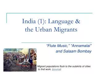
Hyderabad • Rapid growth in population – almost 30% increase from 2001 • Capital of Andhra Pradesh - state was predominantly agri based • IT exports - Rs 22 crore in 1995 >> Rs 20000 crore now
Comparison - 2005 Scenario 1 Scenario 2 High GDP Lower GDP Moderate Population growth Moderate Population growth Scenario 3 Scenario 4 High GDP Lower GDP High Population growth High Population growth
Comparison - 2030 Scenario 1 Scenario 2 High GDP Lower GDP Moderate Population growth Moderate Population growth Scenario 3 Scenario 4 Lower GDP High GDP High Population growth High Population growth
Validation *Population in Millions Area in Sq KM Urban area in 2005 was 714 sq km (source NRSC)
Conclusion • The temporal outcome of this research provides policy makers with scenarios that can be employed in effective planning of infrastructure. • The land use in Urban areas changes with changes in GDP and infrastructure.
Future Work • Simulate the effect of Mass transport corridors like Metro rail on Urban land use and Population Distribution • Sharing short-medium-long term action plan with appropriate government departments • Expanding the above model using Urban modeling to fast growing cities like Hyderabad.