Download
1 / 12
120 likes | 217 Vues
The NASA Short-term Prediction Research and Transition (SPoRT) Center. GOES-R Proving Ground Update 6 January 2014. Contributions from: Kevin Fuell, Geoffrey Stano, Matt Smith, Anita LeRoy. Outline – 6 January 2014 SPoRT Status Report: RGB Imagery

E N D
The NASA Short-term Prediction Research and Transition (SPoRT) Center GOES-R Proving Ground Update 6 January 2014 Contributions from:Kevin Fuell, Geoffrey Stano, Matt Smith, Anita LeRoy
Outline – 6 January 2014 SPoRT Status Report: • RGB Imagery • RGB Evaluation for Aviation and Cloud Analysis(NTmicro, DNB products) • Alaska, Southern and Western Region WFOs • User Feedback • Training module for Alaska users • AWG Support • Assessment reports in progress and to start • JPSS • Collaborations and data processing with UAF/GINA • VSP with Pacific Region • AWIPS II • AWIPS II software teletraining (EPDT) • Future workshops/code sprints • Total Lightning • CO LMA • SPC Collaborations • 2014 Evaluation planning
RGB Evaluation for Aviation and Cloud Analysis Assessment • RGB Products • Nighttime Microphysics • VIIRS Day-Night Band RGBRadiance and Reflectance • Comparing to SPoRT Hybrid 11-3.9 and other products • AK WFOs: Anchorage, Fairbanks, Juneau, (AAWU: tentatively) • WR WFOs: Medford, Eureka • SR WFOs: 6 coastal WFOs • Feedback started early December • AK/WR: 22 user feedback forms • SR coastal: 6 user feedback forms and some blog posts • SR coastal: Will end after Jan. Fog High Clouds Low Clouds MODIS NTmicro RGB – 1/1/2014 at 0545UTC
RGB Imagery Assessment: AK/WR User Feedback • 1/1/14 • The RGB nighttime microphysics imagery show low clouds/fog underneath thin layers of high clouds, which is something we haven't been able to see with traditional fog imagery products. It's a great tool for situational awareness and knowing where low clouds/fog are offshore. • 12/29/13 • Tonight, was able to discern the low clouds from the fog using the RGB imagery. This also allowed me to narrow my area for the dense fog advisory for this morning. • 12/28/13 • Helped with the issuance of dense fog advisory. • 12/26/13 • The night time micro RGB was by far the easiest to analyze. It's a huge improvement over the legacy products.
RGB Imagery Assessment: SR Coastal User Feedback • 12/25/13 • I was able to use the VIIRS Nighttime microphysics 12/25 736 UTC image to see the low strato cu cloud cover that was developing on the edge and under mid/high level clouds. It gave me confidnce on the 9Z taf update to increase the 4 kft cloud cover in the HOU and IAH TAFS. • 12/10/13 • Still getting used to the RGB Day/Night microphysics and Reflectance/Radiance products. There is a considerable amount of detail present with respect to cloud thickness, cloud top temperature. Still having some trouble seeing the difference between stratus and fog. • 12/11/13 • I find little, if any utility in a product that is so rarely available. In fact, there are times that we don't get a new image on my entire shift.(processing issue) • 11/27/13 • Wish the RGB Nighttime, Radiance and Reflectance imagery were available from a geostationary satellite. Still, the limited data provided excellent spatial coverage.
RGB Training Module for AK users • AK-centric examples • Similar to SR micro-lesson on same topic • MODIS and VIIRS case in McCarthy, AK • Nighttime Microphysics and Day-Night Band • 15 minutes of audio • User interaction to identify features in RGBs • Reviewed by Eric Stevens of GINA
Assessment Reports • In progress • Quantitative Precipitation Estimate (QPE) with AK and San Juan • Has been reviewed by users, developers and internally • Second version is being edited • VIIRS Front Range Night-time Applications • First draft has been reviewed and edits being made • GOES-R Convective Initiation • Summary being written of testbed user experiences with new version • Starting • RGB Imagery for Aviation and Cloud Analysis with Southern Region Inland WFOs
AMS Activities Related to Sat. Proving Ground ~8 Presentations and ~3 Posters topics: • AWIPS II, Lightning Tracking Tool • Total Lightning case study: Moore OK Supercell • Hybrid in AK as proxy to ABI • RGB Dust – new capability • RGBs compared to Hyperspectral IR retrievals • Assimilation of Hyperspectral IR retrievals into WRF • Transition of AIRS Ozone to Operations • VIIRS Front Range Nighttime Imagery Assessment • Assessment Methodology and Experiences
JPSS PG / OCONUS • VIIRS included in Assessment of RGB imagery suite • Nighttime Microphysics, Day-Night-Band • RGBs very popular w/ users • Satellite Liaison meeting held at SPoRT Nov 12-14 • All liaisons in attendance • Established bi-monthly coordination call • Set SPoRT focal point for each liaison • Hawaii VSP proposal funded • Planning w/ Bill Ward has begun for data access and potential local processing in future • Processing on GINA Virtual Machines • Hardware causing some processing latency • SPoRT RGBs & Hybrids via LDM from GINA to WFOs • Ongoing telecons with GINA and AK WFOs
AWIPS IIExperimental Products Development Team Teletraining sessions on bi-weekly basis continue (topics: data access framework, review of subgroup projects) Future: -Spring2014: March/April/May (?) Huntsville, AL Group A (same attendees): Advanced training Group B (new attendees): Basic training -Fall2014: Code Sprint
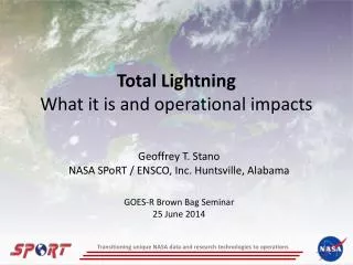
Total Lightning Update • AWIPS II performance evaluation complete • WFO Boulder now added to the LMA plug-in ATAN • Transition Colorado LMA to WFO Boulder in AWIPS II soon • Working to move PGLM mosaic into operations at SPC • Preparing for 2014 evaluations • New VSP accepted • Collaborations with Albuquerque, Boulder, Cheyenne, and SMG • Aviation collaborations • CWSU Albuquerque, Denver, and Houston 1442 UTC Total Lightning 3.4° Reflectivity, ~20 kft 1450 UTC 1452 UTC Transitioning unique NASA data and research technologies to operations