Assignment 3: Building and Site Analysis
Assignment 3: Building and Site Analysis . Hola -Hi Youth Home. Scope of the Thesis Is for the design of a home (orphanage) for children between the ages of 10 and 14. Home in a residential setting based on a sustainable design and environmental preservation considerations.

Assignment 3: Building and Site Analysis
E N D
Presentation Transcript
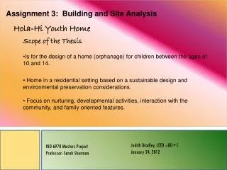
Assignment 3: Building and Site Analysis Hola-Hi Youth Home • Scope of the Thesis • Is for the design of a home (orphanage) for children between the ages of 10 and 14. • Home in a residential setting based on a sustainable design and environmental preservation considerations. • Focus on nurturing, developmental activities, interaction with the community, and family oriented features. Judith Bradley, LEED AP BD+C January 24, 2012 IND 6970 Masters Project Professor: Sarah Sherman
Property Physical Characteristics— • 260 acres of rolling hills • Half forest and half open land • Beautiful view of the entire Valley (Valle General) below and • the Chirripo Park above • 4200 ft of elevation providing a variety of climate zones • Hiking paths, horse stable, pole barn, internal road(s), fruit trees • Electricity from a hydropower plant on the property. • Already a house on the property that can be used for a residence and office at start of construction. • Traffic— • San Isidro del General (Perez • Zeledon) is 40 minutes away. • Perez Zeledon is the fastest • growing city in the country. • Pacific Coast is 45 minutes from • the site. • San Jose is 3 hours by the Pan • American highway. • Most of the property is surrounded • by lands that are private or state • protected; it is considered old forest . • City lights can be seen at night. • There is 1,978 meters (1.2 Miles) of Road frontage. • Water Features— • There are 6 creeks, springs, a large and small waterfalls Property Features Location: San Isidro de El General, Costa Rica.
Recreational Center Selection • Small footprint • Youth home needs a gymnasium • and the size and height is • required for the home’s facility • An approximate 8,194 sq ft is • needed for the home’s rec center • so the court is little larger than • needed, but will probably take • advantage of the entire facility • The windows on the front will take advantage of the beautiful view of the valley • The area between the entry and the courts will be used for the admin space and the front lobby. Can be suitable for entertaining • The back section of the center will be the housing for the children and the caregivers. Reasons for Site Selection Views of the building’s exterior and interior *Central Intelligence Agency. The world factbook. ISSN 1553-8133, Retrieved from https://www.cia.gov/library/publications/the-world-factbook/geos/cs.html , on September 30, 2011. Recreational Center
View Diagram • Casual • environment • Agriculture • Texture • Take advantage • of the views • Eco technology • is a natural Current Site N View to the North of Chirripo Park • The homes should • take advantage of • the park views on • the back of the • building. The • homes are the • main focus of the • project. • Gardens and • Outdoor projects • involving the youth • can be developed. • The Administration • tasks should be • on the south of the • building where • there is more • action. W E S View to the West of the city East to Caribbean Sea View to the South N Future Site` 1874_22-finca-12.JPGImage 22 of 30
Court—10,612 Sq Ft Square Footage Admin –9,073 Sq Ft Back Facilities—6,798 Sq Ft Recreational Area—4,724 Sq Ft Square footage provides a starting place for organizing the required space for the home First Floor Square Footage Court—10,612 Sq Ft Back Facilities—6,848 Sq Ft Recreational Area—10,494 Sq Ft Second Floor Square Footage N *Central Intelligence Agency. The world factbook. ISSN 1553-8133, Retrieved from https://www.cia.gov/library/publications/the-world-factbook/geos/cs.html , on September 30, 2011. Square Footage of the Rec Center as it is
There are 260 acres of rolling hills so there is no noise other than nature • The Pan American highway is the major route through Costa Rica. It is close but not so close that it can be heard. • The site has its own roads • There is 1,978 meters (1.2 Miles) of Road frontage. • San Isidro lights can be seen at night. • The site butts up to Chirripo National Park to the North. • There are 6 creeks, springs, a large and small waterfalls. • Parking will need to be established Site and Exterior Enclosure Diagrams • Noise is only • from nature • Roads on the • property are back • roads. Except for • the 1.2 miles of • frontage. Chirripo National Park 1.2 Miles of road Frontage Pan American Highway Falls, Creeks, and Springs City Lights in Distance Recreational Center Placed on Site Agricultural Land and Forest N *Central Intelligence Agency. The world factbook. ISSN 1553-8133, Retrieved from https://www.cia.gov/library/publications/the-world-factbook/geos/cs.html , on September 30, 2011. Building on Site
Spatial Diagrams Spatial Analysis provides information on the exits and entries to the building. The vertical access is also recognized LEGEND First Floor Linkages to Exterior and interior Vertical Assess Largest Spatial Distribution Exterior Linkage to Interior Available Interior Second Floor • The building feature a variety of spatial shapes and angles that will add intrigue to the design. N *Central Intelligence Agency. The world factbook. ISSN 1553-8133, Retrieved from https://www.cia.gov/library/publications/the-world-factbook/geos/cs.html , on September 30, 2011. The Spatial Diagrams is a Study of the space allocations
Zoning Diagrams LEGEND Exterior Edge Condition Interior Edge Condition Service Zone Public Zone Semi-Private Private Semi Private Column Grid Daylight First Floor Second Floor N *Central Intelligence Agency. The world factbook. ISSN 1553-8133, Retrieved from https://www.cia.gov/library/publications/the-world-factbook/geos/cs.html , on September 30, 2011. Public, Private, and Semi private Information
Structural Diagram LEGEND First Floor Structure Egress Exits/Entry Bearing Wall Grid Patterns Columns Second Floor Structure N *Central Intelligence Agency. The world factbook. ISSN 1553-8133, Retrieved from https://www.cia.gov/library/publications/the-world-factbook/geos/cs.html , on September 30, 2011. Structural Features
D3 D4 Circulation Diagrams D2 The circulation could be either Linear or Arial. It will depend on the layout of the areas. Path are logical flow. District are defined to provide some space where centers will be Located. D1 LEGEND District Designation Landmarks Arrival/Exit Space Primary Path Secondary Path Node Districts First Floor D6 D5 D7 Second Floor N *Central Intelligence Agency. The world factbook. ISSN 1553-8133, Retrieved from https://www.cia.gov/library/publications/the-world-factbook/geos/cs.html , on September 30, 2011. The Circulation Diagrams provide an analysis of the circulation patterns.
Materiality Diagrams First Floor Exterior • The exterior of the building is • CBS construction with stucco siding. • Red and Yellow coloring is applied • with stucco in select spaces.. • There is extensive curtain wall • exposure on what will be the east, • and south. Second Floor N *Central Intelligence Agency. The world factbook. ISSN 1553-8133, Retrieved from https://www.cia.gov/library/publications/the-world-factbook/geos/cs.html , on September 30, 2011. The Materiality Diagrams provides information about the materials used in the structure.
Materiality Diagrams First Floor Interior • The interior of the building also • looks to be CBS construction with • stucco finishes. • Red and Yellow coloring are • applied with stucco in select • spaces. • There is again extensive glazing • use on the interior. • Stainless steel is a popular • treatment. • Fluorescence lighting is used in • the corridors. • It appears that rugs and vinyl tile • areused on the floor. Second Floor N *Central Intelligence Agency. The world factbook. ISSN 1553-8133, Retrieved from https://www.cia.gov/library/publications/the-world-factbook/geos/cs.html , on September 30, 2011. The Spatial Diagrams is a Study of the space allocations
Notes:• = Daylight saving time, * = Next day. How to read this graph? Change preferences. MEP General information about sunrise and sunset. The graph shows data on dusk and the sun and dawn. • HVAC has to • be re-designed • since the current • system is • connected to • the chiller • on campus. • The plumbing • system is also • different since • it will need to be a • septic tank. There • will need be • pumps installed to • control the input • of water from the • available sources • on the property or • from • rainwater. *Central Intelligence Agency. The world factbook. ISSN 1553-8133, Retrieved from https://www.cia.gov/library/publications/the-world-factbook/geos/cs.html , on September 30, 2011. Information for Acquired During Building Analysis
MEP The orange lines correspond to the sun’s rays over the Site. The numbers identify the elevation of the sun as shown in the graph. The globe identifies the path of the sun in the summer on the top and the winter on the Bottom. 10 15 13 16 14 9 8 7 17 12 11 110 250 N
San Isidro, Costa Rica – Solar energy and surface meteorology These data were obtained from the NASA Langley Research Center Atmospheric Science Data Center; New et al. 2002Notes:Help. Change preferences. San Isidro, Costa Rica – Basic information Latitude: +9.37 (9°22'12"N)Longitude: -83.71 (83°42'36"W)Time zone: UTC-6 hoursLocal time: 10:06:02 Country: Costa Rica Solar Energy And Surface Meteorology *Central Intelligence Agency. The world factbook. ISSN 1553-8133, Retrieved from https://www.cia.gov/library/publications/the-world-factbook/geos/cs.html , on September 30, 2011. General Information that may be of Value Sustainability
Global Wind Image Description:The Global Current Wind image shows current wind in kilometers per hour around the world, color contoured every 5 knots. Actual winds are given at selected cities. Wind direction is determined by the direction from which it originates. For example, a northerly wind blows from the north to the south. Wind is the flow of air that occurs as it is heated by the sun and thus rises. Cool air then occupies the area from which the hot air has moved, creating what could loosely be termed a convection current. Winds are commonly classified by their spatial scale, their speed, the types of forces that cause them, the geographic regions in which they occur, or their effect. N *Central Intelligence Agency. The world factbook. ISSN 1553-8133, Retrieved from https://www.cia.gov/library/publications/the-world-factbook/geos/cs.html , on September 30, 2011. General Information that may be of Value Sustainability
Site Survey N *Central Intelligence Agency. The world factbook. ISSN 1553-8133, Retrieved from https://www.cia.gov/library/publications/the-world-factbook/geos/cs.html , on September 30, 2011.
Site Survey With Rec Center N *Central Intelligence Agency. The world factbook. ISSN 1553-8133, Retrieved from https://www.cia.gov/library/publications/the-world-factbook/geos/cs.html , on September 30, 2011.