Location, location, location…
300 likes | 831 Vues
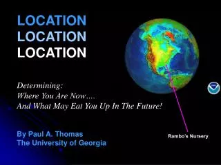
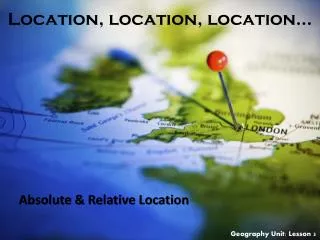
Location, location, location… . Absolute & Relative Location. Geography Unit: Lesson 3. Location. Where places are located on earth 2 types of Location Absolute Location An exact spot on earth (fixed—doesn’t change) Latitude/Longitude Hemispheres Grid System Address

Location, location, location…
E N D
Presentation Transcript
Location, location, location… Absolute & Relative Location Geography Unit: Lesson 3
Location • Where places are located on earth • 2 types of Location • Absolute Location • An exact spot on earth (fixed—doesn’t change) • Latitude/Longitude • Hemispheres • Grid System • Address • Relative Location • Location determined by comparing one location to another (variable—changes based on your starting point) • Miles • Distance • Direction • Example: Canada is north relative to the USA. The USA is south relative to Canada.
Let’s look at a globe… • What are some things that you see? • Do you see land? • Do you see water? • Do you see lines? • Are there really lines on the globe? • These are imaginary lines that help us find absolute location. • Does anyone know any of the names of the imaginary lines?
Imaginary Lines Arctic Circle Tropic of Cancer Equator Prime Meridian Tropic of Capricorn Antarctic Circle
Imaginary Lines Game • To help us understand the positions on the globe we use imaginary lines. NOSE PRIME MERIDIAN HEAD NORTH POLE EARS ARTIC CIRCLE SHOULDERS TROPIC OF CANCER WAIST EQUATOR KNEES TROPIC OF CAPRICORN ANKLES ANTARCTIC CIRCLE TOES SOUTH POLE
Graphs • You may be familiar with this type of graph from math class. It’s a line graph. • The graph is made up of different “points” with lines that connect the points.
Y axis Graphs • Each point has two values • The “X” value that runs along the horizontal “X” axis • The “Y” value that runs along the vertical “Y” axis X axis
graphs • X value stated first, followed by the Y value (X, Y) • When the X and Y value are both zero this is called the point of origin (0, 0) Y (3,8) (9,5) X (0,0)
graphs • A point can also have negative values (-) • Negative X value are to the left of the origin • Negative Y value are below the origin Y (-X,+Y) (+X,+Y) (0,0) X (-X,-Y) (+X,-Y)
From Graphs to Maps • Let’s apply the coordinate plan from math class to maps. • Which imaginary line coincides with the X axis? • The Equator • Which imaginary line coincides with the Y axis? • The Prime Meridian • When the X and Y axes intersect on a map it called a set of latitude and longitude coordinates. Y X
The earth can be divided into hemispheres. • hemi=half • sphere=globe • What is the name of the imaginary line that divides the Earth into a northern & southern hemisphere? • Equator • What is the name of the imaginary line that divides the Earth into a western & eastern hemisphere? • Prime Meridian
Quadrants of the Globe N • Using the Equator and the Prime Meridian as the point of origin the earth is divided into four quadrants, or quarters. • The quadrants are designated by either N or S AND E or W. W E S
Quadrants of the Globe • What does the N and S indicate in terms of position on the earth? • N indicates above the equator • S indicates below the equator • What does the E and W indicate in terms of position of the Earth? • E indicates East of the Prime Meridian • W indicates West of the Prime Meridian (N, W) (N, E) (S, W) (S, E)
Quadrants of the Globe ? ? NW NE Arctic Circle Tropic of Cancer Equator Prime Meridian Tropic of Capricorn Antarctic Circle ? ? SW SE
Quadrants of the Globe North America is North of the Equator and West of the Prime Meridian • In which quadrant is North America? (N, W)
Quadrants of the Globe • In which quadrant would Australia be located in? • This means the latitude & longitude coordinates would be (S, E) ? Australia is South of the Equator and East of the Prime Meridian (S, E)
What exactly is latitude? • Latitude is the distance N or S from the equator and is measured along the Y axis • Values are expressed in degrees from 0°-90° N or S • What will all points along the equator have? • 0° 90°N Y X 90°S
Lines parallel to the Equator are lines of latitude, or parallels
East is the direction of rotation of the Earth Latitude: (90oN to 90oS) Tropic of Cancer Latitude 23½o North 21st June 66½o 23½o 90o 22nd Sept 20th March North Pole Equator Latitude 0o 23½o 900 22nd December Tropic of Capricorn Latitude 23½o South South Pole Positioning on the Earth’s Surface
longitude • Longitude is the distance E or W from the Prime Meridian measured on the X axis • What value will all points located on the Prime Meridian have? • Value is expressed from 0°-180° E or W • 360° total (degrees in circle!) Y X 180°W 180°E
Lines that are east or west of the Prime Meridian are lines of longitude, or meridians
East is the direction of rotation of the Earth Longitude: (180oE to 180oW) Prime Meridian 0o Longitude 30oE Equator Latitude 0o Longitude 90o West Longitude 90oEast Longitude 60o West Longitude 60o East Longitude 30o West Longitude 30o East Positioning on the Earth’s Surface
Look at the diagrams. • How are lines of latitude and longitude measured? • degrees
East is the direction of rotation of the Earth Latitude: (90oN to 90oS) Longitude: (180oE to 180oW) Prime Meridian 0o Longitude Tropic of Cancer Latitude 23½o North 21st June 66½o 90oE 60oE 30oW 30oE 60oW 90oW 23½o 90o 22nd Sept 20th March North Pole Equator Latitude 0o 23½o 900 22nd December Tropic of Capricorn Latitude 23½o South Longitude 90o West Longitude 90oEast Longitude 60o West Longitude 60o East Longitude 30o West Longitude 30o East South Pole Positioning on the Earth’s Surface Latitude and Longitude together enable the fixing of position on the Earth’s surface.
In which quadrant are these coordinates located in? • Use the map on your notesheet and a PENCIL to plot the coordinates and label with the correct quadrant (A, B, C, D). 1. 40°N, 20°E 2. 37°N, 76°W 3. 72°S, 141°W 4. 7°S, 23°W 5. 15°N, 29°E 6. 34°S, 151°E
A B 1 2 4 5 6 3 C D 1. B 2. A 3. C 4.C 5. B 6. D
Why is this important? • Using latitude and longitude you are able to locate places on the globe. • With a set of coordinates, you are able to determine the quadrant in which a place is located, making it easier to find on a map. • Also, depending on the degree of latitude, you can approximate what the climate of area might be like. • For example, what do you think the temperature might be like at the following degrees of latitude? Why? • 66°N • O° • 70°S
Latitude/Longitude Practice • Using the Textbook Atlas on A1-A22, work with your partner to find the names of the locations at the coordinates listed on the sheet. • There are hints on the paper to help narrow your focus. • You may have to look at a world map to find the quadrant the coordinates are in, then find a more zoomed in map on that area. • You have until the end of the period.