Download
1 / 29
290 likes | 601 Vues
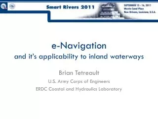
e-Navigation and it’s applicability to inland waterways. Brian Tetreault U.S. Army Corps of Engineers ERDC Coastal and Hydraulics Laboratory. e-Navigation International definition (IMO, IALA) :.

E N D
e-Navigationand it’s applicability to inland waterways Brian Tetreault U.S. Army Corps of Engineers ERDC Coastal and Hydraulics Laboratory
e-NavigationInternational definition (IMO, IALA): “e-Navigation is the harmonised collection, integration, exchange, presentation and analysis of maritime information onboard and ashore by electronic means to enhance berth to berth navigation and related services, for safety and security at sea and protection of the marine environment”
“Information Paper on the Draft IALA Recommendation e-Nav 140 on e-Navigation Architecture – the shore perspective”
e-Navigation: “three sides of the coin” “Information Paper on the Draft IALA Recommendation e-Nav 140 on e-Navigation Architecture – the shore perspective”
e-Navigation issues • Internationally developed – very SOLAS focused • Naturally ship-centric • “blue-water” vs. inland waterways • Still conceptual – IMO implementation plan: • Identify user needs • Develop an e-Navigation architecture • Complete studies: gap analysis, cost-benefit analysis, risk analysis • Plan to be finalized in 2012 • National vs. international interests, capabilities, authorities, etc. • Technical issues • How do we address these? • How can we start to get the benefits of e-Nav sooner?
U.S. National e-Navigation Strategy • “Strategic Action Plan” • Committee on the Marine Transportation System • Concrete efforts • Based on existing systems • To address existing needs
e-Navigation: U.S. e-Navigation Strategic Action Plan “The U.S. vision for e-Navigation is: To establish a framework that enables the transfer of data between and among ships and shore facilities, and that integrates and transforms that data into decision and action information.”
Hydrographic Surveys Maritime Safety Information Coastal Applications & Services The Various E-Navigation Parts Inland Electronic Navigation Charts Navigation Data Center Coastal Structures Management, Analysis, and Ranking Tool River Information Services Center Notice to Mariners Channel Portfolio Tool River Information Services PORTS VTS Hydrodynamic Models NOAA Tide Gages Real Time Current Velocities Cargo Manifest Wind Speed & Direction AIS USACE Tide Gages Federal Industry Logistic Standardization/Federal Initiative Navigation Data Enhancement Lock Operations Management Application USGS Stream Gages Electronic Charts USCG Western Rivers AtoN Data Standards
Summary • e-Navigation is a developing concept • There are huge potential benefits, but some issues • “Third side of the coin” • e-Navigation will be built on existing capabilities – let’s get started!
Thank you for your attention! Brian Tetreault brian.j.tetreault@usace.army.mil
U.S. River Information Servicesbringing e-Navigation to the inland waterways Brian Tetreault U.S. Army Corps of Engineers ERDC Coastal and Hydraulics Laboratory
Overview • RIS concept • RIS-related projects • LOMA • Current capabilities • Future capabilities
Main functions of RIS • Waterway infrastructure information • IENCs • Met-Hydro data (obs. & forecasts) • Navigation Notices/Notices to Mariners • Vessel traffic information • Traffic monitoring • Traffic management (lock management) • Calamity management • Voyage information • Electronic cargo • Voyage planning www.doris.bmvit.gv.at
U.S. RIS concept Other agencies’ data USCG AIS Industry voyage data USCG Vessel data RIS “Portal” One-time, standardized reporting USACE lock operations data • Correlated data: • Dangerous cargo tracking • Waterway statistics • Value added services • Need to address data protection USACE AIS
Lock & waterway info from USACE • Vessel info: • AIS • USCG Barge/Cargo info from industry
RIS-related projects • FILS-FINDE • Data standards and sharing • USCG Louisville testbed • Use USCG AIS capability to transmit USACE lock operations data • Initial data sharing efforts • USCG AVIS information • LOMA – initial RIS “foundation”
Lock Operations Management Application (LOMA) • Provide end users information needed for decision support • Goals: • Increase lock operator situational awareness • Provide vessel operators better information • Provide better information to Corps management • Exchange information with external users • AIS is the central LOMA technology
Station Ashore Automatic Identification System (AIS) Ship - ShipSituational Awareness Ship - ShoreMonitoring, reporting Shore – Ship Navigation info.
Current situation 5 screens – no situational display of approaching vessels Manual entry of statistical data
LOMA overview USCG data capabilities: AIS archive, validation, etc. • Internal and external Navigation data sources: • Met/hydro • Commodity • Voyage plans • Other USCG • Internal applications: • LPMS/OMNI • CPT • Other apps Industry Internal/External web access Web Services: XML, RSS, etc. AIS Service Manager Data Storage Public AIS aboard vessels Other Gov’t agencies Lock Operator GUI
Current LOMA Capabilities • Zone management • Playback capability • Lock operator situational display • AIS vessel information
Current LOMA benefits • Better planning • Advance knowledge of vessel traffic • Reduced equipment cycling • Unexpected benefits • Clearance of debris/drift/ice
Future Capabilities • Integration with other systems • Channel Portfolio Tool • SMARTGate • Industry data • Approaching tow information • Real time met/hydro information • Sensors • Observations • Predictions
Future Capabilities:Predictive tools • Hydrodynamic modeling • Historical observations and analysis • Transit time • Long term predictions, for waterway managers and industry • System optimization • Maximize throughput • Emergency prioritization
Where do we stand? • AIS • USCG Nationwide AIS, LOMA • IENCs • US Army Corps of Engineers, NOAA • Notices to Skippers • Initial harmonization work underway • Electronic voyage reporting • Initial discussions underway ✔ ✔
More information • Conferences: • eNavigation 2011 - Seattle 29-30 November 2011 • http://www.enavigation.org • e-Nav Underway – Copenhagen-Oslo 18-20 January 2012 • http://www.efficiensea.org/ • Working groups: • International: IMO, IALA, PIANC • National: CMTS, FILS/FINDE, RTCM • Online: • LOMA main page: https://loma.usace.army.mil/ (internal USACE only) • USACE CHL website: http://chl.erdc.usace.army.mil/navigationbranch • e-Nav Wiki: http://cirp.usace.army.mil/navwiki/
Thank you for your attention! Brian Tetreault brian.j.tetreault@usace.army.mil