The 50 States
The 50 States. Ashley Moore Education 295. Map of the United States. To complete your own United States map, click on the picture then print the map. New England. Connecticut Maine Massachusetts New Hampshire Rhode Island Vermont . Deep South. Alabama Florida Georgia Louisiana

The 50 States
E N D
Presentation Transcript
The50 States Ashley Moore Education 295
Map of the United States To complete your own United States map, click on the picture then print the map.
New England • Connecticut • Maine • Massachusetts • New Hampshire • Rhode Island • Vermont
Deep South • Alabama • Florida • Georgia • Louisiana • Mississippi Click on each of the states to find out some “Fast Facts” about each of them
Northwest • Idaho • Montana • Oregon • Washington • Wyoming
The Great Lakes • Illinois • Indiana • Michigan • Ohio • Wisconsin For more information and statistics about the Great Lakes, click on the picture.
Pacific West • Alaska • California • Hawaii
Mid- Atlantic • Delaware • Maryland • New Jersey • New York • Pennsylvania • West Virginia
South Central • Arkansas • Kansas • Missouri • Oklahoma • Texas
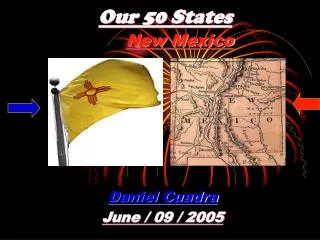
Southwest • Arizona • Colorado • Nevada • New Mexico • Utah
Mid-South • Kentucky • North Carolina • South Carolina • Tennessee • Virginia
Upper Plains • Iowa • Minnesota • Nebraska • North Dakota • South Dakota
References • US State Information, US Maps, and “Fast Fact” sheets and Mid-Atlantic state flags - www.50states.com • Great Lake states picture- www.und.edu/.../ natpark/greatl/greatl.htm • Hawaii picture- www.duncanentertainment.com/ downloads2.php • Alaska picture-www.duncanentertainment.com/ downloads2.php • New England states picture-www.duncanentertainment.com/ downloads2.php • Upper Plain states picture-www.vessco.com/02_ contact/contact.html • Mid-South states picture- web.co.wake.nc.us/.../ POP/Census/roadtour.htm


![Our 50 States: [Alaska]](https://cdn1.slideserve.com/2047428/our-50-states-alaska-dt.jpg)