Download
1 / 12
120 likes | 391 Vues
New Flood Maps for COUNTY through TXCHART. Creating Community Awareness. Collaboration. COMMUNITY began working with FEMA and its mapping partners in MONTH YEAR COMMUNITY provided input and data Meetings included Storm Surge Updates Wave Height Analysis for Flood Insurance Study (WHAFIS)

E N D
New Flood Maps for COUNTY through TXCHART Creating Community Awareness
Collaboration • COMMUNITY began working with FEMA and its mapping partners in MONTH YEAR • COMMUNITY provided input and data • Meetings included • Storm Surge Updates • Wave Height Analysis for Flood Insurance Study (WHAFIS) • Technical Workshops • Community Consultation Meeting
Better Information, Better Community • With better information comes better planning • Develop better ordinances, zoning and land use policies • Makes COMMUNITY/COUNTY more resilient to flooding
Community Role in Public Education & Outreach • Risk Awareness begins at the Local Level • Easily make information available • You are the trusted source • Inform our citizens • Tools and templates available • Review your current Community Outreach Plan • We have products to support your efforts
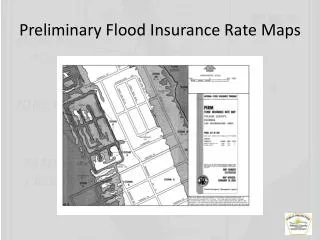
Regulatory Products Received Traditional Mapping Products DFIRM Database Flood Insurance Rate Map
Non-Regulatory Products Received • Changes Since Last FIRM (CSLF) • Risk MAP Coastal Depth Grids • Areas of Mitigation Interest (AOMI) • Flood Risk Report • Flood Risk Database
Moving Forward • COMMUNITY/COUNTY is better served with this information • FEMA created models • Provide to developers and builders to decrease costs • Making COMMUNITY/COUNTY more attractive to development
Sharing the Information • Provide residents and businesses with new information • One year to inform citizen and businesses • Options for community regarding insurance • FEMA provides training and assistance
Public Open House Goals • Promote public awareness of the flood risk • Convey technical information and educate public to use new tools to make informed decisions about their flood risk The Open House meeting: • Led by County and Community FPAs • FEMA supports your Outreach • Interactive Digital Maps, Community tables with paper maps, Engineering support, Insurance Specialists, new flood risk products, coastal mapping video, TXCHART.com assistance
FEMA Resources • TXCHART.com • Riskmap6.com • Key Message App- http://txchart2go.riskmap6.com • Communication Assistance • Flood risk products/flood hazard maps • Media materials • FloodSmart for Local Officials • Social media tips • Coastal fact sheets and resources – available in Spanish, Vietnamese and Haitian Creole
Get the word out to our citizens… • Coastal Texans must be informed; it’s up to everyone to know their risk, know their role, and take action now. • Through flood studies and updated maps, communities in coastal areas will receive more precise flood risk information about the flood risk where they work and live. • Share information about this study with your family and neighbors; visit our website – INSERT WEBSITE