Download
1 / 22
220 likes | 294 Vues
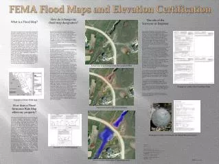
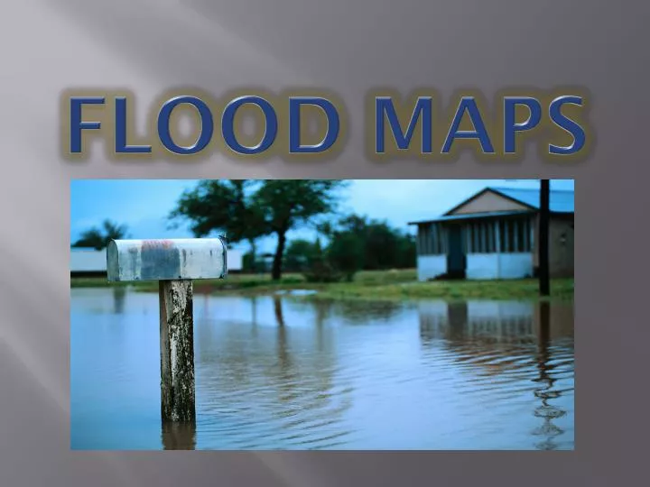
Flood Maps. FEMA Map Service Center. FIRMette Tutorial. Louisiana Mapping Project. Louisiana Mapping Project. WELCOME

E N D
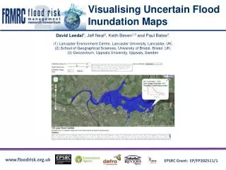
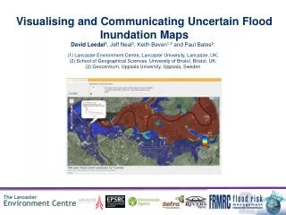
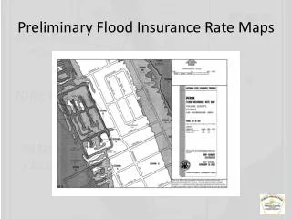
Louisiana Mapping Project • WELCOME • Welcome to the home page for the Louisiana Mapping Project (LaMP). The LaMP effort is being undertaken by Department of Homeland Security’s Federal Emergency Management Agency (FEMA) as part of its ongoing nationwide effort to update and modernize flood hazard maps. The LaMP effort will result in homeowners, business owners, State and local government officials, and other citizens of 15 parishes in Louisiana receiving more accurate flood hazard and risk information. Click here to view a map of the affected Louisiana parishes. • New FEMA Flood Maps: What Makes Them The Best? • An intensive five-year mapping project guided by the Federal Emergency Management Agency (FEMA) has reached an important milestone. Updated preliminary flood hazard maps have now been provided to all Louisiana coastal parishes. The new maps, known as Preliminary Digital Flood Insurance Rate Maps (DFIRMs), are based on the most technically advanced flood insurance study ever performed for Louisiana, followed by multiple levels of review. They provide an up-to-date, accurate picture of coastal Louisiana flood risks. (more)
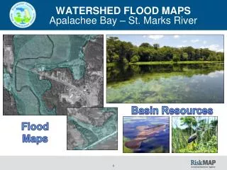
Louisiana Mapping Project Parish Post Preliminary Fact Sheet
Early Notice and Public Review of a Proposed Activity in a 100-Year Floodplain • Early Notice and Public Review of a Proposed • Activity in a 100-Year Floodplain • [Note: May also be combined with other notices such as state floodplain or wetland notices so long as it contains the required information] • To: All interested Agencies [include all Federal, State, and Local], Groups and Individuals • This is to give notice that [HUD under part 50 or Responsible Entity under Part 58] has conducted an evaluation as required by [Executive Order 11988 and/or 11990], in accordance with HUD regulations at 24 CFR 55.20 Subpart C Procedures for Making Determinations on Floodplain Management, to determine the potential affect that its activity in the floodplain and wetland will have on the human environment for [Program Name] under [HUD grant or contract number]. [Describe the activity, e.g. purpose, type of assistance, the size of the site, proposed number of units, size of footprint, type of floodplain, natural values]. [State the total number of acres of floodplains]. The proposed project(s) is located [at addresses] in [Name of City], [Name of County]. • There are three primary purposes for this notice. First, people who may be affected by activities in floodplains and those who have an interest in the protection of the natural environment should be given an opportunity to express their concerns and provide information about these areas. Second, an adequate public notice program can be an important public educational tool. The dissemination of information about floodplains can facilitate and enhance Federal efforts to reduce the risks associated with the occupancy and modification of these special areas. Third, as a matter of fairness, when the Federal government determines it will participate in actions taking place in floodplains, it must inform those who may be put at greater or continued risk. • Written comments must be received by [HUD or Responsible Entity] at the following address on or before [month, day, year] [a minimum 15 calendar day comment period will begin the day after the publication and end on the 16th day after the publication]: [HUD or Responsible Entity],[Address] and [phone number], Attention: [Name of Certifying Officer], [Title], during the hours of 9:00 AM to 5:00 PM. Comments may also be submitted via email at [email address]. • Date:
Final Notice and Public Explanation of a Proposed Activity in a 100-Year Floodplain • To: All interested Agencies [include all Federal, State, and Local], Groups and Individuals • This is to give notice that the [HUD under part 50 or Responsible Entity under Part 58] has conducted an evaluation as required by [Executive Order 11988 and/or 11990], in accordance with HUD regulations at 24 CFR 55.20 Subpart C Procedures for Making Determinations on Floodplain Management, to determine the potential affect that its activity in the floodplain and wetland will have on the human environment for [Program Name] under [HUD grant or contract number]. The proposed project(s) is located [at addresses] in [Name of City], [Name of County]. [Describe the activity, e.g. purpose, type of assistance, the size of the site, proposed number of units, size of footprint, type of floodplain, natural values]. [State the total number of acres of floodplains involved]. • [HUD or Responsible Entity] has considered the following alternatives and mitigation measures to be taken to minimize adverse impacts and to restore and preserve natural and beneficial values: [and reasons (quantitatively based if possible) for non-selection, (iii) all mitigation measures to be taken to minimize adverse impacts and to restore and preserve natural and beneficial values] [Cite the date of any final or conditional LOMR’s or LOMA’s from FEMA where applicable] [Acknowledge compliance with state and local floodplain protection procedures]