Download
1 / 31
310 likes | 393 Vues
Brooks Road Environmental Limited (formerly Edwards Landfill), Vertical Capacity Expansion Environmental Assessment has opened a Public Open House to present the contents for the draft EA report.Visit website for more info: http://www.brenvironmental.com.

E N D
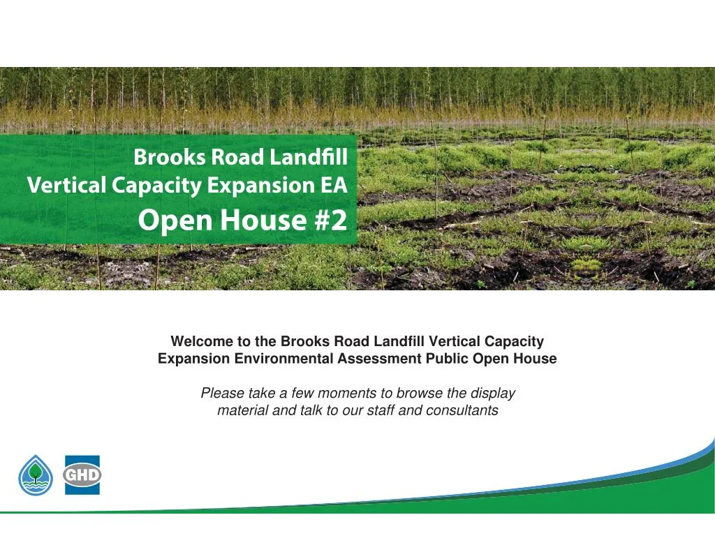
Brooks Road Landfill Vertical Capacity Expansion EA Open House #? Welcome to the Brooks Road Landfill Vertical Capacity Expansion Environmental Assessment Public Open House Please take a few moments to browse the display material and talk to our staff and consultants
PURPOSE OF OPEN HOUSE Welcome to Public Open House #2 for the Brooks Road Vertical Capacity Expansion Environmental Assessment (EA). Please sign-in at the welcome desk so we may add you to our contact database. Feel free to walk around and view the displays. Project Team members are available to answer questions and address your comments. The general purpose of this Open House is to: ? Present the contents for the Draft EA Report ? Describe the Draft EA review process ? Meet the Project Team & ask questions ? Outline the next steps in the EA process Brooks?Road?Landfill?Site? Vertical?Capacity?Expansion?EA?
THE PROPOSED UNDERTAKING Brooks Road Environmental (BRE) is proposing a vertical expansion to their existing landfill to provide additional disposal capacity for Industrial, Commercial and Institutional (IC&I) customers as well as a small amount of residential waste (Municipal Solid Waste (MSW)) within Haldimand County and the surrounding areas. The material proposed to be received at the Brooks Road Landfill Site (IC&I and MSW) is a continuation of what is currently accepted. The Brooks Road Landfill Site accepts only non- hazardous waste materials. ? The Brooks Road Landfill Site (Site) has an approved fill rate of 500 tonnes per day and a capacity of 624,065 m3 (including waste and daily/final cover). ? The proposed vertical capacity expansion seeks approximately 421,000 m3of additional capacity (including waste and daily/final cover) over a 5 to 7 year planning period. ? This will be achieved through a re-engineering of the final contours of the existing Brooks Road Landfill. ? All proposed changes will occur within the existing waste footprint and boundaries of the Site. Brooks Road Landfill Site Vertical Capacity Expansion EA
HISTORY OF THE SITE ? The Site has gone from being a rural “dump” (i.e., a non?engineered, unlined, waste disposal pits) to a modern engineered and operated waste management facility/landfill. ? Due to the nature of some of the waste historically disposed of, the Site has been remediated to remove previous waste deposited on?Site from the unlined disposal pits, some of which was deemed to be hazardous under Ontario Regulations. ? Since BRE has taken ownership, the Site has undergone numerous improvements from an operational and safety standpoint. ? To date, BRE has remediated all hazardous waste previously disposed of at the Brooks Road Landfill Site. Brooks Road Landfill Site Vertical Capacity Expansion EA
ONTARIO’S EA PROCESS The Brooks Road Landfill Vertical Capacity Expansion is subject to an EA under the Ontario Environmental Assessment Act. The ToR was approved by the Minister of the Environment and Climate Change (Minister) on July 31, 2015. The chart below provides an overview of the EA process being carried out for the Brooks Road Landfill Vertical Capacity Expansion. Brooks?Road?Landfill?Site? Vertical?Capacity?Expansion?EA?
TOR OVERVIEW The ToR was approved by the Minister on July 31, 2015. ? The ToR provides a framework or “roadmap” for conducting the EA. ? The ToR was prepared in consultation with the MOECC, other Agencies, Aboriginal communities, and the public. ? The ToR describes the following key aspects of the proposed project: ? The Undertaking • Vertical expansion of the Site for receipt of IC&I • 5 to 7 year planning period • Amend Site's rate of fill to allow for a maximum of 151,000 tonnes per year Rationale for the Undertaking • Established the need for additional disposal capacity for IC&I solid, non- hazardous waste within Haldimand County and the surrounding areas Alternatives To the Undertaking • Identified functionally different ways of approaching and dealing with the defined problem or opportunity • Establishing a new landfill; expanding the existing landfill (vertically); exporting waste to another disposal facility Alternative Methods of Carrying Out the Undertaking • Different ways of implementing the proposed undertaking Evaluation Methodology, Criteria and Indicators • Characterization of the existing environment • Presents the evaluation criteria and indicators to be utilized in the EA • Describes the methodology to be used in the assessment of each Alternative Method – Comparative Evaluation Consultation Plan • Outlined the consultation activities to be carried during the EA Brooks Road Landfill Site Vertical Capacity Expansion EA
RATIONALE FOR THE UNDERTAKING In accordance with Section 6.1(2) of the Ontario Environmental Assessment Act, BRE is to provide a description of, and a statement of the rationale for the proposed undertaking in its EA. BRE is undertaking this EA to provide additional IC&I solid, non-hazardous waste disposal capacity within Haldimand County and surrounding areas. ? BRE is a private waste service provider for the disposal of residual wastes. Accounting for current IC&I diversion rates, there is an ongoing need for residual waste disposal capacity services. ? Based on a business case analysis, BRE believes there is a sustainable market opportunity for BRE to provide up to 140,000 tonnes of landfill disposal capacity annually for a 5 to 7 year planning period. ? This timeframe was determined to be appropriate, given a number of factors (i.e. changes to legislation) that may affect the volume of disposal capacity required. ? The vertical expansion will provide approximately 421,000 m3 of landfill disposal capacity air space. ? A change to the Site’s rate of fill is also being proposed. The current rate of fill is a maximum of 500 tonnes per day. An annual rate of fill to a maximum of 140,000 tonnes per year is proposed as part of this EA. ? This change would accommodate the busier spring and summer months of operation, when volumes of construction waste are typically higher. ? Brooks Road Landfill Site Vertical Capacity Expansion EA
ALTERNATIVE METHODS “Alternative methods” are different ways of implementing the proposed undertaking. ? Three vertical expansion alternatives have been developed for comparative analysis ? The following aspects will be identical across all three vertical expansion alternatives, including: An expansion capacity of 421,000 m3, including waste, daily cover, and interim cover ? Limit of waste (i.e., landfill footprint) ? Traffic associated with importing waste, daily cover, and interim cover ? Location of the site entrance, scalehouse, and other ancillary supporting features ? Size and location of all buffer areas ? Final cover design (0.6 m of compacted fine-grained soil overlain by a 0.15 m thick vegetative layer) ? Leachate treatment (i.e., batch leachate treatment system) ? Alternative 2 Alternative 1 Alternative 3 Brooks Road Landfill Site Vertical Capacity Expansion EA
ALTERNATIVE METHODS VERTICAL EXPANSION ALTERNATIVE 1 ? Expansion capacity with 3H to 1V (33%) side slopes to a peak elevation of 219.7 metres above mean sea level (mAMSL) ? Final elevation of top of landfill approximately 10 mabove existing landfill ? Height of landfill approximately 21m above existing grade (199mAMSL) ? Post-Closure leachate generation rate of 29 m3/day ? Estimate 16 vehicles per day associated with waste and construction materials 3D visual renderings of Alternative Method 1 looking north towards the Site along Brooks Road from near the abandoned railway to the south of the Site (right) and from Talbot Road / Highway 3 (below) Brooks Road Landfill Site Vertical Capacity Expansion EA
ALTERNATIVE METHODS VERTICAL EXPANSION ALTERNATIVE 2 ? Expansion capacity with 4H to 1V (25%) side slopes to a peak elevation of 221.5 mAMSL ? Final elevation of top of landfill approximately 12 mabove existing landfill ? Height of landfill approximately 23 mabove existing grade (199 mAMSL) ? Post-Closure leachate generation rate of 29 m3/day ? Estimate 16 vehicles per day associated with waste and construction materials 3D visual renderings of Alternative Method 2 looking north towards the Site along Brooks Road from near the abandoned railway to the south of the Site (right) and from Talbot Road / Highway 3 (below) Brooks Road Landfill Site Vertical Capacity Expansion EA
ALTERNATIVE METHODS VERTICAL EXPANSION ALTERNATIVE 3 ? Expansion capacity with 3H to 1V (33%) side slopes to a peak elevation of 222.1mAMSL and bench at 210.0 mAMSL ? Final elevation of top of landfill approximately 13 mabove existing landfill ? Height of landfill approximately 23 mabove existing grade (199 mAMSL) ? Post-Closure leachate generation rate of 29 m3/day ? Estimate 16 vehicles per day associated with waste and construction materials 3D visual renderings of Alternative Method 3 looking north towards the Site along Brooks Road from near the abandoned railway to the south of the Site (right) and from Talbot Road / Highway 3 (below) Brooks Road Landfill Site Vertical Capacity Expansion EA
STUDY AREAS ? Two study areas were established for the EA: ? Site Study Area include all lands (i.e., 14.3 ha) within the existing, approved boundaries of the Brooks Road Landfill Site, as defined by ECA No. A110302, dated July 21, 2014, as amended. ? Local Study Area includes all lands and waters within a 1 km radius of the Site Study Area boundaries. Brooks Road Landfill Site Vertical Capacity Expansion EA
EXISTING CONDITIONS ? The following environmental components potentially affected by the proposed undertaking were described in individual assessment reports available for review at this Open House: ? Air Quality & Odour ? Noise ? Geology & Hydrogeology ? Surface Water Resources ? Terrestrial & Aquatic Environment ? Archaeology & Cultural Heritage ? Transportation ? Land Use ? Agriculture, Soils & Mining ? Socio-Economic Brooks Road Landfill Site Vertical Capacity Expansion EA
ASSESSMENT & EVALUATION METHODOLOGY Brooks Road Landfill Site Vertical Capacity Expansion EA
MITIGATION MEASURES Mitigation Measures (all three Alternatives) Pave internal road (~224 m from landfill entrance to the main part of the landfill) to reduce particulate matter emissions from road traffic ? Fugitive Dust Best Management Plan to include controls such as watering and sweeping of roadways to allow for a minimum 75% emission reduction ? Views can be minimized by increasing the height of the berms and/or planting trees or shrubs on top of the berm ? An extended detention wet stormwater management pond will mitigate the effects of an increase in runoff, total suspended solids concentrations and peak flow rates ? Best Management Practices (all three Alternatives) Nuisance related effects to surrounding agricultural operations, off- Site recreational, and residential properties within the Local Study Area mitigated through the implementation of Best Management Practices (BMPs) (e.g., dust suppression, vermin control, etc.) ? Noise impacts minimized through the implementation of BMPs, such as barriers and/or berms at Landfill perimeter and administrative controls that limit on-site landfilling activities ? Terrestrial and Aquatic Environment BMPs include: ? Notifying on-Site personnel of the presence of reptiles and amphibians in the surrounding areas, including visual identification tools for local Species at Risk (SAR) ? Allowing any wildlife incidentally encountered on-Site to move away from the area on its own and do not knowingly cause harm. Notify Site Supervisor if the animal does not move from the area. If the animal is a known or suspected SAR, contact Ministry of Natural Resources & Forestry SAR biologists for advice. ? Brooks Road Landfill Site Vertical Capacity Expansion EA
OUR APPROACH: ODOUR MITIGATION ? We take all odour complaints seriously and have implemented an ongoing Odour Mitigation Program to ensure we are tracking, recording and implementing new mitigation measures to improve the issue ? Our Odour Mitigation Program includes a suite of tools used to prevent or lower odour emissions and to reduce the occurrence of adverse odour effects ? We know that managing odour is dependent on developing an understanding of its properties, frequency and duration of occurrence, sources, and any potential impact to our community. All of these steps are part of our process. ? Our approach also brings together a wealth of information that industry, regulators and government have used to develop odour management plans across Canada ? We are committed to resolving issues that are the result of our operations and we do rely on community feedback to let us know how we are doing Brooks Road Landfill Site Vertical Capacity Expansion EA
ODOUR MITIGATION ON-SITE ? Odours are mitigated on-Site through the implementation of operational BMPs as well as the application of odour control substances ? Operational BMPs to minimize odour include: ? Daily odour monitoring carried out by the Site Operator ? Limiting the size of the active landfill working face ? Applying daily cover to the active landfill working face ? Applying interim cover at a minimum thickness of 300mm on areas of the landfill where landfilling has ceased for 6 months or more ? Limiting exposed areas of the leachate ? Odour control substances applied on-Site include: ? Odour control granules from the Odor Control Company, Inc. applied directly to the waste ? Rydall biodegradable odor eliminator, an aqueous odour control solution, added directly to the leachate Brooks Road Landfill Site Vertical Capacity Expansion EA
VOLUME OF ODOUR COMPLAINTS ? Each complaint submitted to our on-site staff or to the MOECC is well documented ? Since 2014, we have successfully reduced the number of complaints by 57% (2014 received 16 complaints, 2016 received 6 complaints) ? We continue to invest in our Odour Monitoring Program and will continue to review each complaint with a mandate to identify the source and mitigate or reduce odours that are impacting our community Brooks Road Landfill Site Vertical Capacity Expansion EA
WHAT’S NEXT FOR ODOUR Record Keeping ? Keeping records is an important tool for us to measure our progress ? It is important to document a description of the odour and the conditions in which it was experienced Community Engagement ? The community itself can become a valuable source of qualitative data, providing information to be used when assessing other prevention and mitigation tools ? Establishing good community and neighbourhood relations is both a prevention and mitigation tool. While technical solutions are important, an often underestimated aspect of odour management is public opinion within the local community. ? Please send us your feedback so that we can ensure that we are doing all we can to mitigate the odours Brooks Road Landfill Site Vertical Capacity Expansion EA
GYPSUM MINE ? An abandoned gypsum mine is located to the northwest of the Site within the Local Study Area ? The mine was operated by the Cayuga Gypsum Company Limited between 1942 and 1949 ? GHD prepared a report assessing the potential influences from the gypsum mine on the landfill ? The report concluded that there is no evidence of an influence related to the Cayuga Gypsum Mine on the bedrock aquifer at the Site Brooks?Road?Landfill?Site? Vertical?Capacity?Expansion?EA?
COMPARATIVE EVALUATION Environmental Component Atmospheric Environment Evaluation Criteria Air Quality Indicator Alternative Method 1 Net Effects Alternative Method 2 Net Effects Alternative Method 3 Net Effects Predicted off?Site point of impingement concentrations (?g/m3) of indicator compounds Number of off?Site receptors potentially affected (residential properties, public facilities, businesses, and institutions) Criteria Ranking: Criteria Rationale: Air quality property boundary maximum exposure of 120 ?g/m3for TSP LOW NET EFFECTS Up to 14 residences may experience a change in the predicted off- site air quality impact LOW NET EFFECTS Air quality property boundary maximum exposure of 118 ?g/m3for TSP LOW NET EFFECTS Up to 14 residences may experience a change in the predicted off- site air quality impact due LOW NET EFFECTS Air quality property boundary maximum exposure of 119 ?g/m3 for TSP LOW NET EFFECTS Up to 14 residences may experience a change in the predicted off-site air quality impact LOW NET EFFECTS 2nd 3rd 1st From a potential air quality TSP impact exposure perspective, Alternative Methods 1, 2 and 3 are nearly identical. However, Alternative Method 2 has the lowest property boundary concentration followed by Alternative Method 3, then Alternative Method 1. Reduced/maintained Site boundary and off-Site odour concentrations LOW NET EFFECTS LOW NET EFFECTS Odour Predicted off?Site odour concentrations (?g /m3and odour units) Reduced/maintained Site boundary and off-Site odour concentrations Reduced/maintained Site boundary and off-Site odour concentrations LOW NET EFFECTS Up to 14 residences may experience a change in the predicted off-site odour impact LOW NET EFFECTS Tied for 1st Number of off?Site receptors potentially affected (residential properties, public facilities, businesses and institutions) Criteria Ranking: Criteria Rationale: Predicted off?Site noise level Up to 14 residences may experience a change in the predicted off- site odour impact LOW NET EFFECTS Tied for 1st Up to 14 residences may experience a change in the predicted off- site odour impact LOW NET EFFECTS Tied for 1st From a potential odour impact exposure perspective, Alternative Methods 1, 2 and 3 are identical. Noise impact exposure ranges from 40 dBA to 52 dBA, which is below the 55 dBA noise limit. LOW NET EFFECT Net sound level change for 14 off-Site receptors is 3 dBA or lower1. LOW NET EFFECT Noise Noise impact exposure ranges from 40 dBA to 52 dBA, which is below the 55 dBA noise limit. LOW NET EFFECT Net sound level change for 14 off-Site receptors is 3 dBA or lower1. LOW NET EFFECT Noise impact exposure ranges from 40 dBA to 52 dBA, which is below the 55 dBA noise limit. LOW NET EFFECT Net sound level change for 14 off-Site receptors is 3 dBA or lower1. LOW NET EFFECT Tied for 1st Number of off?Site receptors potentially affected (residential properties, public facilities, businesses, and institutions) Criteria Ranking: Criteria Rationale: Environmental Component Ranking: Tied for 1st Tied for 1st There is no distinction between the alternatives in terms of their predicted off-Site noise levels and the number of off-Site receptors potentially affected. As such, all three alternatives are preferred 3rd From a potential air quality, odour, and noise impact exposure perspective, Alternative Methods 1, 2 and 3 are nearly identical. However, Alternative Method 2 has the lowest property boundary TSP concentration followed by Alternative Method 3, then Alternative Method 1. No effects to groundwater quality at property boundaries and off-Site. NO NET EFFECTS NO NET EFFECTS 1st 2nd RATIONALE Geology & Hydrogeology Groundwater Quality Predicted effects to groundwater quality at property boundaries and off?Site No effects to groundwater quality at property boundaries and off-Site. No effects to groundwater quality at property boundaries and off- Site. NO NET EFFECTS Tied for 1st NATURAL Criteria Ranking: Criteria Rationale: Predicted groundwater flow characteristics Tied for 1st Tied for 1st All three alternatives are preferred as they would all results in no effects to groundwater quality at property boundaries and off-Site. No effects to groundwater flow characteristics. NO NET EFFECTS Tied for 1st All three alternatives are preferred as they would all results in no effects to groundwater flow characteristics. Tied for 1st There is no distinction between the alternatives in relation to their effects on groundwater quality and flow characteristics. No predicted changes to vegetation communities within the Study Areas. NO NET EFFECT No predicted changes to wildlife habitat within the Study Areas. NO NET EFFECT No predicted changes to vegetation or wildlife (including rare, threatened, or endangered species) within the Study Areas. NO NET EFFECT Tied for 1st There is no distinction between the alternatives in terms of their effects on the terrestrial environment. All three alternatives are preferred as they would all result in no net effects to the terrestrial environment. No predicted changes to water quality within the Study Areas. NO NET EFFECT NO NET EFFECT No predicted changes to aquatic habitat within the Study Areas. NO NET EFFECT NO NET EFFECT No predicted changes to aquatic biota within the Study Areas. NO NET EFFECT NO NET EFFECT Tied for 1st Tied for 1st There is no distinction between the alternatives in terms of their effects on the aquatic environment. All three alternatives are preferred as they would all result in no net effects to the aquatic environment. Tied for 1st Tied for 1st There is no distinction between the alternatives in terms of their effects on the terrestrial and aquatic environment. All three alternatives are preferred as they would all result in no net effects to the terrestrial and aquatic environment. Groundwater Flow No effects to groundwater flow characteristics. NO NET EFFECTS Tied for 1st No effects to groundwater flow characteristics. NO NET EFFECTS Tied for 1st Criteria Ranking: Criteria Rationale: Environmental Component Ranking: RATIONALE Terrestrial Ecosystems communities Tied for 1st Tied for 1st Terrestrial & Aquatic Environment Predicted impact on vegetation No predicted changes to vegetation communities within the Study Areas. NO NET EFFECT No predicted changes to wildlife habitat within the Study Areas. NO NET EFFECT No predicted changes to vegetation or wildlife (including rare, threatened, or endangered species) within the Study Areas. NO NET EFFECT Tied for 1st No predicted changes to vegetation communities within the Study Areas. NO NET EFFECT No predicted changes to wildlife habitat within the Study Areas. NO NET EFFECT No predicted changes to vegetation or wildlife (including rare, threatened, or endangered species) within the Study Areas. NO NET EFFECT Tied for 1st Predicted impact on wildlife habitat Predicted impact on vegetation and wildlife including rare, threatened or endangered species Criteria Ranking: Criteria Rationale: Predicted changes in water quality Aquatic Ecosystems No predicted changes to water quality within the Study Areas. No predicted changes to water quality within the Study Areas. NO NET EFFECT No predicted changes to aquatic habitat within the Study Areas. NO NET EFFECT No predicted changes to aquatic biota within the Study Areas. NO NET EFFECT Tied for 1st Predicted impact on aquatic habitat No predicted changes to aquatic habitat within the Study Areas. Predicted impact on aquatic biota No predicted changes to aquatic biota within the Study Areas. Criteria Ranking: Criteria Rationale: Environmental Component Ranking: Tied for 1st RATIONALE 1A net sound level change of 0 to 3 dBA is recognized as environmentally and acoustically insignificant.
COMPARATIVE EVALUATION Environmental Component Surface Water Resources Evaluation Criteria Surface Water Quality Indicator Alternative Method 1 Net Effects Alternative Method 2 Net Effects Alternative Method 3 Net Effects Predicted effects on surface water quality on?site and offsite Criteria Ranking: Criteria Rationale: Change in drainage areas No effects on surface water quality on-site or off-site. NO NET EFFECTS No effects on surface water quality on-site or off-site. NO NET EFFECTS No effects on surface water quality on-site or off-site. NO NET EFFECTS Tied for 1st Tied for 1st Tied for 1st No on-site or off-site effects on surface water quality associated with any of the three alternative methods. No change in drainage areas. NO NET EFFECTS No off-site effects to surface water quantity. NO NET EFFECTS Tied for 1st No effects on surface water quantity associated with any of the three alternative methods. Tied for 1st All three alternative methods have no net effect with respect to surface water quality and quantity No loss of or disturbance to cultural and heritage resources within the Local Study Area. NO NET EFFECTS Surface Water Quantity No change in drainage areas. No change in drainage areas. NATURAL NO NET EFFECTS NO NET EFFECTS Predicted occurrence and degree of off?site effects Criteria Ranking: Criteria Rationale: Environmental Component Ranking: RATIONALE Cultural & Heritage Resources Study Area and predicted impacts on them Criteria Ranking: Criteria Rationale: Archaeologica l Resources Local Study Area and predicted impacts on them Criteria Ranking: Criteria Rationale: Environmental Component Ranking: No off-site effects to surface water quantity. No off-site effects to surface water quantity. NO NET EFFECTS Tied for 1st NO NET EFFECTS Tied for 1st Tied for 1st Tied for 1st Archaeology & Cultural Heritage Cultural and heritage resources (built and landscapes) in the Local No loss of or disturbance to cultural and heritage resources within the Local Study Area. NO NET EFFECTS No loss of or disturbance to cultural and heritage resources within the Local Study Area. NO NET EFFECTS Tied for 1st All three alternatives are preferred as they would all result in no loss or disturbance to cultural and heritage resources within the Local Study Area. No loss of/disturbance to archaeological resources within the Local Study Area. NO NET EFFECTS Tied for 1st All three alternatives are preferred as they would all result in no loss or disturbance to archaeological potential within the Local Study Area. Tied for 1st There is no distinction between the alternatives in relation to their effects on cultural and heritage resources and archaeological potential within the Local Study Area. View of the Site from surrounding areas will be minimized by heightening/ vegetating screening berms. LOW NET EFFECTS LOW NET EFFECTS 1st 2nd Although views of all three alternatives will be minimized by heightening and/or vegetating the screening berms along the western property boundary, Alternative Method 1 is slightly preferred from a visual impact perspective as it will have the lowest height at final closure (10 m above the existing landfill versus 12 m and 13 m for Alternative Methods 2 and 3, respectively). 11 residential dwellings within the Local Study Area. LOW NET EFFECTS LOW NET EFFECTS Tied for 1st Tied for 1st There is no distinction between the alternatives in terms of the number of residential dwellings within the Local Study Area and, therefore, potentially affected. All alternatives rank the same. 1st 2nd While there is no distinction between the alternatives in terms of the number of residential dwellings within the Local Study Area, Alternative 1 ranks 1stfrom a Social perspective as it will have the lowest height at final closure (10 m above the existing landfill versus 12 m and 13 m for Alternative Methods 2 and 3, respectively). Continue to employ 6 persons for the duration of Site operations. MEDIUM (POSITIVE) NET EFFECTS MEDIUM (POSITIVE) NET EFFECTS Continue services to customers for waste disposal for the 5 to 7 year planning period. MEDIUM (POSITIVE) NET EFFECTS MEDIUM (POSITIVE) NET EFFECTS Tied for 1st Tied for 1st There is no distinction between the alternatives in relation to their positive effects on employment at the site and opportunities to provide products or services. No effects on the use of lands for traditional purposes. NO NET EFFECTS NO NET EFFECTS Tied for 1st Tied for 1st CULTURAL Archaeological resources in the No loss of/disturbance to archaeological resources within the Local Study Area. NO NET EFFECTS Tied for 1st No loss of/disturbance to archaeological resources within the Local Study Area. NO NET EFFECTS Tied for 1st Tied for 1st Tied for 1st RATIONALE Social Visual Impact of Facility Predicted changes in perceptions of landscapes and views View of the Site from surrounding areas will be minimized by heightening/ vegetating screening berms. View of the Site from surrounding areas will be minimized by heightening/ vegetating screening berms. LOW NET EFFECTS 3rd Criteria Ranking: Criteria Rationale: Effects on Local Residents Number of residences 11 residential dwellings within the Local Study Area. 11 residential dwellings within the Local Study Area. LOW NET EFFECTS Tied for 1st SOCIO-ECONOMIC Criteria Ranking: Criteria Rationale: 3rd Environmental Component Ranking: RATIONALE Economic Effects on/ Benefits to Local Community Employment at site (number and duration) Opportunities to provide products or services Continue to employ 6 persons for the duration of Site operations. Continue to employ 6 persons for the duration of Site operations. MEDIUM (POSITIVE) NET EFFECTS Continue services to customers for waste disposal for the 5 to 7 year planning period. MEDIUM (POSITIVE) NET EFFECTS Tied for 1st Continue services to customers for waste disposal for the 5 to 7 year planning period. Environmental Component Ranking: RATIONALE Potential Effects on Aboriginal Communities Environmental Component Ranking: ABORIGINALAboriginal Potential effects on use of lands for traditional purposes No effects on the use of lands for traditional purposes. No effects on the use of lands for traditional purposes. NO NET EFFECTS Communities Tied for 1st Tied for 1st Tied for 1st There is no distinction between the alternatives in relation to their effects on the use of lands for traditional purposes within the Local Study Area. RATIONALE
COMPARATIVE EVALUATION Environmental Component Transportation Effects on Evaluation Criteria Indicator Alternative Method 1 Net Effects Alternative Method 2 Net Effects Alternative Method 3 Net Effects Bird strike hazard to aircraft in Local Study Area Criteria Ranking: Criteria Rationale: No bird strike hazard to aircraft in Local Study Area. No bird strike hazard to aircraft in Local Study Area. No bird strike hazard to aircraft in Local Study Area. Airport Operations NO NET EFFECTS Tied for 1st NO NET EFFECTS Tied for 1st NO NET EFFECTS Tied for 1st There is no distinction between the alternatives in terms of their effects on bird strike hazards to aircraft in the Local Study Area. All three alternatives are preferred as they would result in no effects to bird strike hazards to aircraft. Minimal potential for traffic collisions in Local Study Area. LOW NET EFFECTS LOW NET EFFECTS Negligible disturbance to traffic operations in Local Study Area and wider road network. LOW NET EFFECTS LOW NET EFFECTS No road improvements required. NO NET EFFECT NO NET EFFECT Tied for 1st Tied for 1st There is no distinction between the alternatives in terms of their effects from truck transportation along access roads. All three alternatives are preferred as they would result in a minimal impact on traffic safety and a negligible impact on traffic operations in the Local Study Area and surrounding road network. There are no road improvements required. Tied for 1st Tied for 1st There is no distinction between the alternatives in terms of their effects on airport operations and effects from truck transportation along access roads. All three alternatives are preferred as they would equally result in minimal impacts to traffic safety, have a negligible impact on traffic operations in the Local Study Area and surrounding road network, and would not require any potential road improvements. No change to the current land uses within the Site and Local Study Areas. NO NET EFFECTS NO NET EFFECTS No effects on planned future land use within the Site and Local Study Areas. NO NET EFFECTS NO NET EFFECTS Official Plan indicates “Identified Trail Locations” on Brooks Road and the abandoned railway to south of the Site, parallel to Highway 3, within 500 m of the landfill footprint. LOW NET EFFECTS LOW NET EFFECTS 2 residences are located within 500 m of the landfill footprint. LOW NET EFFECTS LOW NET EFFECTS Effects from Truck Transportation Along Access Roads Potential for traffic collisions Minimal potential for traffic collisions in Local Study Area. Minimal potential for traffic collisions in Local Study Area. LOW NET EFFECTS Negligible disturbance to traffic operations in Local Study Area and wider road network. LOW NET EFFECTS No road improvements required. NO NET EFFECT Tied for 1st Disturbance to traffic operations Negligible disturbance to traffic operations in Local Study Area and wider road network. Potential road improvement requirements Criteria Ranking: Criteria Rationale: No road improvements required. Tied for 1st Environmental Component Ranking: RATIONALE No change to the current land uses within the Site and Local Study Areas. No change to the current land uses within the Site and Local Study Areas. NO NET EFFECTS No effects on planned future land use within the Site and Local Study Areas. NO NET EFFECTS Official Plan indicates “Identified Trail Locations” on Brooks Road and the abandoned railway to south of the Site, parallel to Highway 3, within 500 m of the landfill footprint. LOW NET EFFECTS 2 residences are located within 500 m of the landfill footprint. LOW NET EFFECTS Land Use Effects on Current and Planned Future Land Uses Current land use No effects on planned future land use within the Site and Local Study Areas. Planned future land use Official Plan indicates “Identified Trail Locations” on Brooks Road and the abandoned railway to south of the Site, parallel to Highway 3, within 500 m of the landfill footprint. Type(s) and proximity of off-Site recreational resources within 500 m of landfill footprint potentially affected Type(s) and proximity of off-Site sensitive land uses (i.e., dwellings, churches, cemeteries, parks) within 500 m of landfill footprint potentially affected Environmental Component Ranking: 2 residences are located within 500 m of the landfill footprint. BUILT Tied for 1st Tied for 1st Tied for 1st There is no distinction between the alternatives in terms of their effects on current and planned future land uses. All three alternatives are preferred as they would all result in no effects to current or planned future land use and low effects to off-Site recreational resources and the two residences within 500 m of the landfill footprint. Low net effects to surrounding agricultural operations. LOW NET EFFECTS LOW NET EFFECTS 19 farm tax rated property parcels within the Local Study Area, including 2 cash crop farms immediately adjacent to the Site boundary to the east and south will continue to operate. LOW NET EFFECTS LOW NET EFFECTS Type(s) and proximity of mining operations No effects on active mining operations within the Local Study Area. NO NET EFFECTS Soil classification No loss of soil with agricultural capability. NO NET EFFECTS Environmental Component Ranking: Tied for 1st RATIONALE There is no distinction between the alternatives in relation to their effects on soils and existing agricultural and mining operations within the Local Study Area. Site Design & Operational Characteristics leachate treatment facility, site access, or scale house facility. LOW NET EFFECTS Operational flexibility Requires placement and grading of waste/cover with steeper slopes. Additional limitations on potential post-closure uses. Low net effects on the management of leachate, stormwater, odour, and traffic. LOW NET EFFECTS RATIONALE Agriculture / Soils & Mining Effects on Soils and Existing Agricultural and Mining Operations Predicted impacts on surrounding agricultural operations Type(s) and proximity of agricultural operations (i.e., organic, cash crop, livestock) Low net effects to surrounding agricultural operations. Low net effects to surrounding agricultural operations. LOW NET EFFECTS 19 farm tax rated property parcels within the Local Study Area, including 2 cash crop farms immediately adjacent to the Site boundary to the east and south will continue to operate. LOW NET EFFECTS No effects on active mining operations within the Local Study Area. NO NET EFFECTS No loss of soil with agricultural capability. NO NET EFFECTS Tied for 1st 19 farm tax rated property parcels within the Local Study Area, including 2 cash crop farms immediately adjacent to the Site boundary to the east and south will continue to operate. No effects on active mining operations within the Local Study Area. NO NET EFFECTS No loss of soil with agricultural capability. NO NET EFFECTS Tied for 1st Complexity of Site infrastructure Minor changes to final contours and site grading/drainage, with little to no impact on the stormwater management pond, screening berms, Minor changes to final contours and site grading/drainage, with little to no impact on the stormwater management pond, screening berms, leachate treatment facility, site access, or scale house facility. LOW NET EFFECTS No changes to proposed waste/cover slopes. Fewer limitations on potential post-closure uses. Low net effects on the management of leachate, stormwater, odour, and traffic. Minor changes to final contours and site grading/drainage, with little to no impact on the stormwater management pond, screening berms, leachate treatment facility, site access, or scale house facility. LOW NET EFFECTS Requires placement and grading of waste/cover with steeper slopes and a bench. Additional limitations on potential post-closure uses. Low net effects on the management of leachate, stormwater, odour, and traffic. LOW NET EFFECTS 3rd Site Design & Operations LOW NET EFFECTS 1st 2nd Environmental Component Ranking: While low net effects are anticipated for all alternatives, Alternative Method 2 ranks 1st from a Site Design & Operations perspective as a result of the simplified final contours and increased operational flexibility. 2nd 1st RATIONALE OVERALL RANKING 3rd
PREFERRED / RECOMMENDED ALTERNATIVE ? All three Alternatives are nearly identical in terms of their net effects on the environment. ? Alternative Method 2 is slightly preferred for the following reasons: ? Lowest Air Quality (Total Suspended Particulate) property boundary maximum exposure (concentrations at or past the property boundary are well within the applicable emission limits for all three Alternative Methods). ? Operational flexibility is increased as there are no changes to proposed waste/cover slopes; fewer limitations on potential post-closure uses; and low net effects on the management of leachate, stormwater, odour, and traffic. ? Alternative Method 2 is approximately 2 m taller than Alternative 1 and ranks 2nd from a Visual Impact perspective. Views from surrounding areas will be minimized by heightening and/or vegetating the screening berms. Brooks Road Landfill Site Vertical Capacity Expansion EA
LEACHATE TREATMENT ? Leachate management alternatives identified for the Site: ? Alternative 1: Recirculation ? Alternative 2: Off-Site Treatment: ? Alternative 2a: Transport by tank truck to licensed liquid industrial waste disposal facility ? Alternative 2b: Pre-treatment (on-Site) with transport by tank truck to municipal waste water treatment plant (WWTP) ? Alternative 2c: Pre-treatment (on-Site) with transport via direct forcemain connection to municipal sanitary sewer (Cayuga WWTP) ? Alternative 3: On-Site Treatment: ? Alternative 3a: Evaporation system ? Alternative 3b: Full on-Site (biological) treatment facility ? Alternatives were comparatively evaluated using an assessment method that considered engineering, environmental, economic and social criteria ? Comparative evaluation identified on-Site treatment facility (Alternative 3b) as the preferred leachate management alternative for the long term ? On-Site leachate treatment system is currently being designed and constructed ? No significant changes expected to the quantity or quality of leachate that require treatment as a result of the proposed vertical expansion alternatives, so no changes are anticipated to be required to the approved on-Site leachate treatment system currently being established Brooks?Road?Landfill?Site? Vertical?Capacity?Expansion?EA?
IMPACT ASSESSMENT ? Detailed impact assessment of the Preferred Alternative (Alternative Method 2) to confirm: ? Potential environmental effects ? Mitigation or compensation measures ? Remaining net effects following the application of mitigation and/or compensation measures ? Alternative Method designs developed beyond the level of detail typically prepared for the conceptual design stage ? Preferred Alternative design was not advanced further, save for inputs provided by the Technical Discipline Leads in order to avoid or minimize environmental impacts ? “No” to “Low” net effects anticipated across all environmental components considered for the implementation of the Preferred Alternative ? Cumulative environmental effects are effects that are likely to result from the proposed project in combination with other projects or activities that have been or will be carried out within the foreseeable future ? Site is not likely to cause significant adverse cumulative environmental effects during operation or post-closure ? Analysis concluded that climate change will have no appreciable adverse effect on the proposed Undertaking Brooks?Road?Landfill?Site? Vertical?Capacity?Expansion?EA?
ADVANTAGES & DISADVANTAGES Environmental Component Advantages Disadvantages ? Reduced/maintained Site boundary and off-Site odour concentrations. ? Up to 14 residences may experience a change in the predicted off-site air quality and odour levels, however, with appropriate mitigation measures, the effects will be negligible. ? Net sound level change for 14 off- Site receptors is 3 dBA or lower. ? No disadvantages to Geology & Hydrogeology. Air Quality & Odour ? Noise impact exposure range is below the 55 dBA noise limit. ? No effects to groundwater quality at property boundaries and off-Site. ? No effects to groundwater flow characteristics. ? Stormwater management pond will attenuate runoff peak flow rates for all storm events modelled. ? No effects on surface water quality. ? No change in drainage areas. ? No off-site effects to surface water quantity. ? No changes to vegetation communities, wildlife habitat, and vegetation and wildlife (including rare, threatened or endangered species) are anticipated. ? No changes to water quality, aquatic habitat, and aquatic biota are anticipated. ? No loss of or disturbance to cultural and heritage resources and archaeological resources. ? No road improvements required. ? No bird strike hazard to aircraft in Local Study Area. ? No change to the current land uses. ? No effects on planned future land use. Noise Geology & Hydrogeology ? No specific mitigation measures required beyond the continued operation of the stormwater management pond to attenuate peak flows to protect downstream receivers from potential changes in water quantity. ? Potential for some species to access the site, but BMPs will protect wildlife and SAR. Surface Water Resources Terrestrial & Aquatic Environment ? No disadvantages to the Archaeology and Cultural Heritage. Archaeology & Cultural Heritage ? Minimal potential for traffic collisions. Transportation ? BMPs to manage nuisance related effects during construction and operation for the two residences and “Identified Trail Locations” on Brooks Road and the abandoned railway to south of the Site ? BMPs to manage nuisance related effects during construction and operation resulting in low net effects to surrounding agricultural operations. ? Minor changes to final contours and site grading/drainage, with little to no impact on the stormwater management pond, screening berms, leachate treatment facility, site access, or scale house facility. Land Use ? No effects on active mining operations. ? No loss of soil with agricultural capability. ? 19 farm tax rated property parcels within the Local Study Area will continue to operate. ? No changes to proposed waste/cover slopes. ? Fewer limitations on potential post- closure uses. ? Low net effects on the management of leachate, stormwater, odour, and traffic. Agriculture/ Soils & Mining Socio- Economic Brooks Road Landfill Site Vertical Capacity Expansion EA
MONITORING & COMMITMENTS ? Monitoring Discipline Proposed Monitoring Daily odour monitoring Landfill gas monitoring (gas probes) Routine landfill equipment monitoring Groundwater monitoring Leachate monitoring Surface water monitoring Monitor all major policy reviews (i.e., Official Plan) Air Quality & Odour Noise Geology & Hydrogeology Surface Water Resources Land Use ? Commitments Discipline Air Quality & Odour EA Commitment Fugitive Dust Best Management Plan will be implemented Odour control measures will be continued and modified, as necessary: •Daily odour monitoring •Minimizing exposed waste through the application of cover material •Reducing the amount of leachate through off-Site disposal •Application of odour control granules and liquid spray •Upgrades to the on-Site leachate treatment facility •Community outreach to identify impacts at neighbouring residences An eighth monitoring station (SW-2) will be added following the construction of the on-Site stormwater management pond. SW 2 will be located on Site at the outlet from the on-Site stormwater management pond. BMPs for continued operation: •Notify Site operators and delivery contractors of the presence of reptiles and amphibians in the surrounding areas. Includes visual identification tools for species at risk (SAR) common to the area. •Any wildlife incidentally encountered during Site operation activities will not be knowingly harmed and will be allowed to move away from the area on its own if at all possible. •Notify Site Supervisor in the event that an animal encountered during Site operation activities does not move from the area, or is injured. •In the event that the animal is a known or suspected SAR, the Site Supervisor will contact MNRF SAR biologists for advice. The Cemeteries Act, R.S.O. 1990 c. C.4 and the Funeral, Burial and Cremation Services Act, 2002, S.O. 2002, c.33 (when proclaimed in force) require that any person discovering human remains must notify the police or coroner and the Registrar of Cemeteries. Surface Water Resources Terrestrial & Aquatic Environment Archaeology & Cultural Heritage Brooks?Road?Landfill?Site? Vertical?Capacity?Expansion?EA?
OTHER APPROVALS ? The following further environmental approvals will be required in support of the proposed undertaking: ? Application to amend the existing ECA for the Site to be submitted to the MOECC for approval ? Changes to the design and operations of the landfill will be documented in an update to the existing Design and Operations (D&O) Report for the Site ? Updated D&O and amended ECA will include any additional mobile noise sources ? Other landfill operations equipment and potential on-Site noise sources will be addressed under the Site ECA ? Updated D&O and amended ECA will include details of any changes required to the approved on-Site stormwater management system ? Should any archaeological sites be uncovered during construction, work will cease and an archaeological investigation will be conducted by a licensed archaeologist as per Section 48 (1) of the Ontario Heritage Act Brooks?Road?Landfill?Site? Vertical?Capacity?Expansion?EA?
CONSULTATION ? The Brooks Road Landfill Vertical Capacity Expansion EA consultation program has been designed to be: ? Open and inclusive to ensure potentially-affected or interested parties have full information made available to them and are given the opportunity to make their views known. ? Transparent by documenting the consultation process that is carried out during the EA. ? Responsive by providing opportunities for interested parties to comment on the EA at key stages and by ensuring that such comments are addressed in the EA. ? Meaningful by identifying how comments and concerns have been considered throughout the EA process. ? Flexible by allowing response to new issues that emerge as the EA proceeds. ? Consultation activities throughout the EA process include: ? Notification through newspaper, mailouts & website postings ? Public Open House events ? Public Liaison Committee Meetings ? Posting of materials for public review on the Project website: brenvironmental.com ? Toll-free telephone number: 1-888-40-BRENV(27368) ? Consultation events are your opportunity to get involved in the EA process to let us know your opinion and ideas about the proposed development at the Site. Brooks Road Landfill Site Vertical Capacity Expansion EA
DRAFT EA REPORT & NEXT STEPS ? EA process results for the Brooks Road Landfill Vertical Capacity Expansion documented in the Draft EA Report ? Draft EA Report posted July 22, 2016 ? Available on the project website (brenvironmental.com) ? Hard copies available: ? Haldimand County Office (45 Munsee Street North, Cayuga) ? Cayuga Public Library (28 Cayuga Street North, Cayuga) ? MOECC, Hamilton District Office (Ellen Fairclough Building, 9th Floor, 119 King Street West, Hamilton) ? You are invited to submit your comments via the project website (brenvironmental.com), mail or email: ? Richard Weldon, Manager, Brooks Road Environmental T: 416-928-4810, E: richard@brenvironmental.com ? Blair Shoniker, RPP, Senior Environmental Planner, GHD T: 905-830-5656, E: Blair.Shoniker@ghd.com ? You may also provide feedback via the comment form available at this Open House ? All comments received by Friday, August 26, 2016 will be considered in the preparation of the Final EA Report ? Final EA Report to be submitted to the MOECC for approval by the Minster in Fall 2016 and will include a further review period Brooks?Road?Landfill?Site? Vertical?Capacity?Expansion?EA?