Download
1 / 69
690 likes | 849 Vues
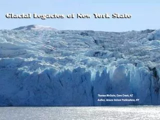
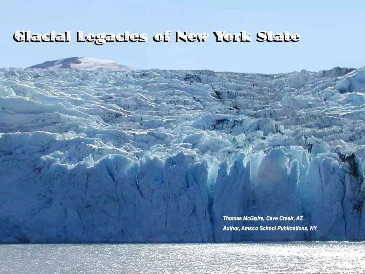
Thomas McGuire, Cave Creek, AZ Author, Amsco School Publications, NY. What if it were to snow…a lot… …and snow...and snow…and snow? Much more snow than could melt in the summer. 2.

E N D
Thomas McGuire, Cave Creek, AZ Author, Amsco School Publications, NY
What if it were to snow…a lot… …and snow...and snow…and snow? Much more snow than could melt in the summer. 2
At least four geologically recent ice ages glaciers covered almost all the land surface of New York State. This is probably what most of the state looked like about 20,000 years ago. 3
Glacier: • A mass of ice and surficial snow that persists throughout the year and flows outward or downhill like a fluid under its own weight. Most range in size from 100 meters to 10,000 kilometers. 4
The average global temperatures over the past 1000,000 years. 5 5
Ice coverage of North America approximately 21,000 years ago 6
The only part of New York that was clearly never covered by glaciers is Allegheny State Park in Western New York State. Long Island was built by glacial sediment. 7 7
The alpine Athabaska Glacier in Canada is one of the most accessible modern glaciers. Note the road and cars parked left of the melt water lake. 8
Glaciers push, drag and carry great quantities of sediment from clay size to boulders. The blue lines show the far edge of this glacier about a quarter mile away. This is the Castner Glacier in Alaska. 9 9 9
Two lateral (side) moraines beside the Athabaska glacier. Ice flowing in the valley to the right has pushed these ridges of unsorted till into place. 10 10
Debris from the continental glaciers was left behind as irregular (hummocky) terrain such as this terminal (end) moraine on Cape Cod. 11 11
Glacial till sediment, in some places hundreds of feet thick, covers most of New York State. 13
Within moraines closed depressions are common. Some may have been created by a block of ice melting within the glacial deposits. Here we see ice on a former water surface. The ice makes this kettle northwest of Oneonta especially visible. 14
Terminal moraines form the backbone of Long Island and extend to the east. 15
Looking south toward the Ronkokoma Moraine on Long Island. 16 16
The Ronkokoma Moraine dips below sea level at Montauk Point. This is New York’s most eastern landfall. Note the boulders washed out of the moraine. 17 17
This hummocky, irregular land surface south of Naples, NY is a part of the Valley Heads Moraine. The irregular land surface and kettle holes are typical of moraines. 18
Sediment deposited directly by the ice Is a mixed jumble of sediment from clay size particles to large boulders. But this is layered glacial outwash on Long Island that is deposited by water from the melting glaciers. Layering indicates water deposits while a jumble of unsorted material is a sign of glacial ice deposits. 19
The north shore of Long Island has bluffs of glacial till in the Harbor Hill Moraine. The transported rocks of diverse types settle onto the beach. 20 20
The sandy beaches along the south shore are composed of sorted outwash sediment. 21
Glacial outwash deposits are a prime source for high quality sand and gravel. Surprisingly. this is New York State’s most economically valuable geological resource. 22
This is part of a NYS Geological Survey map of surface deposits in Westchester County and nearby Long Island. 23
The ice wall is the lower end of the Castner Glacier in central Alaska. Glacial meltwater feeds this fast flowing river emerging from the glacier. Much of the melting occurs at the bottom of the ice. Long ridges called eskers are sometimes deposited in tunnels by these subglacial streams. 24
An esker is along US Route 6 in Northern Westchester County, NY. 25
Another esker follows NY Route 79 north of Binghamton, NY. 26
Parts of Route 79 were built right along the esker. (See the arrows.) Eskers make a firm road base, that is well drained and can supply hgh quality sand and gravel. 27
Glacial deposits such as these at Croton Point in the Lower Hudson River contain rocks that have been transported by the moving ice. Although most of New York State does not have igneous or metamorphic bedrock, these rock types are common throughout the state in glacial deposits. 28
Cobblestone homes in Western New York State were constructed from glacially deposited stones that were embedded in thick mortar. Many of these stones differ greatly from the composition of nearby bedrock. Some of them were clearly transported hundreds of miles southward from Canada. 29
An erratic is an especially large transported rock. This one is almost the size of a house. It is located east of Tarrytown, NY. 30 30
Occasionally an erratic is left perched on top of smaller boulders after many years of erosion. This perched erratic is at North Salem in Westchester County. 31
Drumlins are elongated hills of unsorted sediment, usually aligned north-south. Drumlins form under continental glaciers. Hundreds of them can be seen betweenRochester and Syracuse in Western New York State. 32 32
This is pat of drumlin field east of Rochester, NY. Note that the trailing ends of the hills are the southern slopes. The north slopes are usually more blunt. 33
New York’s drumlin field is among the most extensive anywhere. 34
Drumlins are eroded by wave action along the south shore of Lake Ontario at Chimney Bluffs County Park. Fine clay binds the sediment the includes particles as big as large boulders. The unsorted sediment is an indication of ice deposited till. 35
Both alpine and continental glaciers scour broad U-shaped valleys. This is about a ten mile walk up the the alpine Castner Glacier. 36 36
A V-shaped stream valley such as this in the Rocky Mountains of Colorado is the work of stream erosion. 37
Some New York streams, including the Genesee River in Letchworth Gorge carve out narrow V-shaped valleys. 38
Glaciers carved this broad U-shaped valley in the Rocky Mountains of Montana. 39
U-shaped valleys such as this one in the western Finger Lakes are common in this part of New York State. 40 40
The Finger Lakes of Western New York State were excavated as U-shaped valleys by the glaciers advancing to the south. Moraines dammed the former south flowing outlet rivers. 41 41
Portions of Seneca and Cayuga Lakes looking north from an airplane. Can you match them with the last image? 42
Looking north along Canandaigua Lake in the Finger Lakes. 43
Glacial erosion deepened the main north-south valley where the town of Montour Falls, NY is located. But the east-west tributary valleys were not made deeper. So this waterfall descend from a hanging valley. 44
Glacial polish and striations (diagonal to the top left) are displayed on this rock surface near Tarrytown. 45
Striations can be observed at about 4000 feet elevation on Hunter Mountain in the Catskills. They show that the ice was a minimum of a mile thick over this part of New York State. 46
Grooves and glacial polish near Peekskill, NY document the southward movement of the ice. Also notice the stepped edges on the right (south) side. 47 47
Glacially carved grooves are common in the hard rocks of the Adirondacks. 48 48
Rocks carried by a glacier are often partially rounded and scratched by abrasion with other rocks. 49
Chatter marks and crescent gouges on hard bedrock surfaces are more evidence of glacial movement. 50 50 50