Download
1 / 14
140 likes | 281 Vues
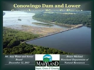
Sediment Management in Prado Basin and Lower Santa Ana River. Greg Woodside, P.G., C.Hg Executive Director of Planning & Natural Resources September 20, 2011. Prado Dam. Main purpose is flood control Water conservation is additional beneficial use. Prado Basin Area = 11,500 acres. Prado

E N D
Sediment Management in Prado Basin and Lower Santa Ana River Greg Woodside, P.G., C.Hg Executive Director of Planning & Natural Resources September 20, 2011
Prado Dam • Main purpose is flood control • Water conservation is additional beneficial use Prado Basin Area = 11,500 acres Prado Dam
Water/Sediment Mechanics • Sediment laden water enters Prado Basin • Velocity of water slows and sediment settles out in Prado Basin • Water released through Prado Dam is sediment deficient • >95% sediment trap efficiency estimated by Warrick & Rubin (2007) for Prado Dam
Impacts of Prado Basin Sedimentation • Prado Basin • Water conservation reduced • 25,000 af lost below elev. 505 since 1941 • Sedimentation threatens infrastructure • Impacts to endangered species habitat • Lower Santa Ana River • Scouring threatens infrastructure • SAR channel has incised between 5 and 15 feet from Prado Dam to Weir Canyon with localized incision exceeding 15 feet • Channel incising harms riparian habitat • Beach replenishment reduced • Marine ecosystems starved of sediment • Riverbed armoring & coarsening reduces percolation rate
Percolation Impacts • Sediment-deficient high flows change sediment characteristics below Prado Dam • Cause armoring and coarsening • Percolation reduced
Changes in Sediment Characteristics SAR at Weir Canyon SAR at Imperial SAR at Five Coves
Proposed Solution • Perform demonstration project to remove sediment from Prado Basin and place it below Prado Dam • Demonstrate feasibility of re-establishing natural sediment transport regime • Allow high flows released from Prado Dam to redistribute sediment down river • Use results from demo project to assess feasibility of long-term sediment management solution
Sediment Management Demonstration Project Layout • Dredging • Hydraulic dredge • Pump sediments to temporary storage area • Slurry pump sediments to re-entrain in SAR below Prado Dam
Project Outreach • U.S. Army Corps of Engineers • U.S. Fish and Wildlife Service • CA Department of Fish and Game • CA State Parks • Regional Water Quality Control Board • Flood control districts • OC Coastkeeper / Inland Empire Waterkeeper • Santa Ana Watershed Project Authority • Local cities
Near-Term & Long-Term • Near-Term • Prado Basin Demonstration Project • Test in field • Collect data to measure benefits, assess potential impacts • Long-Term • Corps’ Prado Basin Feasibility Study • Implementation of project(s) from FS