Download
1 / 18
180 likes | 381 Vues
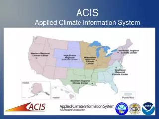
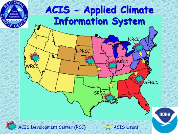
ACIS - Applied Climate Information System. NRCC. HPRCC. MRCC. WRCC. SERCC. SRCC. ACIS Development Center (RCC). ACIS Users. Available now to subscribers. To receive more subscription details ACIS on-line HPRCC University of Nebraska Lincoln, NE 68583-0728 Or Email

E N D
ACIS - Applied Climate Information System NRCC HPRCC MRCC WRCC SERCC SRCC ACIS Development Center (RCC) ACIS Users
Available now to subscribers To receive more subscription details ACIS on-line HPRCC University of Nebraska Lincoln, NE 68583-0728 Or Email http://www.hprcc.unl.edu/comments.html
System Architecture Takes advantage of the internet and the latest web tools Distributed/Synchronized data bases Redundancy built in to handle system failures Flexible interface can link to part or all of the ACIS product suite Object-oriented programming design allows for extension of capabilities
State-of-the-Art Techniques netCDF Data Structures PostgreSQL RDBMS (for metadata) Python and JAVA programming languages Quixote (web application server) CORBA compliant network software Open Source software components
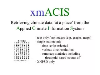
Integrated Data Sources Time-integrated datasets Coop-3206, 3200 (final, preliminary, keyed), and NOAAport (SHEF, DSM, local) 9641 (normals) 3280 (surface airways) 3220 (monthly) – planned Integrated with other data sources Mesonets: AWDN- Operational RAWS, SNOWTEL, SCAN, USGS - planned Meta data to support all stations Resolution of inconsistencies
Quality Assurance Programs Built on open architecture concept with high speed algorithms Procedures tuned to site and season Refined interpolation leads to tighter confidence intervals Estimates provided but original data retained Manuscript in preparation
Mapping Products Standard and Regional map products Analyses match at the boundaries Over 1700 maps generated and maintained on-line 38 maps updated daily 14 maps for latest month/season 9 maps/month are archived Maps regenerated as high-quality data obtained SHEF NCDC prelim NCDC final
COOP SITE AWDN STATIONS
Recent ACIS Developments NCDC includes ACIS maps in reports Drought Monitor teams use ACIS maps to resolve finer spatial resolution of drought NCDC and USDA provided with ACIS daily data USDA/JAWF & Delta Research Station provided with XML-RPC clients NWS web sites adopt ACIS maps http://www.crh.noaa.gov/gid/svrwx/events03/ may_drought/drought/drought_update.htm
ACIS Supported Access Public Users Web interface to standard ACIS products Custom interfaces to selected products Wholesale Users Manual or automated scripting via XML-RPC Access to standard ACIS products ACIS outputs ‘feed’ local products Efficient access to recurring products Product Developer Programs within ACIS environment Develops new products to satisfy needs
Available now to subscribers To receive more subscription details ACIS on-line HPRCC University of Nebraska Lincoln, NE 68583-0728 Or Email http://www.hprcc.unl.edu/comments.html