Download

1 / 34
410 likes | 562 Vues
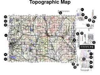
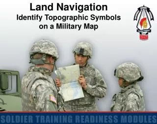
Identify Topographic Symbols on a Military Map. Military Map. NOT a military map. Colors. BLACK. Cultural (man-made) features other than roads. BLUE. Water. BROWN. All relief features – contour lines on old maps; cultivated land on red-light readable maps. GREEN. Vegetation. RED.

E N D
BLACK Cultural (man-made) features other than roads
BLUE Water
BROWN All relief features – contour lines on old maps; cultivated land on red-light readable maps
GREEN Vegetation
RED Major roads, built-up areas, special features on old maps
RED - BROWN All relief features and main roads on red-light readable maps
Drainage • Blue These symbols include lakes, streams, rivers, marshes, swamps, and coastal waters
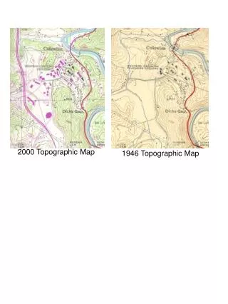
Relief • Brown These features are normally shown by contour lines. Intermediate contour lines, and form lines. In addition to contour lines, there are relief symbols to show cuts, levees, sand dunes, ice fields, strip mines and glaciers.
Vegetation • Green These symbols include woods, shrub, orchards, vineyards, tropical grass, mangrove and marshy areas, or tundra
Roads • Red, Black or Red-Brown These symbols show hard-surface, heavy-duty roads; hard surface, medium duty roads; improved light-duty roads; unimproved dirt roads; and trails. On foreign road maps symbols may differ slightly. Check the map legend for proper identification of roads.
Railroads • Black These symbols show single-track railroads in operation; single-track railroads not in operation; double or multiple-track railroads
Buildings • Black, Yellow, Red or Pink These symbols show built-up areas, schools, churches, ruins, lighthouses, windmills, and cemeteries
Identify each object by its shape on the map. For example, a black, solid square represents a building or a house; a round or irregular blue item is a lake or a pond. • Use logic and color to identify each map feature. For example, blue represents water. If you see a symbol that is blue and has clumps of grass, this would be a swamp. • The size of the symbol show the relative size of the object. Most symbols are enlarged six to ten times so that you can see them under dim light. • Use the legend which should identify most of the symbols on the map.
Top of Map Sheet • Top Left Corner – the geographic location covered by the map and the scale of the map
Top of Map Sheet • Top Center – the name of the map sheet
Top of Map Sheet • Top Right Corner – the map edition, the map series, and the map sheet number
Bottom of Map Sheet • Lower Left Corner – the legend, the name of the agency that prepared the map, the map sheet number, and the map sheet name.
Bottom of Map Sheet • Bottom Center – the bar scales in meters, yards, miles and nautical miles; the contour interval of the contour lines; the grid reference box; the declination diagram; and the G-M angle (mils or degrees)
Bottom of Map Sheet • Lower Right Corner – the elevation guide, the adjoining map sheet diagram, and the boundaries box, which shows any boundaries that might be on the map