Download
1 / 34
350 likes | 704 Vues
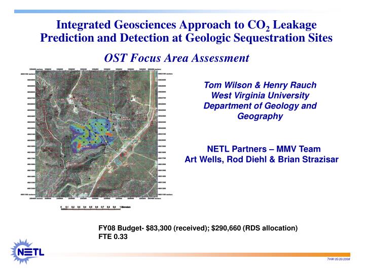
Integrated Geosciences Approach to CO 2 Leakage Prediction and Detection at Geologic Sequestration Sites. OST Focus Area Assessment. Tom Wilson & Henry Rauch West Virginia University Department of Geology and Geography. NETL Partners – MMV Team Art Wells, Rod Diehl & Brian Strazisar.

E N D
Integrated Geosciences Approach to CO2 Leakage Prediction and Detection at Geologic Sequestration Sites OST Focus Area Assessment Tom Wilson & Henry Rauch West Virginia University Department of Geology and Geography NETL Partners – MMV Team Art Wells, Rod Diehl & Brian Strazisar FY08 Budget- $83,300 (received); $290,660 (RDS allocation) FTE 0.33
Potential Benefits of Technology • Help extend and enhance partnership geophysical monitoring applications • Help partnerships fill technology gaps and enhance technology applications for example through • Surface mapping and fracture studies • Acquisition/analysis of satellite imagery • Evaluation of INSAR potential • Evaluation of NIR and SWIR spectral properties for seep identification • Use of innovative logging tools (FMI & Sonic Scanner) • Planning 2D seismic monitoring effort • Planning of 3C VSP monitoring activities • Locate potential CO2 leakage pathways • Identify locations for optimal placement of monitoring technologies to permit accurate estimation of CO2 escape volume
Goals • Programmatic Goals • Interact with the NETL MMV team (Wells, Diehl & Strazisar) to develop of an integrated geosciences approach to locate existing and potential CO2 leakage pathways and to understand their origins. • Technical Issues • Determine optimal locations to place monitoring technologies so that very small amounts of CO2 leakage can be detected and accurately quantified. • Explain mechanisms that facilitate leakage should it occur • Help expand outgrowths of partnership monitoring efforts by filling technology gaps and enhancing technology applications
Objectives • Assist NETL and partnership collaborations with their MMV and site characterization activities in the San Juan Basin (SJB) and other pilot sites • Compliment and extend background geologic, geophysical and remote sensing characterization of the SJB and other pilot sites • Compliment and extend use of geophysical technologies (SJB and other pilot sites) • Assist with ground water surveys and analysis at SJB site • Perform ground water survey and analysis at Montana State University study site • Identify high risk leakage areas and, as an outgrowth, • Recommend additional monitoring locations to the NETL MMV team
Challenges CO2 leakage detection presents new scientific and technical challenge • Adapt geophysical/geological technologies and applications in innovative ways to help detect potential leakage pathways that might facilitate release of injected CO2 back into Earth’s atmosphere. • A major challenge faced in all sequestration efforts is to adapt, modify and integrate characterization, monitoring and detection methodologies for CO2 leakage detection and storage validation. The optimal approach is likely to vary from site to site and our approaches need to be flexible and adaptive.
Technical Approach – Future Plans • Work with Schlumberger to integrate logging and pre-injection VSP observations: SWP - San Juan Basin Pilot. • Interpret VSP and 3D seismic observations for evidence of fracture zones or faults in the vicinity of the injection well: SWP - San Juan Basin Pilot. • Help the NETL MMV team interpret post injection PFC tracer and soil gas observations: SWP - San Juan Basin Pilot. • Obtain access to 3D seismic over the Michigan Basin Pilot • Help the NETL MMV team interpret post injection tracer and soil gas observations: Michigan Basin Pilot. • Explore avenues for additional collaborative support of NETL MMV efforts with other partnerships as part of their continued Phase II and Phase III sequestration efforts
Technical Approach – Future Plans As injection proceeds we will continue to • Work with Schlumberger and the SWP on acquisition of their monitor VSP, time lapse comparison & modeling. • Provide continued input to the NETL MMV team regarding implications of initial VSP and integrated time-lapse VSP/log analysis: SWP - San Juan Basin Pilot.
Technical Approach – Future Plans • Provide continued assistance and advice to the SWP on monitoring water well technical issues related to the their San Juan Basin pilot: including well design, well sampling procedures, well pump testing procedures, water sample field analysis, water sample transport, water sample chemical lab analysis, and chemical data processing and interpretation. • Provide assistance on the ZERT Montana State University (MSU) effort, at Bozeman Montana with shallow ground water monitoring and data analysis associated with the July, 2008 CO2 injection test.
Technical Approach – Future Plans • We also plan to explore uses of visualization cave conferencing capabilities • Development of capabilities to help integrate the great variety of multidisciplinary data collected over sequestration pilot sites in an interactive 3D visualization environment.
Technical Approach – Overview of research efforts & collaborations • Background Characterization Efforts • Develop subsurface database, structure maps and interpretations of subsurface geology • Conduct Field work • Map fractures & local geology around the injection well • Collect EM terrain conductivity data over the site • Collect spectral measurements for vegetation, soil and rock samples at the site • Conduct remote sensing studies and integrated lineament & surface fracture trace analysis • Provide input to the NETL MMV team regarding location of additional PFC tracer and soil gas samples • Expand geophysical studies to enhance on-site Partnership activities See additional supplemental slides
Example efforts/collaborations QuickBird: satellite image-based fracture evaluation Injection Well West Rim Master Joints Southeast Rim QuickBird image acquisition See additional supplemental slide
F G CO2 Injection Well D A B C E Technology Approach -Surface Terrain Conductivity Surveys Approximately 27 line kilometers of EM observations collected over the SJB site using a multi-frequency terrain conductivity meter. Low-conductivity anomalies are interpreted to be well drained areas within the massive sand covering the mesa. Recommendations were made to our NETL MMV partners for additional placement of CATS and soil gas sample locations based on conductivity response. This work will also be integrated into the near-surface migration modeling efforts of Small and Gray. Technology reference: Huang & Won, 2000, Conductivity and susceptibility mapping using broadband electromagnetic sensors: Environmental and Engineering Geophysics
Radar Interferometry (INSAR) Test for Subsidence Detection Acquired and analyzed three images over three month period (August –October, 2006) Good coherence and an abundance of point targets in the area make this a viable method for monitoring surface inflation in response to CO2 injection. The SWP currently has MDA collecting INSAR imagery at regular intervals and will conduct analysis pending results of surface tiltmeter observations undertaken by Pinnacle. Injection Well Technology reference – MacDonald, Detwiler and Associates Ltd, 2007, Evaluation of InSAR Technology for Monitoring Ground Movement in New Mexico: report prepared for Tom Wilson, June, 2007 Rabus et al., 2004, Interferometric point target analysis of RadarSay-1 data for deformation monitoring at the Beridge/Lost Hills Oil fields: International Geoscience and Remote Sensing Symposium conference. See additional supplemental slide
Technology Approach – Innovative Logging Observations FMI log • Helped initiate, finance and coordinate development of injection well logging plan • Run 1 (WVU): Top of Fruitland to surface casing • Platform Express: ray, neutron, bulk density, lateral log • FMI: Bottom 500 ft interpreted for fractures and anisotropy, plus bedding and faulting • Sonic Scanner: P & S wave velocity with all mechanical properties • Sonic Scanner: Advanced anisotropy (bottom 500 ft, same interval as FMI log) Sonic Scanner Technology References: Schlumberger, 2002, FMI, Borehole geology, geomechanics and 3D reservoir modeling: www.slb.com/media/services/evaluation/geology/fmi.pdf Schlumberger, 2005, Sonic scanner, acoustic scanning platform: www.slb.com/media/services/evaluation/petrophysics/acoustic/sonic_scanner.pdf
Technology Approach - VSP monitoring to detect CO2 invasionSWP Collaborative Effort We helped the SWP design their VSP monitoring effort. The locations of utilities, pipelines, and tiltmeters and archaeological issues had to be considered in locating VSP source points. The VSP design incorporates analysis of 3C observations, shear wave splitting and coordination of analysis with the logging effort through Schlumberger. See additional supplemental slide
Logging and VSP monitoring efforts – characterization and detection innovations • Integration of geophysical technologies for prediction and detection • Use of the FMI log for borehole fracture characterization • Use of sonic anisotropy to extend those observations into the region around the well bore • Use of VSP observations of slow and fast shear directions to obtain larger Fresnel zone scale look at anisotropy in the region surrounding the wellbore provided by the VSP, and the • Use of time lapse comparison of variable azimuth offset VSP observations for flood front detection Example VSP technology references – Horne et al., 2002, Planning, acquiring and processing a walkaround VSP for fracture induced anisotropy: EAGE conference and Exhibition. Thompson et al., 2002, Seismic fracture characterization of a sandstone reservoir – Rangely Field, CO: SEG conference & Exhibition.
Subsurface Characterization of the Michigan Basin Pilot • Initiated subsurface characterization effort for the MRCSP Michigan Basin Bass Island Pilot. • Developed a database of well logs and formation top picks • Constructed maps showing total till thickness, subsea depth to base of till, subsea depth to Antrim Shale • Located 2D and 3D seismic data sets over the area • Uncovered detailed history of well casing corrosion, water dumping and inadvertent flooding of the deeper Niagaran Reef trend Technology Reference – Toelle, B., Pekot, L., and Mannes, R., 2007, CO2 EOR from a north Michigan Silurian reef: Procedings paper, Spciety of Petroleum Engineers SPE-111223-PP, 6p.
Subsurface Characterization of the Michigan Basin Pilot The Charlton 4-30 is the Bass Island injection well. It is expected to become available for operation in the deeper Niagaran reef during 2008. Corroded casing is common to all wells. Locally the Dundee is used for disposal of produced water. As a consequence water has been indirectly injected into the deeper Niagaran The 2-30 well began to produce water in 1985 100% water cut arrived at the C2-30 well in 1997 ending primary production in the field. Interconnections observed between C2-30 and 1-30 wells From Toelle et al. (2007)
Ground Water Work (Rauch) Initially located and designed four ground water monitoring wells in the San Juan Basin (SJB) NM study area. Assisted Reid Grigg of New Mexico Tech with plans for constructing, sampling, and analyzing water of the SJB monitoring wells. The following figures show current planned locations for the water monitoring wells (May, 2008)
Ground Water Work (Rauch) Proposed May 2008 locations of ground water monitoring wells. The locations are based on topographic lineaments, drainage and EM conductivity anomalies. Digital Orthophoto, File 36107G61, from NM Resource GIS Program USGS Topographic Map Figure, from NM Resource GIS Program
Ground Water Work (Rauch) Ground water monitoring using water wells was performed at the Montana State University (MSU) field test site in 2007 for the first horizontal well CO2 injection test. This test, involving a 6 – 8 ft deep horizontal injection well, simulated surface ground leakage of sequestered CO2 along fracture zones or faults, to test MMV techniques. This work was done in coordination with other MMV assessment teams. More such ground water monitoring work is planned at the MSU test site for summer 2008 during the second horizontal well CO2 injection test. The next two figures illustrate monitoring well locations relative to the horizontal injection well trace and activity locations of other MMV teams for the summer 2007 test. Similar MMV activities will occur in summer 2008, for a higher CO2 injection rate test.
5 4 3 2 1 SW end NE end -7 8 7 -6 5 -8 6 -5 4 -4 -3 -2 2 3 -1 0 1 -1 -2 -3 -4 -5 -6 Technical Approach – Future Plans at MSU Test Site 6 plant experiments LBL EC tower WALKWAY MSU fiber optic box NETL PNNL 9 -9 MSU LIDAR WALKWAY array of water wells LANL EC tower MSU multispectral camera scaffolding
N MSU water monitoring well placement near trace of horizontal CO2 injection well (gray line); 2007 15° Ground water gradient (0,-3) =10 foot deep well 1m =5 foot deep well (Bottom 2 feet of wells is screened) 10m (0,-4)
Productivity and Results • Our focus throughout has been to interact with the NETL MMV team and associated partnerships to enhance outgrowths of collaborative efforts • We have attempted to be adaptive in our approach, looking for opportunities to fill technology gaps • incorporating surface mapping/fracture characterization • through use of remote sensing observation (QuickBird/Landsat/RadarSat) • through acquisition and evaluation of time lapse INSAR • acquisition and interpretation of EM surveys • design of a geophysical logging program • design of surface and VSP seismic monitoring programs • We have collaborated with and sought guidance from Schlumberger in the development of integrated geophysical applications (logging and VSP) for subsurface characterization and CO2 detection.
Productivity and Results • Groundwater efforts • Designed the shallow ground water monitoring system at the SWP San Juan Basin test site in New Mexico • Our Team will continue to assist NETL, SWP, and other partnership efforts to • Characterize the subsurface, • Help determine and evaluate the integrity of pilot sites, • Facilitate use of innovative geophysical approaches to monitoring/ subsurface evaluation • Help optimize locations of PFC and soil gas sample locations • Better understand local groundwater systems • And overall, help enhance the viability and effectiveness of carbon storage activities
Presentations and Papers Presentations: Tensen, J., and Warner, T., 2006, Field spectra collection in support of reservoir integrity characterization for a coal bed methane carbon sequestration site.Sixty First Annual meeting of the Southeastern Division of the Association of American Geographers (SEDAAG), Morgantown, WV Henthorn, B., Wilson, T., and Wells, A., 2007, Subsurface Characterization of a Carbon Sequestration Pilot Site: San Juan Basin: Poster Presentation, 2007Annual AAPG Convention, Long Beach CA Young, G., Schepers, K., Oudlnot, A., Reeves, S., McPherson, B., Henthorn, B., Wilson, T., Bromhal, G., Smith, D., 2007, San Juan Basin enhanced coalbed methane – carbon storage pilot: Role of pre-injection site characterization in project design:Poster Presentation, 2007 Annual AAPG Convention, Long Beach CA Strazisar, B.R, Wells, A.W., Diehl, J.R., Wilson, T.H., and Rauch. H.W., 2007, NETL’s Near-Surface Monitoring at the San Juan Basin Project Site. Sixth Annual Carbon Capture & Sequestration Conference, Pittsburgh, PA. Proceedings Paper: Henthorn, B., Wilson, T., and Wells, A., 2007, Subsurface Characterization of a Carbon Sequestration Pilot Site: San Juan Basin: Search and Discovery Article #80005, posted at http://www.searchanddiscovery.net/documents/2007/07047henthorn/ index.htm, adapted from the AAPG poster presentation and publishes on the meeting CD.
Presentations and Papers In preparation: Wilson, T., Wells, A., Rauch, H., Strazisar, B., and Diehl, R., 2008, Site characterization activities with a focus on NETL MMV efforts: Southwest Regional Partnership, San Juan Basin Pilot, New Mexico: accepted for presentation at the 2008 International Coal Conference, Pittsburgh, PA Related Collaborative Papers/Articles • Wilson, T., Wells, A., Diehl, R., Bromhal, G., Smith, D., Carpenter, W. and White, C., 2005, Ground penetrating radar survey and lineament analysis of the West Pearl Queen carbon sequestration pilot site, New Mexico: The Leading Edge, vol. 24, p. 718-722. • Wilson, T., and Miller, R., 2006, Introduction to the Special Section: Carbon Sequestration/EOR: The Leading Edge, vol. 25, p 1262-1263. • Wells, A., Hammack, R., Veloski, G., Diehl, R., Strazisar, B., Rauch, H., Wilson, T., and White, C., 2006, Monitoring, mitigation, and verification at sequestration sites: SEQURE technologies and the challenge for geophysical detection: The Leading Edge, vol. 25, p. 1264-1270. • Wells, A., Diehl, J., Bromhal, G., Strazisar, B., Wilson, T., and White, C., 2007, The use of tracers to assess leakage from the sequestration of CO2 in a depleted oil reservoir, New Mexico, USA: Applied Geochemistry, vol. 22, p. 996- 1016. • Fessenden, J., Dentaku, K., Rauch, H., Dobeck, L., Pickles, W., and Spangler, L., 2007, Isotope tracing of CO2 seepage: Results from controlled release experiment in Bozeman, Montana, USA, Proceedings of EOS, vol. 88, no. 52.
References cited • Holloway, S. et al. (eds), 2004, Best Practice Manual from SACS—Saline Aquifer CO2 Storage Project. Issued by Statoil Research Center, Trondheim, Norway, 18 and 33. • Henthorn, B., Wilson, T., and Wells, A., 2007, Subsurface Characterization of a Carbon Sequestration Pilot Site: San Juan Basin: Poster Presentation, 2007 Annual AAPG Convention, Long Beach CA • Horne et al., 2002, Planning, acquiring and processing a walkaround VSP for fracture induced anisotropy: EAGE conference and Exhibition. • Huang & Won, 2000, Conductivity and susceptibility mapping using broadband electromagnetic sensors: Environmental and Engineering Geophysics • Lorenz & Cooper, 2003, Tectonic setting and characterization of natural fractures in Mesaverde and Dakota reservoirs of the San Juan Basin: New Mexico Geology, vol. 25. • Rabus et al., 2004, INSAR monitoring of the Alaska pipeline following the November, 2002 earthquake: International Pipeline conference. • Rabus et al., 2004, Interferometric point target analysis of RadarSay-1 data for deformation monitoring at the Beridge/Lost Hills Oil fields: International Geoscience and Remote Sensing Symposium conference. • Ramos & Davis, 1997, 3D AVO analysis and modeling applied to fracture detection in coalbed methane reservoirs: Geophysics, vol. 62, no. 6. • Schroot, B., 2003, Seismic Anomalies Indicating Leakage: examples from the Southern North Sea: in Abstracts AAPG 88th Annual meeting, 11-14 May 2003, Salt Lake City. • Schroot, B., 2004, How can injected CO2 be monitored? OSPAR Workshop, Trondheim, Netherlands Institute of Applied Geoscience, National Geological Survey, TNO. • Schroot, B., 2005, Surface and subsurface expressions of gas seepage to the seabed – examples from the southern North Sea: Marine and Petroleum Geology (vol 22). • Schlumberger, 2002, FMI, Borehole geology, geomechanics and 3D reservoir modeling: www.slb.com/media/services/evaluation/geology/fmi.pdf • Schlumberger, 2005, Sonic scanner, acoustic scanning platform: www.slb.com/media/services/evaluation/petrophysics/acoustic/sonic_scanner.pdf • Thompson et al., 2002, Seismic fracture characterization of a sandstone reservoir – Rangely Field, CO: SEG conference & Exhibition. • Toelle, B., Pekot, L., and Mannes, R., 2007, CO2 EOR from a north Michigan Silurian reef: Proceedings paper, Society of Petroleum Engineers SPE-111223-PP, 6p. • Van der Meer et al., 2002, Remote sensing and petroleum seepage: a review and case study: Terra Nova, v. 14. • Winthaegen, P., 2005, Monitoring Subsurface CO2 Storage: Oil and Gas Technology – Rev IFP (vol 60).
Supplemental Slide Technical Approach - Subsurface Mapping Huerfanito Bnt. Fruitland Base Kirtland-Ojo Alamo Unc. Fruitland Isopach Technology Reference: Henthorn, B., Wilson, T., and Wells, A., 2007, Subsurface Characterization of a Carbon Sequestration Pilot Site: San Juan Basin: Poster Presentation, 2007Annual AAPG Convention
Supplemental Slide –Fracture Trace/Orientation Analysis Injection Well Upper Sand Middle Sand Rock Fall Resistant Sands of the Site Mesa Sapping and headword erosion of canyons Shale Interval Seep undercutting resistant sandstone Canyon Development Technology Reference: Lorenz & Cooper, 2003, Tectonic setting and characterization of natural fractures in Mesaverde and Dakota reservoirs of the San Juan Basin: New Mexico Geology, vol. 25.
Supplemental Slide - Field Mapped Fracture Trace Orientations/ General Recommendations for Additional Monitoring Injection Well West Rim Master joints and secondary less systematic joint sets provide a “noisier” database Southeast Rim Local fracture systems control canyon development and trend
Supplemental Slide – Technology Approach –Radar Interferometry (INSAR) Subsidence Detection Satellite radar images were collected and processed to determine whether differential subsidence related to oil and gas production could be detected over the region. Localized subsidence differentials might imply decoupling along local fracture zones/faults 1 RADARSAT archive image and 3 new-collects were processed for this evaluation.View times spanned the January 2004 and October 2006 period and included images collected on January 22, 2004 August 15, 2006 October 2, 2006 October 26, 2006 Technology reference – MacDonald, Detwiler and Associates Ltd, 2007, Evaluation of InSAR Technology for Monitoring Ground Movement in New Mexico: report prepared for Tom Wilson, June, 2007.
Supplemental Slide Radar Interferometry (INSAR) Test for Subsidence Detection In this longer term differential we see some unusual features cross cutting the canyon flanks of the mesa on which the pilot well will be located. Local Display - August 15 to October 26, 2006, Vertical Differentials Injection Well Technology reference – Rabus et al., 2004, Interferometric point target analysis of RadarSay-1 data for deformation monitoring at the Beridge/Lost Hills Oil fields: International Geoscience and Remote Sensing Symposium conference.
Supplemental Slide SWP VSP monitoring efforts for CO2 detection Cuba Mesa Nacimiento Kirtland Ojo Alamo Upper K Middle K Lower Kirtland Fruitland Coals VSP Ray tracing suggests we will have a high amplitude response from the Fruitland coal section. Fruitland Fm. Pictured Cliffs Lewis Shale