Download
1 / 66
670 likes | 849 Vues
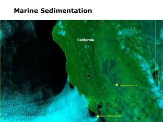
Marine Sedimentation. Sediment Defined: unconsolidated organic and inorganic particles that accumulate on the ocean floor originate from numerous sources weathering and erosion of the continents volcanic eruptions biological activity

E N D
Sediment Defined: • unconsolidated organic and inorganic particles that accumulate on the ocean floor • originate from numerous sources • weathering and erosion of the continents • volcanic eruptions • biological activity • chemical processes within the oceanic crust and seawater • impacts of extra-terrestrial objects • classified by size according to the Wentworth scale
grain size indicates condition under which sediment is deposited • high energy environments characteristically yield sediments larger in size • small particles (silts, clays) indicate low energy environments • considered well-sorted if most particles appear in the same size classification • poorly sorted sediments comprised of multiple sizes • sediment maturity is indicated by several factors • decreased silt and clay content • increased sorting • increased rounding of grains, as a result of weathering and abrasion • particle transport is controlled by grain size and velocity of transporting medium
4-1 Sediment in the Sea • Average grain size reflects the energy of the depositional environment. • Hjulstrom’s Diagram graphs the relationship between particle size and energy for erosion, transportation and deposition.
4-1 Sediment in the Sea Classification of marine sediments can be based upon size or origin. • Size classification divides sediment by grain size into gravel, sand and clay. • Mud is a mixture of silt and clay. • Origin classification divides sediment into five categories: Terrigenous sediments, Biogenic sediments, Authigenic sediments, Volcanogenic sediments and Cosmogenic sediments.
Terrigenous (or Lithogenous Sediments): • derived from weathering of rocks at or above sea level (e.g., continents, islands) • two distinct chemical compositions • ferromagnesian, or iron-magnesium bearing minerals • non-ferromagnesian minerals – e.g., quartz, feldspar, micas • largest deposits on continental margins (less than 40% reach abyssal plains) • transported by water, wind, gravity, and ice • transported as dissolved and suspended loads in rivers, waves, longshore currents
(LANDSAT images adapted from Geospace Images catalog). • sediment delivered to the open-ocean by wind activity as particulate matter (dust) • primary dust source is deserts in Asia and North Africa • comprise much of the fine-grained deposits in remote open-ocean areas (red clays) • volcanic eruptions contribute ash to the atmosphere which settles within the oceans
sediment also transported to the open-ocean by gravity-driven turbidity currents • dense 'slurries' of suspended sediment moved as turbulent underflows • typically initiated by storm activity or earthquakes • first identified during 1929 Grand Banks earthquake • seismic activity triggered turbidity current which severed telegraph lines • initial flow often confined to submarine canyons of the continental shelf and slope • form deep-sea fans where the mouth of the canyon opens onto the continental rise
boulder to clay size particles also eroded and transported to oceans via glacial ice • glacier termination in circum-polar oceans results in calving and iceberg formation • as ice (or icebergs) melt, entrained material is deposited on the ocean floor • termed 'ice-rafted' debris
Biogenous Sediments: • composed primarily of marine microfossil remains • shells of one-celled plants and animals, skeletal fragments • median grain size typically less than 0.005 mm (i.e., silt or clay size particles) • characterized as CaCO3 (calcium carbonate) or SiO2 (silica) dominated systems • sediment with biogenic component less than 30% termed calcareous, siliceous clay • calcareous or siliceous 'oozes' if biogenic component greater than 30%
siliceous oozes (primarily diatom oozes) cover ~15% of the ocean floor • distribution mirrors regions of high productivity • common at high latitudes, and zones of upwelling • radiolarian oozes more common in equatorial regions
calcareous oozes (foraminifera, coccolithophores) cover ~50% of the ocean floor • distribution controlled largely by dissolution processes • cold, deep waters are undersaturated with respect to CaCO3 • deep water is slightly acidic as a result of elevated CO2 concentrations • solubility of CaCO3 also increases in colder water and at greater pressures • CaCO3 therefore readily dissolved at depth • level below which no CaCO3 is preserved is the 'carbonate compensation depth' • typically occurs at a depth of 3000 to 4000 m
DissolutionCalcium carbonate dissolves better in colder water, in acidic water, and at higher pressures. In the deep ocean, all three of these conditions exist. Therefore, the dissolution rate of calcium carbonate increases greatly below the thermocline. This change in dissolution rate is called the lysocline.Below the lysocline, more and more calcium carbonate dissolves, until eventually, there is none left. The depth below which all calcium carbonate is dissolved is called the carbonate compensation depth or CCD.
Hydrogenous (or Authigenic) Sediments: • produced by chemical processes in seawater • essentially solid chemical precipitates of several common forms • non-biogenous carbonates • form in surface waters supersaturated with calcium carbonate • common forms include short aragonite crystals and oolites • phosphorites • phosphate crusts (containing greater than 30% P2O5) occurring as nodules • formed as large quantities of organic phosphorous settle to the ocean floor • unoxidized material is transformed to phosphorite deposits • found on continental shelf and upper slope in regions of high productivity
manganese nodules • surficial deposits of manganese, iron, copper, cobalt, and nickel • accumulate only in areas of low sedimentation rate (e.g., the Pacific) • develop extremely slowly (1 to 10 mm/million years)
The term evaporites is used for all deposits, such as salt deposits, mainly chemical sediments that are composed of minerals that precipitated from saline solutions concentrated by evaporation. Evaporite deposits are composed dominantly of varying proportions of halite (rock salt) (NaCl), anhydrite (CaSo4) and gypsum (CaSo4.2H2O). Evaporites may be classified as chlorides, sulfates or carbonates on the basis of their chemical composition (Tucker, 1991).
evaporites ('salt' deposits') • occur in regions of enhanced evaporation (e.g., marginal seas) • evaporative process removes water and leaves a salty brine • e.g., Mediterranean 'Salinity Crisis' between 5 and 6 million years ago
Cosmogenous Sediments: • sediments derived from extraterrestrial materials • includes micrometeorites and tektites • tektites result from collisions with extraterrestrial materials • fragments of earth's crust melt and spray outward from impact crater • crustal material re-melts as it falls back through the atmosphere • forms 'glassy' tektites
Distribution of Marine Sediments: • sediments thickest along continental margins, thin at mid-ocean ridges • coastlines • dominated by river-borne and wave reworked terrigenous sediments • shelf and slope characterized by turbidites and authigenic carbonate deposits • glacial deposits and ice-rafted debris common at high latitudes • high input of terrigenous sediments 'dilutes' biogenous components • deep-sea (pelagic) basins • abyssal clays (wind blown deposits) common • lower quantities of biogenic material • distribution of biogenous sediments dependent upon three primary factors • production in surface waters • dissolution in deep waters • dilution by other sediments types
Nearshore sediments, turbidites:Up to km/my (kilometers/million years)Hemipelagic deposits: Tens to hundreds of m/myDrift deposits40-400 m/myMid-latitude eolian deposits: 3 to 10 m/myIce rafted material: 10+ m/myCarbonate oozes: Up to 50 m/mySiliceous oozes: Up to 10 m/myHydrothermal deposits: (off ridge axes)About 0.5 m/myHydrogenous sediments: Rarely exceed 0.2 m/myFerromanganese nodules: 0.0002 to 0.005 m/my (0.2 to 5 mm/my) • high productivity in zones of upwelling and nutrient-rich high latitude waters • calcareous oozes more common in warmer or shallower water • siliceous oozes more common in colder or deeper water • terrigenous sedimentation rates range from ~1 mm to 10's cm/1000 years • biogenous sedimentation rates typically ~1 cm/1000 years
4-2 Sedimentation in the Ocean Shelf sedimentation is strongly controlled by tides, waves and currents, but their influence decreases with depth. • Shoreline turbulence prevents small particles from settling and transports them seaward where they are deposited in deeper water. • Particle size decreases seaward for recent sediments. • Past fluctuations of sea level has stranded coarse sediment (relict sediment) across the shelf including most areas where only fine sediments are deposited today.
4-2 Sedimentation in the Ocean Geologic controls of continental shelf sedimentation must be considered in terms of a time frame. • For a time frame up to 1000 years, waves, currents and tides control sedimentation. • For a time frame up to 1,000,000 years, sea level lowered by glaciation controlled sedimentation and caused rivers to deposit their sediments at the shelf edge and onto the upper continental slope. • For a time frame up to 100,000,000 years, plate tectonics has determined the type of margin that developed and controlled sedimentation.
60% of the world’s shelves are covered with relict sediments that were formed about 15,000 y BP under a different energy regime.