Download

1 / 22
220 likes | 410 Vues
The Next Edition of the Manual of Surveying Instructions and the Modern Cadastre. Presented by: John Farnsworth, Acting Chief Cadastral Surveyor Oregon/Washington State Office, Portland, OR Bob Dahl, Cadastral Surveyor BLM Lands and Realty Group, Washington, D.C.

E N D
The Next Edition of theManual of Surveying Instructionsand the Modern Cadastre Presented by: John Farnsworth, Acting Chief Cadastral Surveyor Oregon/Washington State Office, Portland, OR Bob Dahl, Cadastral Surveyor BLM Lands and Realty Group, Washington, D.C. Oregon Association of County Engineers and Surveyors 2005 Spring Conference Eagle Crest, OR June 13, 2005
Agenda • Cadastre – Cadastral – Cadastral Survey • What is the Manual of Surveying Instructions? • Why is the Manual relevant to the County Surveyor in Oregon?
Agenda • Scope of the project • – Technical project nested in a web of administration • What is the process? • How are we going about it? • Where are we to date?
Cadastral Presence • At the DOI level – BLM is 1 of 15 Bureaus and Offices • Within BLM – Cadastral is one of nearly 60 programs
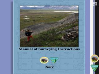
What is the Manual of Instructions for the Survey of the Public Lands of the United States? (Manual) Whom/What is affected?
Why is the Manual Relevant to the County Surveyor/PLS in Oregon?
OREGON REVISED STATUTESTitle 10. Property Rights and TransactionsChapter 105. Property RightsAction to Establish Boundary ORS § 105.718. Procedure for determining location of public land survey corner. Shall establish and monument the true location of the corner in accordance with the current Manual
OREGON REVISED STATUTESTitle 20. Counties and County OfficersChapter 209. County Surveyors ORS § 209.070. Duties in respect to surveys. The county surveyor shall: (4) Make all surveys of legal subdivisions with reference to the current Manual. ORS § 209.250(1). RPLS shall comply with ORS 209.070(4).
OREGON REVISED STATUTESTitle 20. Counties and County OfficersChapter 209. County Surveyors • ORS § 209.200. Resurvey of government-surveyed lands. • County Surveyor or RPLS shall observe the following rules: • Original corners approved by BLM must stand • They must be reestablished at identical spot • They must be reestablished with reference to • current Manual
COURT OF APPEALS OF OREGON Voelz v. Board of Engineering Examiners, 586 P.2d 807 (1978); Petitions for Review Denied by Supreme Court, 590 P.2d 235 (1979) 1) Procedures for the resurvey of the PLSS must follow Manual 2) A complete disregard for ORS and the BLM Manual of Surveying Instructions and the property rights of other individuals constitutes gross negligence
COURT OF APPEALS OF OREGON Hambleton v. Board of Engineering Examiners, 594 P2d 416 (1979) Board found petitioner used procedures that were contrary to BLM Manual: 1) Petitioner’s wilful indifference to the standards and procedures is gross negligence 2) Petitioner’s failure to conduct surveys in accordance with the Manual demonstrates incompetence
UNITED STATES CODETitle 43 Public Lands § 2 The Secretary of the Interior or such officer as he may designate (BLM) shall perform all executive duties appertaining to the surveying and sale of the public lands of the United States
UNITED STATES CODETitle 25 Indians § 176 Whenever it becomes necessary to survey any Indian lands, the same shall be surveyed under the direction and control of the BLM And as nearly as may be in conformity to the rules and regulations under which other public lands are surveyed
United States Supreme Court It is settled law that the United States may survey what it owns and thereby establish and reestablish boundaries, but what the government does in this regard is for its own information and cannot affect the rights of owners on the other side of an existing boundary. United States v. State Investment Co., 264 U.S. 206, 212 (1924), citing Lane v. Darlington, 249 U.S. 331, 333 (1919).
MANUAL The Manual of Surveying Instructions describes how cadastral surveys of the public lands are made in conformance to statutory law and its judicial interpretation. (1973 Manual § 1-1.) It is within the province of the Director to determine what are public lands, what lands have been surveyed, what are to be surveyed, what have been disposed of, what remains to be disposed of, and what are reserved. (1973 Manual § 1-11.)
By fundamental law, upon the issuance of a patent for land by the Federal government; it is just as if the monuments, survey plat and field notes, and the laws, regulations and rules governing how to survey the land described in the patent, are stapled to the face of the patent. The survey rules are spelled out in the manuals, circulars and instructions issued by the GLO and later by the BLM.
Next Edition Website http://www.blm.gov/cadastral/Manual/nextedition.htm Contact Information Announcements: Upcoming Presentations General Information http://www.glorecords.blm.gov