Download
1 / 39
410 likes | 688 Vues
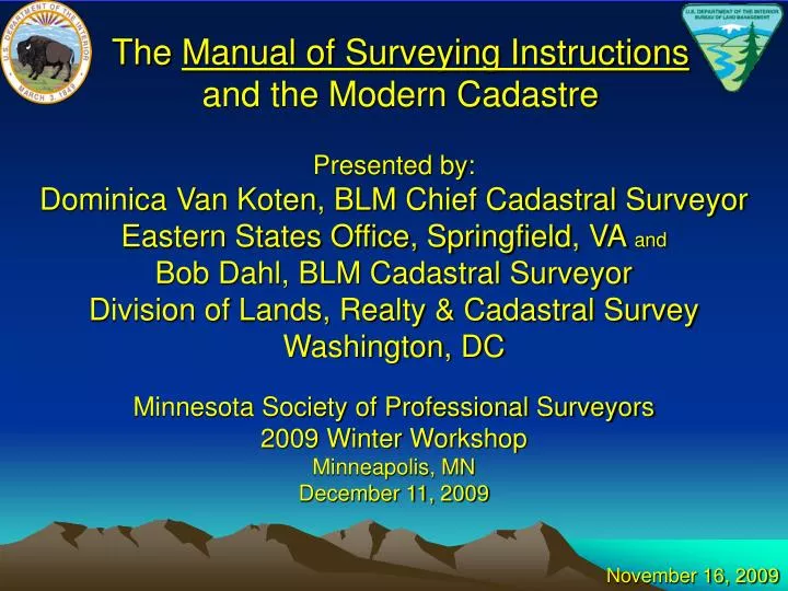
The Manual of Surveying Instructions and the Modern Cadastre. Presented by: Dominica Van Koten , BLM Chief Cadastral Surveyor Eastern States Office, Springfield, VA and Bob Dahl, BLM Cadastral Surveyor Division of Lands, Realty & Cadastral Survey Washington, DC

E N D
The Manual of Surveying Instructionsand the Modern Cadastre Presented by: Dominica Van Koten, BLM Chief Cadastral Surveyor Eastern States Office, Springfield, VA and Bob Dahl, BLM Cadastral Surveyor Division of Lands, Realty & Cadastral Survey Washington, DC Minnesota Society of Professional Surveyors 2009 Winter Workshop Minneapolis, MN December 11, 2009 November 16, 2009
Agenda Cadastre – Cadastral – Cadastral Survey What is the Manual of Surveying Instructions? Why is the Manual relevant to Private, County, and State Surveyors in Minnesota?
Agenda How is the Manual different from the 1973 edition? How is the Manual the same as the 1973 edition? Certified Federal Surveyor (CFedS) Program Overview, Update, and Future Goals
What is the Manual of Surveying Instructions? (Manual) Whom/What is affected?
Why is the Manual Relevant to the Private, County, and State Surveyor in Minnesota?
MINNESOTA STATUTESChapter 389 County SurveyorSection 04 Rules for Surveys Minn. Stat. § 389.04 In subdividing townships, sections, or parts of sections, established by the United States survey In restoring lost or obliterated government corners
MINNESOTA STATUTESChapter 389 County SurveyorSection 04 Rules for SurveysMinn. Stat. § 389.04 The county surveyor shall follow the rules established by or pursuant to acts of Congress And all such surveys shall be made in strict conformity to the original survey made by the United States
MINNESOTA ADMINISTRATIVE CODEBoard of Architecture, Engineering, Land Surveying, Landscape Architecture, Geoscience, and Interior DesignChapter 1800 Licensing and Operation Section 3505 Education and Experience Minn. R. 1800.3505 Subpart 3 For admission to the PLS examination, a minimum of 160 hours of field experience, including section subdivision, boundary surveys, and government corner restoration
SUPREME COURT OF MINNESOTA Lawler v. Counties of Rice and Goodhue, 147 Minn. 236 (1920) It is the established rule that the true corner of a government subdivision is where the United States surveyor established it, whether this location is right or wrong And errors in their location cannot be corrected by the courts
SUPREME COURT OF MINNESOTACogan v. Cook, 22 Minn. 137 (1875) When a deed designates the land conveyed as one of the United States survey subdivisions, the presumption is that the parties intended that the tract conveyed shall be ascertained in the same manner as it is ascertained in the governmental surveys
SUPREME COURT OF MINNESOTA Grandt v. Pokegama, 163 Minn. 368 (1925) For the method to reestablish a lost corner, if the survey was to be governed by the United States survey, it is necessary to resort to the government rules in the Manual of Surveying Instructions
SUPREME COURT OF MINNESOTALunz v. Sandmeier, 172 Minn. 338 (1927) The center of section is the intersection of straight lines from the quarter corners 43 United States Code §§ 752 & 753
Minnesota Land Surveyors Association Public Land Survey in Minnesota State statutes state that the section subdivision methods follow the rules of the Federal Government Subdivision by survey of descriptions which are Federal in origin must follow Federal method down to the smallest size sold
Minnesota Land Surveyors Association Public Land Survey in Minnesota For patentee descriptions which are subject to Federal statutes: “The rules for subdividing the section into two halves, four quarters, eight half-quarters or sixteen quarter-quarters were established by the Federal Government when the statutes for the sale of such parcels become law.”
Minnesota Land Surveyors Association Public Land Survey in Minnesota “The patentee (or others later) who obtained title to part of the legal subdivision of a section is entitled to the exact ground area that his description fits on the record township plat as defined by the monuments on the ground.”
SUPREME COURT OF MINNESOTA Chan v. Brandt, 45 Minn. 93 (1890) All subdivisional lines of a section must be run in accordance with the acts of Congress and rules of the Land Department Boundaries, as established by the government surveyors and returned to and accepted by the government are (1) unchangeable and (2) control the description of lands patented
SUPREME COURT OF MINNESOTA Chan v. Brandt, 45 Minn. 93 (1890) Mistakes in the government surveys cannot be corrected by the State or Federal judicial department State statutes are inoperative when they come in conflict with the rules established by Congress for subdividing sections
SUPREME COURT OF MINNESOTA Chan v. Brandt, 45 Minn. 93 (1890) Lines established in conformity with the government survey will control And The rights of parties who purchase according to the government survey cannot be affected by the act of the legislature
UNITED STATES CODETitle 43 Public Lands § 2 The Secretary of the Interior or such officer as he may designate (BLM) shall perform all executive duties appertaining to the surveying and sale of the public lands of the United States
Other Federal Laws – Containing Survey Rules – The Federal Survey Rules Title 43 U.S.C. §§ 751-753, 772, 773, 1737(c)
UNITED STATES CODETitle 25 Indians § 176 Whenever it becomes necessary to survey any Indian lands, the same shall be surveyed under the direction and control of the BLM And as nearly as may be in conformity to the rules and regulations under which other public lands are surveyed
INTERIOR BOARD OF LAND APPEALSHoward Vagneur, 159 IBLA 272 (2003) 1) BLM is authorized to resurvey the corners and lines of government surveys 2) BLM Survey Manual defines a resurvey 3) Manual defines “existent” “obliterated” and “lost” corners
INTERIOR BOARD OF LAND APPEALSHoward Vagneur, 159 IBLA 272 (2003) 4) Manual provides guidance to surveyors on how to base a resurvey on the “best available evidence” 5) BLM Official Surveys are presumed regular 6) An accurate retracement and reestablishment of the lines of the original survey
United States Supreme Court It is settled law that the United States may survey what it owns and thereby establish and reestablish boundaries, but what the government does in this regard is for its own information and cannot affect the rights of owners on the other side of an existing boundary. United States v. State Investment Co., 264 U.S. 206, 212 (1924), citing Lane v. Darlington, 249 U.S. 331, 333 (1919).
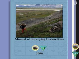
MANUAL The Manual of Surveying Instructions describes how cadastral surveys are made in conformance with statutory law and its judicial interpretation. (2009 Manual § 1-3.) The Director of the Bureau of Land Management has the authority to determine what lands are Federal interest lands, what lands have been surveyed, what are to be surveyed, what have been disposed of, what remains to be disposed of, and what are reserved. (2009 Manual § 1-15.)
SUMMARY By fundamental law, upon the issuance of a patent for land by the Federal government; it is just as if the monuments, survey plat and field notes, and the laws, regulations and rules governing how to survey the land described in the patent, are attached to the face of the patent. The survey rules are spelled out in the manuals, circulars, instructions and regulations issued by the GLO and BLM.
Chapter Crosswalk 1973 Edition 2009 Manual Ch. 1 - The General Plan Ch. 2 - Methods of Survey Ch. 3 - The System of….. Ch. 4 - Monumentation Ch. 5 - Lost or Obliterated Corners Ch. 6 - Resurveys Ch. 7 - Special Surveys and Instructions Ch. 8 - Field Notes Ch. 9 - Plats Ch. 10 - Mineral Surveys Ch. 1 - The General Plan Ch. 2 - Methods of Survey Ch. 3 - The System of….. Ch. 4 - Monumentation Ch. 5 - Principles of Resurveys Ch. 6 - Resurveys and Evidence Ch. 7 - Resurveys and Restoration Ch. 8 - Water Boundaries Ch. 9 - Special Instructions…….. Ch. 10 - Special Surveys and Mineral Surveys
Areas of: Change – Clarification - Addition • Water boundaries • Standard of evidence • Coordinates as collateral evidence • Measurement technology • Mineral survey resurveys • Closing corners • Bona fide rights & good faith location
Water BoundariesChapters III and VIII • Chapter III includes concepts and case studies of original surveys and water boundaries. • Chapter VIII includes concepts and case studies of resurveys and water boundaries. • Navigability determinations. • Submerged lands issues. • Ownership of unsurveyed islands in meandered nonnavigable waters.
Standard of Evidence • Interior Board of Land Appeals (IBLA) has altered the evidentiary standard for proof of a corner point: “beyond reasonable doubt” replaced with “substantial evidence” (More than a scintilla, but less than a preponderance) • Existent – Obliterated - Lost corner definitions use “substantial evidence” standard.
Coordinatesas Collateral Evidence • Repeatable coordinatesmay be the best available evidence for the position of an original corner; therefore it is an obliterated corner not a lost corner
Coordinatesas Collateral Evidence • “…if the first surveyor documents how he or she obtained the coordinates so the second surveyor can, within an acceptable degree of confidence, determine the same point on the earth's surface (following in the computational footsteps) within an acceptable level of certainty, then coordinates may be the best available evidence of the corner position.”
Measurement TechnologyChange in Principal • The next edition is largely technology independent. • How the surveyor determines the relationship between point A and point B (measurement procedures; what instrumentation is used) will be determined for each survey from the best available technology to meet the purpose of that survey. • How to measure is better handled by special instructions.
Mineral Survey Resurveys • Expanded instructions for mineral survey resurveys, mineral leasing surveys, and mineral segregation surveys. • Incorporates much that is in the BLM publication Mineral Survey Procedures Guide.
Closing CornersPolicy Clarification For treatment of closing corners, the Manual instructs the surveyor to determine how an existing closing corner was established.
Closing CornersPolicy Clarification A corner, no matter what it has been called in the official record, (closing corner, junior corner, crossing closing corner, intersection point, or corner of minimum control) established during an obviously careful retracement of the intersected, senior, or existing line, can be accepted in place, and may be an angle point in the intersected, senior, or existing line.
Bona Fide RightsandGood Faith Location Before we get carried away with these doctrines: A landowner's bona fide belief concerning the boundary between his land and Federal interest land is not the same as a bona fide right that must be protected in a survey under 43 U.S.C. § 772. Although a person may have a bona fide belief, based on an understanding with a predecessor-in-interest that a fence marks a boundary, a bona fide right within the meaning of 43 U.S.C. § 772 is based on good faith reliance on evidence of the original survey. Tracy v. Rylee, 174 IBLA 239 (2008).
BLM Survey Manual Website http://blmsurveymanual.org/ Federal Land Records http://www.glorecords.blm.gov BLM Eastern States Office (703) 440-1688