Download
1 / 23
230 likes | 351 Vues
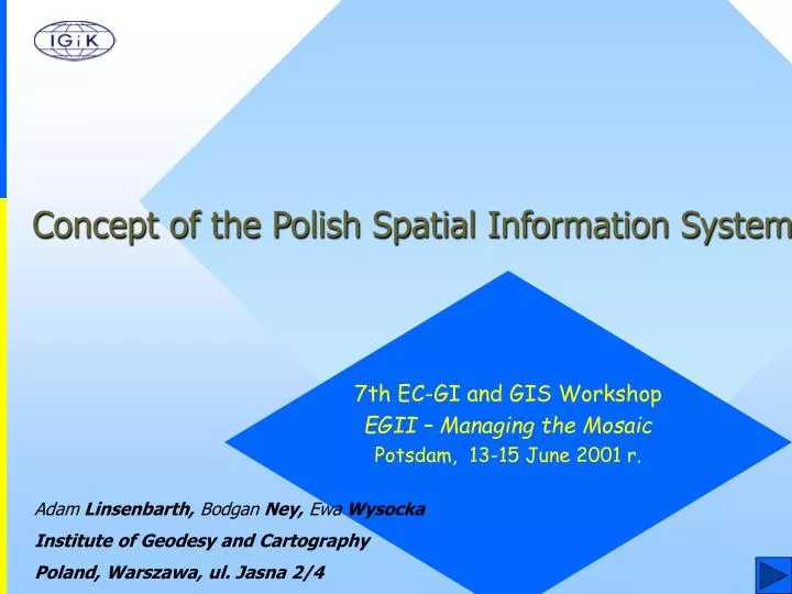
Concept of the Polish Spatial Information System. 7th EC-GI and GIS Workshop EGII – Managing the Mosaic Potsdam, 13-15 June 2001 r. Adam Linsenbarth, Bodgan Ney, Ewa Wysocka Institute of Geodesy and Cartography Poland, Warszawa, ul. Jasna 2/4. General Information.

E N D
Concept of the Polish Spatial Information System 7th EC-GI and GIS Workshop EGII – Managing the Mosaic Potsdam, 13-15 June 2001 r. Adam Linsenbarth, Bodgan Ney, Ewa Wysocka Institute of Geodesy and Cartography Poland, Warszawa, ul. Jasna 2/4
General Information The research project "Concept of the Polish Spatial Information System”, commissioned by the Ministry of the Interior and Administration and financed by the State Committee for Scientific Research were conducted by the Institute of Geodesy and Cartography in Warsaw The project has been implemented in cooperation with Warsaw University of Technology, Academy of Mining and Metallurgy in Cracow, Warmia-Mazury University in Olsztyn, Silesian University as well as other units and individual experts and consultants
General Information The main aim of the project was to propose a general concept of the national spatial information system (SIS), which would function as an integrated system, based on existing and future geographic information systems The works were conducted in the thematic blocks,comprising the following tasks: • SIS users and their needs • conceptual model of SIS • informational and legal aspects of SIS • the technical and functional architecture of SIS • an economic model of SIS • a final conceptual version of the Polish Spatial Information System
User Requirements • Analysis of demand for output spatialinformation • Analysis of operating and designed spatial information systems in Poland of branch and regional type from the point of view of their scope of contents as well as functional integration • Comparative analysis of the selected foreign systems in aspect of their utilization for SIS establishing in Poland.
User RequirementsThematic Contents of SIS Local Level (communites, districts) Scales: 1:500, 1:1000, 1:2000, 1:5000 Thematic Layers (selected examples)
User RequirementsThematic Contents of SIS Regional Level (voivodships) Scales: 1:10 000, 1:50 000 Thematic Layers (selected examples)
User RequirementsThematic Contents of SIS Central Level (national) Scales: 1:100 000, 1:200 000 (aggregated and generalised data) Thematic Layers (selected examples)
SIS Model • Analysis of structural and functional connections of the national SIS with the national statistics registers (PESEL, NIP, REGON) and with branch and regional information systems • Analysis of SIS relations with cadastral system (land and buildings registration) on the levels: local, regional and national • Model of the structure and rules of function of SIS
TWÓRCA TWÓRCA TWÓRCA TWÓRCA twórca danych twórca danych TWÓRCA TWÓRCA opisowych TWÓRCA TWÓRCA opisowych twórca danych twórca danych twórca danych twórca danych opisowych opisowych twórca danych twórca danych geometrycznych geometrycznych opisowych opisowych DYSPONENT DYSPONENT DYSPONENT DYSPONENT ośrodek informacji ośrodek informacji DYSPONENT DYSPONENT DYSPONENT tematycznej DYSPONENT tematycznej ośrodek informacji ośrodek informacji ośrodek ośrodek tematycznej tematycznej ośrodek informacji ośrodek informacji dokumentacji dokumentacji tematycznej tematycznej geodezyjnej i geodezyjnej i kartograficznej kartograficznej INTEGRUJĄCY DYSTRYBUTOR INTEGRUJĄCY DYSTRYBUTOR centrum przetwarzania i firma centrum przetwarzania i firma rozpowszechniania rozprowadzająca rozpowszechniania rozprowadzająca informacji przestrzennej dane przestrzenne informacji przestrzennej dane przestrzenne ODBIORCA ODBIORCA ODBIORCA ODBIORCA ODBIORCA ODBIORCA ODBIORCA ODBIORCA użytkownik C użytkownik A użytkownik B użytkownik D użytkownik A użytkownik B użytkownik C użytkownik D SIS ModelSIS partners relationships Dane opisowe Dane geometryczne Produkty informacyjne Produkty informacyjne SIP SIP Informacja wtórna Produkty informacyjne Produkty informacyjne
Informational and Legal Aspects of SIS • Studies on methodology of the integration of information from different cartographic sources; • Definition and choice of the invariable elements in natural information; • Study on legal aspects of SIS. Elaboration of rules and procedures of the legal regulations for creation and functioning of SIS and attaching the features of documents, which will be respective in administrative and judicial proceedings of the output information.
Informational and Legal Aspects of SIS • legal authorization of SIS in context of one legal regulation or insertion of entries into existing legal acts applied to collecting, updating and making available spatial data; • legal definition of spatial data and information; • legal regulations of the circulation of spatial data and information and making decision on the basis of these data and in administrative proceedings (legal and evidential force of an electronic document); • legal basis for spatial data exchange within public administration units, between these units and between public administration and other partners; • legal basis for the fees of access to spatial information.
Technical and functional architecture of SIS Study on internal structure, functional model and mutual relations of the SIS participants in Poland; Analysis and rational unification of the processes of receiving and updating of input information for the system and concept of its future modernisation; Technical and functional standardisation of SIS with taking advantage of the results of national research and foreign models, especially from EU.
Technical and functional architecture of SISStudy oninternal structureand functional model • 3 level, hierarchical, modular system architecture • Open system with access regulations • Distributed configuration • Object – relational central database • Different data models on different levels • Integrated data collected in Data Warehouses, located in SIS Centres: • 329 district („powiat”) SIS Centres • 16 voivodship SIS Centres • 1 Central SIS Centre
CENTRAL WAREHOUSE Branch thematic systems Regional systems REGIONAL WAREHOUSES DISTRICT WAREHOUSES Technical and functional architecture of SISStudy oninternal structureand functional model SIS structure Local systems
Technical and functional architecture of SISStudy oninternal structureand functional model
Technical and functional architecture of SISStandards • Study on standards and norms concerning: terms, data, metadata, input and output formats, hardware and software • Study on the national standards (formats of data interchange SWING and TANGO) • Adoption of the CEN and ISO standards • Establishing of the Normalisation Commission Geographic Information within the Polish Normalisation Committee (PKN)
Technical and functional architecture of SISMetadata System of Metadata including description of data type, range, origin and access as well as description of structures and data formats, which enables system designers and analysers to develop and modernize the database and design new applications The procedures of data exchange and data access Metadata system properly organized makes possible to meet a demand for openness of SIS in Poland
Technical and functional architecture of SISMutual relations of the SIS participants in Poland The SIS will be connectedwith the governmental / ministerial, specialized and thematic systems through multilevel applications The applications contact with the „outer world” will be organised through dedicated adapters
Technical and functional architecture of SISMutual relations of the SIS participants in PolandLocal level
Technical and functional architecture of SISMutual relations of the SIS participants in PolandRegional level
Technical and functional architecture of SISMutual relations of the SIS participants in PolandRegional level
Central Statistics Office PIOŚ, IOŚ, IMGW Systemy dot. środowiska IUNG, IMUZ Gleby i gospodarka rolna IBL, GDLP Lasy państwowe i gospodarka leśna GDDP, COBD ABiEA Drogi i autostrady IMGW Systemy meteorologii i gospodarki wodnej PIG Geologia i rzeźba terenu Central SIS Centre IGiPZ PAN Sprawy społeczne, flora i fauna Systemy branżowe energetyki, gazu, łączności itp. Central LIS Centre Central administration users Interministerial SIS Council Regional Data Warehouses Technical and functional architecture of SISMutual relations of the SIS participants in PolandCentral level