Download
1 / 22
220 likes | 329 Vues
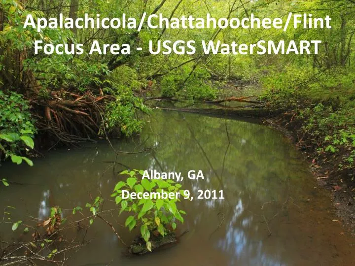
Apalachicola/Chattahoochee/Flint Focus Area - USGS WaterSM A RT. Albany , GA December 9, 2011. Objectives of Water Census. To place technical information and tools in the hands of stakeholders, allowing them to answer two primary questions about water availability:

E N D
Apalachicola/Chattahoochee/FlintFocus Area - USGS WaterSMART Albany, GA December 9, 2011
Objectives of Water Census • To place technical information and tools in the hands of stakeholders, allowing them to answer two primary questions about water availability: • Does the Nation have enough freshwater to meet both human and ecological needs? • Will this water be present to meet future needs?
SECURE Water Act (P.L. 111-11) Report to Congress - Every 5 years: • The current availability of water resources in the United States, • Significant trends affecting water availability, including documented or projected impacts as a result of global climate change, • The withdrawal and use of surface water and groundwater by various sectors, • Significant trends relating to each water use sector, including significant changes in water use due to the development of new energy supplies, • Significant water use conflicts or shortages that have occurred or are occurring, • Each factor that has caused, or is causing, a conflict or shortage.
Focused Water Availability Assessments • Three studies focused on selected watersheds: the Colorado, Delaware, and Apalachicola, Chattahoochee, Flint Rivers—where there is significant competition over water resources. Here, the USGS will work collaboratively with stakeholders to comprehensively assess the technical aspects of water availability.
The ACF Basin • Basin covers about 19,600 square miles • Annual precipitation is about 55 inches • About 74% of the Basin is in Georgia • Drinking water supply - • 60% Georgia • 8% Alabama • 1% Florida • One third of Georgia’s irrigated agriculture • About 6% of the basin lies above Lake Lanier, • BUT 62.5% of basin storage capacity is in Lake Lanier
ACF WaterSMART plans Formed 3 teams to develop goals and activities for: • Water Use Assessment • Integrated Surface-Ground Water Models • Ecological Flow Assessment
Water Use • Compilation of available water withdrawal and return flow data for 2007-2011 • Development of new methods to estimate agricultural withdrawal • Estimation of net water use Goal is to build on existing water use programs in all 3 states
Water Use Tasks • Estimate consumptive use based on available water withdrawal and discharge data • Interbasintransfers • Use satellite-based models to estimate evaporative losses from irrigated lands
Ground Water/Surface Water Interactions Goals • Assess groundwater and surface-water availability under current hydrologic, climatic, land-use, and water-demand conditions • Simulate different climatic scenarios • Simulate projected changes in land-use
GW/SW Tasks • Develop an integrated watershed assessment. • Couple existing digital groundwater- and surface-water-flow system models. • Simulate interaction of climatic factors with human management of system.
Environmental Flow Goals • Improve ability to forecast ecological outcomes for future scenarios of water availability and use • Build on existing models for ACF that couple hydrology with metapopulation dynamics for fish and mussel assemblages • Collect and compile data to narrow uncertainty regarding flow-ecology relations, as conditioned by water quality and landscape condition
Environmental Flows Tasks • Strategic data collection – fish, mussel and water quality dynamics in relation to flow variability • Expanding and developing data sets for testing ecological flow hypotheses • Integrating water quality and flow alteration effects with existing models for forecasting ecological responses to future water management
Progress on ACF WaterSMART • USGS planning meeting on June 22–23, 2011 • Formed working groups for 3 areas of technical concern • Water Use • Ground Water/Surface Water Interactions • Ecological Assessment of Instream Flows • Drought conditions hydrologic, water quality, and ecological sampling during July and August • National meeting week of December 5-9, 2011 • Stakeholder meeting - January 11, 2012
WaterSMART Details • Timescale—3 years, 2012-2014 • Requested Funding • $500K/year for water component* • $200K/year for ecological component • Products • USGS reports, journal articles documenting results • Models/Tools *Current outlook for Federal funding ranges from $300-$500K
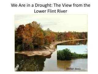
ACF WaterSMART—Drought Synoptic • Drought conditions in basin provided unique opportunity to characterize hydrologic conditions and ecological habitats during peak of irrigation season • USGS Centers launched large scale drought synoptic effort during week of July 18th— • Stream flow and water-quality measured at 200 sites • Groundwater levels measured at 400 wells
ACF WaterSMART—Drought Synoptic Environmental flows work in August/September • Ecological sampling to assess populations of fish and mussels and collect water quality samples in streams within the Piedmont and Coastal Plain. • Will expand this field effort in coming months to measure biological recovery from drought in differing portions of the basin.
Summer 2011 Drought Synoptic Alabama Alabama Georgia Georgia Florida Florida Surface water sites Ground water sites
Ecological Drought Synoptic • Sampled 16 sites in the ACF for fish and water chemistry under extreme low-flow conditions • Data will be used to parameterize models on fish community response to flow conditions
Synoptic flow, groundwater, and ecological sampling in comparison Long Term and average groundwater conditions in Mitchell County, GA 1 Year 5 Year 30 Year
WaterSMART Model Comparison Study 3 different techniques for estimating flow on ungaged streams will be tested: • Statistically-Based Models • Water-Balance Model • Process-Based Model


![[PDF] Free Download Broken Dolls By Sarah Flint](https://cdn4.slideserve.com/8079011/slide1-dt.jpg)