Download

1 / 43
460 likes | 819 Vues
GA Rivers. Essential Questions . Why are rivers important? Which rivers are the major rivers of GA? Where are the major rivers of GA located?. Chattahoochee River. If you look at a map of Georgia and Alabama, you see that the Chattahoochee River, to the west divides Georgia from Alabama.

E N D
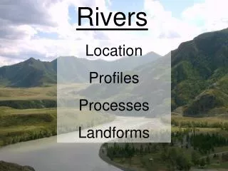
Essential Questions • Why are rivers important? • Which rivers are the major rivers of GA? • Where are the major rivers of GA located?
If you look at a map of Georgia and Alabama, you see that the Chattahoochee River, to the west divides Georgia from Alabama.
Flowing for 400 miles, the Chattahoochee River is the longest river in Georgia. The Chattahoochee River runs through Georgia and into Florida.
Chattahoochee is a Native American name meaning “painted rock. This river begins in the Blue Ridge Region.
The Chattooga River serves as part of the boundary between Georgia, South Carolina after leaving North Carolina.
The fifty-mile Chattooga River begins at the base of Whitesides Mountain. • Cherokee Indians occupied the Chattooga River watershed prior to European arrival.
Chattooga has a variety of meanings, including: “he drank by sips,” or “he has crossed the stream and come out upon the other side.”
Today, Chattooga River is a popular destination for rafters, canoers, and kayakers.
The Ocmulgee River is located in the middle or the sate. Long ago, there were Native American villages located along the Ocmulgee River.
The name Ocmulgee is from a Creek Indian word that means, “bubbling water.”
The Ocmulgee begins that an elevation of around 1,000 feet above sea level in the headwaters of the Yellow and South rivers in north central GA.
As cotton production expanded into the rich Lower Ocmulgee bottomlands, steamboats navigation offered the fastest route to coastal markets.
Today, Ocmulgee River is famous for the Ocmulgee Trail and Ocmulgee State Park.
The Savannah River runs into the Atlantic Ocean. • Though the Savannah itself begins in the Piedmont Region.
The Savannah River, one of GA’s longest and largest waterways, defines most of the boundary between GA and South Carolina.
Savannah River is a major electricity-generating facility operated by GA Power Company.
On the coast, the Savannah River is the shipping channel for the Port of Savannah, the nation’s tenth-busiest port.
Savannah River is one of GA’s most important seaports. Big ships travel this river to take GA goods to other places.
Savannah National Wildlife Refuge is one of GA’s prime bird-watching spots.
Oconee river is 282 mi. long, rising in the Appalachian Mountains, North GA.
The Oconee River begins in Hall County in North GA. It flows through Athens. • As the Oconee River travels south, it joins the Ocmulgee River.
The name of the river is from an early Creek Indian settlement in northeast Baldwin County called Oconee Old Town.
Oconee is the Creek word for “the place of springs” or “the water eyes of the hills.”
Oconee River Whitewater Rafting is very popular! • Oconee River is also popular for camping!
Altamaha River is a major river of the American state of GA. • It flows generally eastward for 137 miles from its origin of the Oconee River and Ocmulgee River towards the Atlantic Ocean.
The Altamaha River is 137 miles long and runs from central GA to the southeastern coast of the state.
The Altamaha River has been declared the 7th most endangered river in the US due to the loss of water flow that has resulted form power plants along the shoreline.
Oconee River is known for fishing. *Flathead Catfish
The Flint River is an approximately 150 miles long river. • The Flint River stretches from the Piedmont to the Chattahoochee River in southwest GA.
The Flint River is famous for floods. Fifteen years ago, a tropical storm made the river rise.
The Flint River flood is one of the worst natural disasters in GA history.
The St. Marys River flows into the Okefenokee Swamp. It is the largest swamp in the United States.
St. Marys River is approximately 90miles long. • St. Marys River is named after the Irish saint St. Mary.