Download
1 / 34
360 likes | 476 Vues
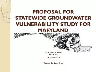
By Olufunso S. Ogidan Environmental Science Officer U.S. Army ADVISER: Dr. Barry Evans 24 May 2010. STATEWIDE DRASTIC GROUNDWATER VULNERABILITY STUDY FOR MARYLAND. Outline. Background & Scope DRASTIC Description Data and Analysis Result Limitations Conclusion. Background and Scope.

E N D
By Olufunso S. Ogidan Environmental Science Officer U.S. Army ADVISER: Dr. Barry Evans 24 May 2010 STATEWIDE DRASTIC GROUNDWATER VULNERABILITY STUDY FOR MARYLAND
Outline • Background & Scope • DRASTIC Description • Data and Analysis • Result • Limitations • Conclusion
Groundwater pollution in Maryland • Methyl Tertiary Butyl Ether (MTBE) leakages into groundwater • Currently there are 8,500 Underground Storage Tanks (UST) and 11,109 confirmed releases • Pesticide presence in groundwater system • Other potential sources of groundwater contamination-Spillage, Waste Disposal sites etc.
Maryland Groundwater Protection Programs • Most groundwater protection plan are implemented at the local government level • Maryland Department of the Environment (MDE) provides technical, informational and funding support to the local governments • Most programs focused on protection of the areas around wells where activities could result in contamination • Groundwater recharge areas protection • Currently there is no statewide groundwater vulnerability map
Project Goal • To develop a Statewide Groundwater Vulnerability map • Rank areas based on the DRASTIC vulnerability index • Identify areas with the greatest potential to groundwater pollution • Provide information on areas where targeted critical vulnerability assessment might be required
Description of the DRASTIC Method • The DRASTIC Model is the most widely used groundwater vulnerability assessment method available • DRASTIC utilizes seven hydrogeologic parameters to determine vulnerability to groundwater contamination • DRASTIC is an acronym that stands for the initial of the seven hydrogeologic parameter D = Depth to groundwater R= net Recharge A= Aquifer media S= Soil media T= Topography (Slope) I = Impact of the vadose zone C= hydraulic Conductivity
Assigned Weight for DRASTIC Parameters • Each DRASTIC parameter is assigned a relative weight ranging from 1 to 5 based on their relative importance in influencing the flow of contaminants into groundwater system. Aller, L., T. Bennett, J.H. Lehr, R.J. Petty, and G. Hackett, 1987. DRASTIC: A Standardized System for Evaluating Ground Water Pollution Potential Using Hydrogeologic Settings. EPA 600/2-87/035, Ada, OK, 163 pp.)
Weighting and Rating • Each hydrogeologic parameter was assigned a rating between 1 and 10 based on the ranges or significant media type • Each rating was scaled by the Weighting factors ranging from 1 to 5 • The summed weighted ratings produced the DRASTIC Index Di
Depth to Water • Depth to water (DTW) determines the distance that contaminants have to travel before reaching the groundwater • Depth to Water was estimated from interpolation of data obtained from USGS for 490 groundwater wells in and around Maryland • An average of depth from the surface to water (in feet) over four years was used to determine Depth to water at that point • Continuous Interpolated Depth to Water surface for the state was generated by interpolation of the point data • Ratings were assigned and reclassified to generate the Depth to Water Surface
Net Recharge • Net Recharge (inch per year) is the quantity of water from precipitation that infiltrate into the ground to reach the water table • There is no existing statewide net recharge data for Maryland • Estimated net recharge was generated from the hydrological soil group characteristics data obtained from the USDA based on an annual precipitation of 46 inches/year • Ratings were assigned and reclassified to generate the Net Recharge Surface
Aquifer Media • Aquifer media refers to the consolidated or unconsolidated subsurface rocks that serves as the aquifer • An aquifer is a water bearing formation that can economically yield water to well • Aquifer media data was obtained from USGS • Ratings were assigned based on the significant media type and reclassified to generate the Aquifer media surface
Soil Media • Soil Media is the upper weathered zone of the earth up to about six feet or less from the surface • Soil Media affect the infiltration and biogeochemical attenuation of contaminants • Soil media data was obtained from the USDA soil data mart • Ratings were applied based on the significant soil type and drainage attribute of the media • Ratings were reclassified to generate the soil media surface
Topography (Slope) • Topography is the slope variability of the land surface • Topography influence the proportion of precipitation and anthropogenic contaminants runoff or infiltration into the ground • Slope was generated from the 30m Resolution Digital Elevation Model (DEM) using the slope tool of ArcGIS Spatial Analyst • Ratings were assigned to the percent slope and reclassified to generate the Slope Surface
Impact of the Vadose Zone • The vadose zone is the zone between the land surface and the regional water table • The DRASTIC ratings for the impact of the vadose zone are based on the characteristics of the unsaturated zone rock types • Vadose zone data was estimated from published geological data • Ratings were assigned based on the significant media type and reclassified to generate the Impact of the Vadose Zone surface
Hydraulic Conductivity • Hydraulic conductivity is the ability of an aquifer to transmit water • Hydraulic conductivity (gpd/ft2) determines the rate at which groundwater will flow under a specific hydraulic gradient in the saturated zone • There is no statewide hydraulic conductivity data for Maryland aquifers • Estimated Hydraulic conductivity was made from the physical characteristics of the local aquifer • Ratings were applied to the estimated hydraulic conductivities and reclassified to generate the Hydraulic Conductivity Surface
DRASTIC Index • DRASTIC index was computed by applying a linear combination of the seven parameters based on the equation below Di= DRDW + RRRW + ARAW + SRSW + TRTW + IRIW + CRCW Where Di = DRASTIC Index D, R, A, S, T, I, C = Initials of the seven hydrogeologic factors, R= Ratings W= Weight
Interpretations • The resulting thematic map provides a relative ranking of the DRASTIC Index (Di) based on susceptibility to groundwater pollution. • The higher the calculated DRASTIC index for an area, the greater the vulnerability of that area to groundwater contamination • In general, the DRASTIC Index is higher in the Eastern part of the state and around the edges of the Chesapeake Bay • Vulnerability generally reduces westward from the Chesapeake Bay with the lowest vulnerability in Garrett and Allegany counties
Limitations • Some hydrogeologic parameters were estimated due to unavailability of published data • There was no available data on the spatial locations of previous groundwater contaminations in the state of Maryland • Di cannot be singularly used to determine the suitability of a site for waste disposal or USTs.
Conclusion • The DRASTIC method utilize a combination of Assigned Weighting and Rating Schemes to seven hydrogeologic parameters to generate groundwater pollution potential map • DRASTIC methodology was used to generate a statewide groundwater vulnerability map for Maryland that show areas with the greatest potential to groundwater pollution • The resulting map provide decision makers with areas where targeted critical groundwater quality and vulnerability assessments might be required