Download
1 / 19
190 likes | 434 Vues
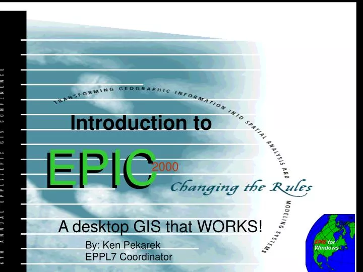
Introduction to. EPIC. EPIC. 2000. 2000. A desktop GIS that WORKS!. By: Ken Pekarek EPPL7 Coordinator. What you will learn today. An Overview of Epic 2000. How to Use Epic 2000 How to install EPIC 2000 How to View and Print Maps How to Produce reports How to understand Data

E N D
Introduction to EPIC EPIC 2000 2000 A desktop GIS that WORKS! By: Ken PekarekEPPL7 Coordinator
What you will learn today An Overview of Epic 2000 How to Use Epic 2000 • How to install EPIC 2000 • How to View and Print Maps • How to Produce reports • How to understand Data • How to build a base map Using Epic to solve problems • How to add graphics into a presentation • How to build a study area • How to add detailed land use & GPS data • How to evaluate proposed sites
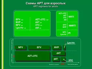
Raster Vector Two Views of GIS or
GIS Options DNR - LMIC extensions link EPPL7, EPIC and ArcView
What is EPIC? EPIC Stands for EPPL Interface Consortium of Minnesota State Agencies. Presently DNR, LMIC & BWSR are members. New members are welcome! EPIC Began as a DOS based interface to EPPL7 8 years ago. In June, 1998 EPIC for Windows 1.1 was released. EPIC 2000 was just released. EPICis a desktop GIS created by users for users. It is a dynamic and evolving program and new data CDs will be released shortly . .
What Epic can do • View and map data • Analyze Data • Build detail study areas • Add GPS data
Epic 2000 Applications • Access to data. EPIC has over 700 data layers that can be mapped or viewed from within ArcView. • Analysis of natural resources. Community foresters use EPIC to control the spread of oak wilt. • Growth management studies: I-94 Corridor Study is a Prototype.
2000 Installing EPIC • Load EPIC from the Start button. Select the Run option, type D:\SETUP.EXEthen follow the prompts • Select Typical installation. • EPIC installs 180 megs of data This is only a sample of over 700 statewide and 150 metro data layers.
2000 Starting EPIC or EPIC 1.1 • Double click EPIC icon & select FILE, Open Study area • Select a study area from the left and a layer from the right • ClickOK
2000 Viewing data: EPIC vs EPIC1.1 • EPIC 2000 draws the map automatically • EPIC 1.1 you need to click the Globe
Lessons on How to use Epic • Lesson 1 - Build a map atlas • Lesson 2 - Make a presentation • Lesson 3 - Evaluate alternative landfill sites in Rice county.
Lesson 1: Building a Base Map EPIC has the most up to date boundary files for the state and tools that allow you to make reference maps. The map below is Map18: Ethanol Plants in Minnesota Lesson 1: How to build a base map to place on the Web, in a report or as part of a statewide map set like “Food for Thought” Map 18: Ethanol Plants (corn processing) Plant Locations existing and proposed
Lesson 2: Define a Project area EPIC has analysis tools that allow you to select a project area, county or school district from over 30 statewide boundary files. The map below is an example of a project area map. Lesson 1: How to locate a project area or school district and create a graphic that can be used in a presentation, on the Web or in a report. Rice County Landfill siting Study An example of how a graphic can be added to a presentation as a reference map.
Lesson 3: Site Evaluation Epic has the ability to load identify point features using GPS data and then evaluate environmental impacts. Lesson 3: Locate landfill sites using GPS data and then evaluate the potential impacts of the proposed sites. Rice County Landfill Study • Existing site
Proposed Landfill Sites EPIC Allows you evaluate the potential impact on adjacent land uses, surface water or groundwater
Evaluation of site 4 Detail maps can be made that show the potential conflicts with adjacent land owners or the potential impact on groundwater resources.
EPIC 2000 - A GIS for the rest of us a desktop GIS that is easy to use! Includes Statewide and county data on CD: land use, NWI, MnDOT roads and lots of useful shapefiles
Location of Existing Landfill Site in Rice County • 22575.056 62.468 Whitewater township 85135 • 153.202 0.679 Urban-Rural Dev. • 6807.605 30.155 Culivated Land • 2564.898 11.362 Hay, Pasture & Grassland • 135.905 0.602 Brushland • 12624.339 55.922 Forest • 155.673 0.690 Water • 130.963 0.580 Bog/Marsh/Fenkfjdkfjdkfdjkf • 2.471 0.011 Mining