Download

1 / 15
150 likes | 270 Vues
Currents and Sediment Transport in the Mississippi Canyon and Effects of Hurricane Georges. Mary Jo Richardson Wilford Gardner Cheryl Burden Vernon Asper. Thanks for inviting us to HCMR. Mary Jo Richardson (Texas A&M University) Wilford Gardner (Texas A&M University - Fulbright Fellow).

E N D
Currents and Sediment Transport in the Mississippi Canyon and Effects of Hurricane Georges Mary Jo Richardson Wilford Gardner Cheryl Burden Vernon Asper
Thanks for inviting us to HCMR • Mary Jo Richardson (Texas A&M University) • Wilford Gardner (Texas A&M University - Fulbright Fellow)
Currents, temperature and particulate matter concentration • May - July 1998 • Aug - Nov 1998 • Current meters, thermographs, light-scattering sensor, sediment traps, cores, ROV video camera
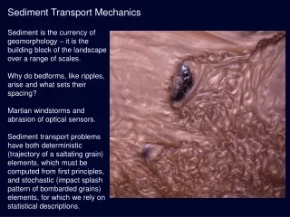
Canyons • Conduits of sediment to deep water • Oscillatory currents - internal waves • Storm events - hurricanes • Winter storm cooled - Mediterranean
Mississippi Canyon station locations and bathymetry. Contoursare in 100 m intervals. A. The upper portion of the map shows station locations from the 1998 cruise, including core, LAPS/ROV and mooring locations. B. The lower portion of the map shows station locations from the 1994 cruise. Transect lines and LAPS stations are numbered. Inset shows the study area in relation to the Louisiana coastline and Mississippi River Delta.
Back-scattered light (measured from the LSS) vs. particulate matterconcentration (PM) for the May 1998 cruise. All data are included; no division was made between surface and deeper water.
Temperatures at 33 and 3.5 mab for deployment 1 and B) deployment 2.
Vertical displacement of 50 m 2C change - saw tooth pattern • Up/down-canyon flow, bed shear stress, particle concentration, and temperature for days 172-181 at the canyon axis mooring site. Current velocity and temperature scales are reversed to match up/down-canyon flow. Deployment 1. • Up/down-canyon flow, cross-canyon flow, bed shear stress, and temperature for days 270-279 at the canyon axis mooring site. Current velocity and temperature scales are reversed to match up/down-canyon flow. Deployment 2.
Progressive vector plot of currents at 3.5 mab during the first mooring deployment. Net transport is mostly cross-canyon (South) at 50 mab and down-canyon at 3.5 mab (East) with a cross-canyon drift. X's denote midnight.
Progressive vector plot of currents at 3.5 mab during the second mooring deployment. Net transport is down canyon (East). X's denote midnight. The passage of Hurricane Georges is denoted in year days. Note unequal axes that also differ from the unequal axes of Figure 8.
Conclusions • Currents oscillated with diurnal periodicity • Currents exceeded critical bed shear stress 30% (normal) 50% (hurricane) • Sediment trap collection increased 70-130 X during hurricane • Trap fluxes better related to input from nearby rivers and resuspended sediment more than current strength, compared with other canyons
Special thanks to Aris (for inviting us) and Victoria (for sharing her office)