Download
1 / 40
400 likes | 548 Vues
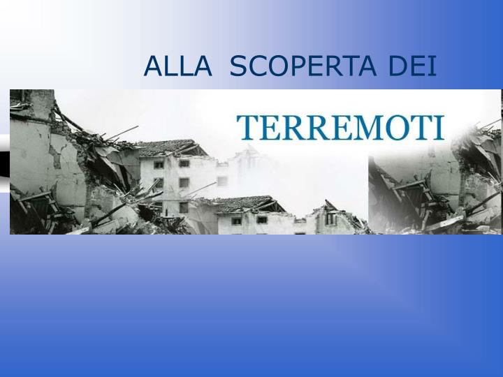
ALLA SCOPERTA DEI. I TERREMOTI. IL TERREMOTO E’ UN MOVIMENTO IMPROVVISO DELLA CROSTA TERRESTRE CHE COMPORTA LA LIBERAZIONE DI UNA GRANDE QUANTITA’ DI ENERGIA. Terremoto. Movimento della crosta terrestre dovuto a una rottura, uno scorrimento relativo o ad una esplosione vulcanica

E N D
I TERREMOTI IL TERREMOTO E’ UN MOVIMENTO IMPROVVISO DELLA CROSTA TERRESTRE CHE COMPORTA LA LIBERAZIONE DI UNA GRANDE QUANTITA’ DI ENERGIA
Terremoto • Movimento della crosta terrestre dovuto a una rottura, uno scorrimento relativo o ad una esplosione vulcanica • Si manifesta come una serie di onde che si propagano da un punto di rottura della faglia
Immaginiamo di prendere una morsa ed un mattone… Comprimiamo il mattone… …il mattone si deforma accumulando energia in modo elastico Se interrompiamo la pressione il mattone torna allo stato iniziale
Se prolunghiamo la pressione il mattone si deforma proporzionalmente all’energia… Quando il mattone non regge più lo sforzo… …si rompe liberando energia sotto forma di… ONDE ELASTICHE come quelle del terremoto
In un terremoto possiamo distinguere: • IPOCENTRO • EPICENTRO
MEASURING EARTHQUAKES The first known instrument for earthquakes measurement is the Chang seismoscope built in China in 132 B.C. Balls were held in the dragons’ mouths by lever devices connected to an internal pendulum. The direction of the epicenter was reputed to be indicated by the first ball released.
ONDE SISMICHE Onde P (o Primarie) Sono le più veloci. Sono anche dette "longitudinali" Fanno oscillare le particelle di roccia che attraversano parallelamente alla loro direzione di propagazione
Onde S (o Secondarie) Viaggiano più lentamente delle "P". Le Onde S non si propagano nei fluidi L'oscillazione delle particelle di roccia che attraversano avviene trasversalmente rispetto alla loro direzione di propagazione
Onde L (o Superficiali) Onde di Rayleigh Fanno vibrare il terreno secondo orbite ellittiche e retrograde rispetto alla direzione di propagazione dell'onda Fanno vibrare il terreno sul piano orizzontale Onde di Love
Esistono due scale per la misura dei terremoti: Mercalli Basata sull’intensità del terremoto Divisa in 12 gradi e si basa sui danni provocati dal sisma Richter Basata sull’energia sviluppata dal terremoto E’ divisa in 10 gradi (teorici)e si basa sulla MAGNITUDO
Approximate correlation between epicentral intensity (Io-MCS) and Richter magnitude INTENSITA’ (Mercalli scale) Empirical scale measuring the effects of an earthquake on the environment, people, and buildings MAGNITUDO (Richter scale) Instrumental scale measuring the amplitude of the ground motion recorded by a seismograph. It’s proportional to the energy released Misura dell’intensità del terremoto
Scala Mercalli 1: percepita soltanto dagli strumenti 2: avvertita solo da persone agli ultimi piani delle case 5: avvertita da tutte le persone, gli oggetti sospesi oscillano
6: avvertita da tutti; parecchi scappano fuori dalle case 8: distruzione di circa il 25% degli edifici 11: distruzione generale degli edifici e ponti coi loro pilastri
Scala Richter Magnitudo Richter effetti sisma Meno di 3.5: Generalmente non sentita, ma registrata. 3.5-5.4:Spesso sentita,raramente causa dei danni. Sotto 6.0: Al massimo lievi danni a solidi edifici. 6.1-6.9: Può arrivare ad essere distruttiva in aree di quasi 100 km. 7.0-7.9: Causa seri danni su grandi aree. 8 o maggiore: Può causare seri danni su vaste aree di svariate centinaia km.
Sismicità e tettonica Source: GSC
LE FAGLIE: • Le faglie: linee preferenziali dove avvengono le fratture ed i conseguenti spostamenti • Possono essere trascorrenti; inverse; dirette(o normali) • Trascorrenti: i 2 blocchi trascorrono l’uno accanto all’altro con direzione prevalentemente orizzontale. • Inverse: uno dei 2 blocchi sovrascorre sull’altro. • Dirette:uno dei 2 blocchi scende rispetto all’altro.
Tipologie di Faglie from Press and Siever (1994)
QUADRO SISMICO DELLA DISPOSIZIONE DELLE FAGLIE NEL BACINO DEL MEDITERRANEO
SAN ANDREAS FAULT Carrizo Plain (California)
I piu intensi terremoti dell’ultimo secolo San Francisco-USA 1906, M = 7.8, 750 victims
Mexico City 1985 M = 7.9 9.500 victims
Kobe - Japan 1995, M = 7.2, 5500 victims 230.000 homeless 70 billions dollars damage
Turkey, Izmit 1999, M = 7.4, about 17.000 victims, about 20.000 missing
Terremoto di Izmit 1999: effetto della faglia sulle costruzini: crolli a sandwich delle costruzioni in c.a. faglia faglia
Università degli studi di Genova Terremoto di Izmit Turkia 1999: deformazione della linea ferroviaria per effetto della rottura in superficie
Il Rischio Sismico Tsunami Ampi e repentini movimenti di onde marine, innescati da perturbazioni nella massa d’acqua Cause Terremoti Frane sottomarine Eruzioni vulcaniche
Italian strong motion network • SSN - ENEL • 258 instruments (95% analog Kinemetrics SMA1) • free field stations with an average spacing of 30 km • nearly 2000 records obtained in about 30 years of activity • annual cost of management and maintenance 600.000 US $
Kyoshin Net (K-NET) Japanese strong motion network http://www.k-net.bosai.go.jp • 1000 digital instruments installed after the Kobe earthquake of 1995 • free field stations with an average spacing of 25 km • velocity profile of each station up to 20 m by downhole measurement • data are transmitted to the Control Center and released on Internet in 3-4 hours after the event • more than 2000 accelerograms recorded in 4 years
Catalogo Parametrico dei Terremoti Italiani CPTI 1999 2480 events with I V-VI MCS and M 4.0 from 2187 B.C. to 1992 (only 24 events before year 1000)
Seismic risk assessment RISK MAP Percentage of the damaged surface of the residential real estate expected per year in each municipality (“Working group SSN-ING-GNDT” of the Civil Protection Department -1996)