Download
1 / 43
430 likes | 540 Vues
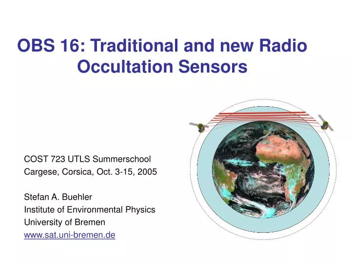
OBS 16: Traditional and new Radio Occultation Sensors. COST 723 UTLS Summerschool Cargese, Corsica, Oct. 3-15, 2005 Stefan A. Buehler Institute of Environmental Physics University of Bremen www.sat.uni-bremen.de. Outline. Motivation / Scientific goals “Classical” GPS radio occultation

E N D
OBS 16: Traditional and new Radio Occultation Sensors COST 723 UTLS Summerschool Cargese, Corsica, Oct. 3-15, 2005 Stefan A. Buehler Institute of Environmental Physics University of Bremen www.sat.uni-bremen.de
Outline • Motivation / Scientific goals • “Classical” GPS radio occultation • Future radio occultation with transmission measurements • Summary and Outlook Acknowledgements: Axel von Engeln ACE+ Mission Advisory Group (in particular Gottfried Kirchengast und Tobias Wehr)
Outline • Motivation / Scientific goals • “Classical” GPS radio occultation • Future radio occultation with transmission measurements • Summary and Outlook
Temperature Variability and Trends IPCC 2001: “The globally averaged surface temperature is projected to increase by ~1.4–5.8°C over the period 1990 to 2100.” (= average increase ~0.1°C to 0.5°C per decade) (Figures: IPCC 2001)
Hydrological cycle for doubling CO2, IPCC scenario (simulation) Water Vapour and Climate Change Water vapour is the most important greenhouse gas. But radiative forcing and feedbacks associated with water vapour changes remain disputed and uncertain. Water vapour abundance is most unknown in the upper troposphere.
Outline • Motivation / Scientific goals • “Classical” GPS radio occultation • Future radio occultation with transmission measurements • Summary and Outlook
“Classical” Radio Occultation • See posters by M. Borsche and S. Schweitzer • Use GPS satellite signals at 1.6 and 1.2 GHz • Receiver on satellite (CHAMP, GRASS on Metop) or ground • Measures phase delay (time measurement) • Phase delay related to speed of propagation in atmosphere • catmosphere = cvacuum / n Refractive index
The Huygens-Fresnel Principle c1, n1 c2, n2 Christiaan Huygens 1629-1695 Augustin Fresnel 1788-1827 (Gerthsen-Kneser-Vogel) Secondary waves at every point along the wave front Wave travels more slowly in medium Ray bends c: speed of light
Snell´s Law n: Refractive index Willebrord Snel van Royen (Snellius) 1580-1626 α1 n1≈1 (e.g., air) n2>1 (e.g., water) α2
Refractive Index and Refractivity in the Atmosphere • Refractive index n (surface: 1.000300) • Refractivity N = 106(n − 1) (surface: 300) • Refractivity for low frequencies: N = 77.6 pT-1 + 3.73 · 105eT-2pressuretemperaturewater vapor pressure • Atmosphere refraction exponentially decreases with altitude • Snell’s law gives direction modification of ray
Radio Occultation Geometry Phase delay (time measurement) Bending angle Refractivity (Figure courtesy Axel von Engeln and/or University of Graz)
Refractivity depends on pressure, temperature, and humidity • Influence of humidity negligible in stratosphere With assumption of hydrostatic balance sensor can measure temperature
CHAMP RO data over Hawaii Figure courtesy Grace Peng < grace.s.peng@ aero.org > • Humidity and temperature both important in troposphere Can (in principle) retrieve humidity if temperature is known from GCM analysis (or vice versa)
Ground Based Receivers • Path delay due to dry atmosphere practically constant (about 2m) • Path delay due to water vapor (about 1/10 of the dry delay) highly variable Can be used to retrieve total column water vapor • Absolute measurement accuracy of about 1 kg/m2 Very good relative accuracy in tropics, not good for extremely dry locations Note: All numbers here are from the top of my head and very uncertain. Better check for yourself before using them!
CHAMP / GRASS • CHAMP is a German managed radio occultation instrument (GFZ) • Launch: July 15, 2000 • Provides measurements of stratospheric temperature and tropopause altitude. • Mixed T/humidity product in troposphere • Height of planetary boundary layer (by-product from altitude where signal is lost) • GRASS will be the RO instrument on Metop, with capabilities broadly similar to Champ
ECMWF Analysis Cases GNSS-LEO Performance Statistics of retrieval results versus requirements • GPS occultation well demonstrated GPS/MET, CHAMP, SAC-C • Important climate parameters with respect to GNSS-LEO are: refractivity, geopotential height, dry temperature, humidity (< 5–8 km) Low-latitude ensemble Mid-latitude ensemble High-latitude ensemble height [km] height [km] height [km] abs. spec. hum. error [g/kg] abs. spec. hum. error [g/kg] abs. spec. hum. error [g/kg] Absolute errors of specific humidity profiles Dry temperature accuracy from example end-to-end simulation; each average profile (every 10-deg lat.) involves ~50 simulated individual GNSS-LEO occultation profiles sampled by ACE+ constellation within a full summer season (June-July-August). Expected 25-year temperature trends 2001–2025 (Model: Hamburg ECHAM5 at T42L39 resolution). height [km] height [km] height [km] temperature error [K] temperature error [K] temperature error [K] Errors of retrieved temperature profiles 31
Atmospheric Refractivity an indicator for climate change Climate-induced refractivity variations Inter-annual refractivity variations 15 km 15 km 5 km 5 km (Figures: Vedel & Stendel, DMI) Atmospheric refractivity is particularly sensitive to climate change, similar to the geopotential height of pressure levels
Outline • Motivation / Scientific goals • “Classical” GPS radio occultation • Future radio occultation with transmission measurements • Summary and Outlook
The Refractive Index Re(n) Im(n) 1 Frequency • Actually a complex quantity • Real part: Responsible for phase delay, measured by GPS systems • Imaginary part: Responsible for absorption, measured indirectly by most other remote sensing techniques • Re(n) spectrally flat for sum of many lines Must measure Im(n) to get trace gas signatures Behavior of complex refractive index near an absorption line
H2O Spectrum Take lowest frequency line to minimize impact of clouds and precip. • 22 GHz line is also used for uplooking passive MW measurements (see poster by A. Haefele) AMSU-B, UARS-MLS Good for radio occultation
What I will show now is from a concept for a RO mission involving several small satellites • Mission name: ACE+ (unrelated to Canadian ACE mission) • Phase A study in 2003/2004 • Not selected, but similar proposals in current call
GPS / Galileo L-Band Transmitter GPS / Galileo L-Band Transmitter 2 ACE+ satellites at ~800 km: X/K-Band Transmitter L-Band Receiver 2 ACE+ satellites at ~650 km: X/K-Band Receiver L-Band Receiver Observation Technique GNSS-LEO Occultation Component 2 ACE+ satellites at ~800 km: X/K-Band Transmitter L-Band Receiver 2 ACE+ satellites at ~650 km: X/K-Band Receiver L-Band Receiver • Exploits refraction of L-band signals between GPS/Galileo and ACE+ receiving satellites. • Measurements of phase delay bending angle real refractivity temperature, pressure (> ~8 km). Humidity, temperature, pressure with a priori information on temperature (< ~8 km).
GPS / Galileo L-Band Transmitter GPS / Galileo L-Band Transmitter LEO-LEO Occultation Component 2 ACE+ satellites at ~800 km: X/K-Band Transmitter L-Band Receiver 2 ACE+ satellites at ~800 km: X/K-Band Transmitter L-Band Receiver 2 ACE+ satellites at ~650 km: X/K-Band Receiver L-Band Receiver 2 ACE+ satellites at ~650 km: X/K-Band Receiver L-Band Receiver Observation Technique • Exploits refraction and absorption of X/K-band signals (~10, 17, 23 GHz at water vapour absorption line) between transmitting and receiving satellites (2 pairs 4 satellite constellation). • Measurements of phase delay & amplitude bending angle & transmission real & imaginary refractivity humidity, temperature, pressure (independently above ~2–6 km).
Need two frequencies to separate humidity absorption from cloud absorption • Third frequency needed for dynamic range
Tangent altitude [km] • Large dynamic range required for receiver Different curves = different frequencies
Self-calibration of both refraction and transmission measurements
Orbits R1 R2 T1 T2 Example LRO event timing • Inter-satellite phasing: 180o for TX; ~80o or 45o for RX • TX-RX pointing at each other to use simple and highly directive antennas • Sun-synchr. orbits at 9:30/21:30 local time • Altitudes: ~650 km (RX) and ~800 km (TX)
1 day 1 day 1 month 1 month LEO-LEO coverage 1 day (232 occultations = 116 setting [] + 116 rising []) LEO-LEO coverage 1 day (232 occultations = 116 setting [] + 116 rising []) LEO-LEO coverage 1 month (7203 occultations = 3601 setting [] + 3602 rising []) LEO-LEO coverage 1 month (7203 occultations = 3601 setting [] + 3602 rising []) 1 day GPS-LEO+Galileo-LEOcoverage 1 day (4515 occultations = 2240 setting [] + 2275 rising []) ACE+ Geographical Coverage • Coverage: • LEO-LEO • ~230 profiles/day • ~7000 profiles/month • GNSS-LEO (GPS & Galileo) • 24 GPS & 27 Galileo sats • ~4500 profiles/day
Satellites • TX and RX satellites identical except for LRO electronics • Modular concept • Configuration driven by antenna accommodation and thermal stability • Star-tracker(s) tightly coupled to LRO antennas • Good attitude control performance: < 0.05o pointing accuracy, < 0.005o pointing drift over 30 s • Thermal stability for LRO electronics (RX: < 0.1o/minute) • Mass: ~160 kg • Power consumption: ~250 W • Data rate: ~250 Mb/orbit • Dimensions: < 1.3 m 0.8 m 0.7 m flight direction LRO antennas Earth limb nadir GRO antenna star-tracker
Geophysical Products Performance Assessment Performance Simulator Observation Simulator • Geometry and signal propagation modelling • Instrument simulation Model atmosphere e.g. from climatology or ECMWF analyses • Temperature, • Humidity, • Pressure, • ... Instrument parameters ACE+ Level 1b data products • Doppler shift profiles • Bending angle profiles • Transmission profiles • ... Comparison Geophysical Retrieval Processor Retrieved atmosphere • Temperature, • Humidity, • Pressure, • ... Background profiles (for retrievals without absorption meas.) • Temperature, • ...
ECMWF Analysis Cases • Input (“true”) atmosphere for simulation: • T511L60 ECMWF analysis (12 UTC analysis of Sept. 15, 2002; background shows integrated liquid water density) • Sampling of ACE+ LEO-LEO occ. in a day (including every 2nd event) • Latitude bands of 30º each: low latitude, mid latitude, high latitude
temperature specific humidity ice water density liquid water density Exemplary latitude-height cross sections at 0º longitude through the ECMWF analysis used in the simulations, indicating the variability of the relevant parameters. ECMWF Analysis Cases Input atmosphere: ECMWF analysis used for retrieval simulation (continued)
ECMWF Analysis Cases Input atmosphere: ECMWF temperature and humidity profiles (all profiles of ensemble) Low-latitude ensemble Mid-latitude ensemble High-latitude ensemble height [km] height [km] height [km] specific humidity [g/kg] specific humidity [g/kg] specific humidity [g/kg] height [km] height [km] height [km] temperature [K] temperature [K] temperature [K]
Low-latitude ensemble Mid-latitude ensemble High-latitude ensemble threshold requirement target requirement height [km] height [km] height [km] abs. spec. hum. error [g/kg] abs. spec. hum. error [g/kg] abs. spec. hum. error [g/kg] Absolute errors of specific humidity profiles threshold requirement target requirement height [km] height [km] height [km] height [km] height [km] height [km] rel. spec. hum. error [%] rel. spec. hum. error [%] rel. spec. hum. error [%] temperature error [K] temperature error [K] temperature error [K] Errors of retrieved temperature profiles Relative errors of specific humidity profiles ECMWF Analysis Cases Statistics of retrieval results versus requirements
Scintillations • Performance at low altitude is limited by scintillations (included in simulations shown) • Scintillations = random fluctuations of signal strength due to small scale refractivity variations associated with turbulence (also affects GOMOS on Envisat) • New mission proposal in the current call exploits pairs of channels at close frequencies to remove scintillations (use derivative of spectrum, same trick as in TDL hygrometer)
Global mean spec.humidity error, 300 hPa Global mean spec.humidity error, 300 hPa Global mean spec.humidity error, 500 hPa Global mean spec.humidity error, 500 hPa dominated by GNSS-LEO data (large number of measurements) dominated by GNSS-LEO data (large number of measurements) dominated by LEO-LEO data (sensitivity at high altitudes) dominated by LEO-LEO data (sensitivity at high altitudes) Specific humidity error [%] Specific humidity error [%] Specific humidity error [%] Specific humidity error [%] Averaging window [days] Averaging window [days] Global mean temperature error, 300 hPa Averaging window [days] Global mean temperature error, 500 hPa Averaging window [days] Temperature error [K] Temperature error [K] Averaging window [days] Averaging window [days] Climate Variability and Trends Measurement Performance Global-mean (ACE+) climatological humidity and temperature accuracy as function of averaging interval and number of ACE+ satellites. Dotted lines: Desired climatological accuracy (to be achieved within < 30 days) for climate variability and trend analysis.
Outline • Motivation / Scientific goals • “Classical” GPS radio occultation • Future radio occultation with transmission measurements • Summary and Outlook
Summary • “Classical” GPS RO provides stratospheric temperature with high absolute accuracy • Refractivity in the troposphere, a priori needed to separate humidity and temperature • Future RO with phase and amplitude measurement can provide accurate humidity throughout the free troposphere • Advantages: Self-calibrating, all-weather, well-understood measurement • Disadvantages:Sparse sampling with only 4 satellites, Poor horizontal resolution
Outlook • Three (3!) RO transmission missions proposed in current call: 1: Combined with IR laser transmission measurement 2: Combined with water vapor lidar 3: Using channel pairs to remove scintillations Fair chance that one of these goes to phase A.