Download
1 / 39
390 likes | 556 Vues
Tropics. Regions between 23.5 ° N and S (tropics of Cancer and Capricorn). These are areas where the sun is directly overhead at some point during the year. This area includes 40-50% of the globe ’ s surface area (including both land and oceans).

E N D
Tropics Regions between 23.5 ° N and S (tropics of Cancer and Capricorn). These are areas where the sun is directly overhead at some point during the year. This area includes 40-50% of the globe’s surface area (including both land and oceans).
Some defining characteristics of most tropical areas Warm temperatures Biological complexity (many species and thus many species interactions) Many soils with low levels of mineral nutrients
In temperate areas (like Michigan), low temperatures and low soil moisture in winter constrain biological processes, like the growth and reproduction of individuals In tropical areas, other factors like biological interactions and low soil nutrients may take over this constraining role
Terrestrial tropical ecosystems vary greatly Rain forests (these get most of the attention) Deciduous forests Scrub forests Savanna Mangroves
Holdridge life zones (1947) Based classification of life zones on 1. Biotemperature(based on temperatures starting at 0° C--below 0° C plants are dormant) • Precipitation 3. Ratio of mean annual potential evapotranspiration to mean total annual precipitation.
Evapotranspiration is evaporation from ground surface plus the water released from plant leaves (transpiration)
When ratio of annual evapotranspiration to annual precipitation is more than 1, what can we say about the climate? http://www.city-data.com/states/Michigan-Climate.html
Detroit’s annual rainfall is about 32.9 inches or 836 mm per year Detroit’s daily average temperature of 49 degrees F or 9 degrees C
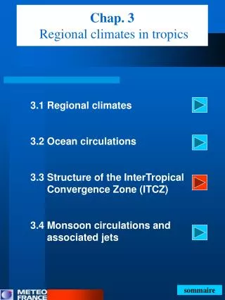
A strong influence on tropical climates is the Intertropical Convergence Zone (ITCZ) Easterly winds from north and south converge near the equator to produce a low pressure area This band of low pressure shifts north and south over the year according to where the earth is in relation to the sun (to changes in solar angles and radiation)
ITCZ does not cover the same area (or latitude range) in different areas of the globe—because of features like mountains
The shifting location of the ITCZ over the year leads to varying patterns of rainfall When ITCZ is present, rainfall is heavy Rainfall diminishes as ITCZ leaves a region
Since the ITCZ is in the vicinity of the equatorial regions (O° latitude) yearround, these regions tend to be wet year round, often with two “rainy” seasons Further from the equator (20° latitude), ITCZ is not in the vicinity as much of the year. These regions often are somewhat drier and have one “rainy” season
Conclusions from two previous slides • Tropical rain forests and savannas are not very seasonal with regard to temperature. • Tropical rain forests and savannas both show seasonal precipitation patterns 3. Seasonal precipitation patterns are more pronounced in tropical savannas.
There is much variability in rainfall, even within an ecosystem type (like savannas), because of features like mountains
El Niño Southern Oscillation Cycle (ENSO) influences tropical climates Multi-year cycle of surface air pressure changes in the tropical Pacific Ocean, resulting in changes in ocean temperature El Niño events happen every 2-8 years and vary greatly in strength
In a normal year, pressure systems are as above. Trade windsover the Pacific Ocean move from east to west. The easterly trade winds bring warm surface waters westward, bringing convective storms to Indonesia and coastal Australia. Along the coast of Peru, cold bottom water wells up to the surface to replace the warm water that is pulled to the west. http://www.physicalgeography.net/fundamentals/7z.html
In an El Niño year, air pressure drops over large areas of the central Pacific and along the coast of South America. The normal low pressure system is replaced by a weak high in the western Pacific (the southern oscillation). This change in pressure pattern causes reduced trade winds. This reduction means warm ocean water along the coastlines of Peru and Ecuador. This accumulation of warm water causes the thermocline to drop in the eastern part of Pacific Ocean which cuts off the upwelling of cold deep ocean water along the coast of Peru. http://www.physicalgeography.net/fundamentals/7z.html
Three phases in ENSO cycle El Niño phase—warm ocean surface temperatures La Niña phase—cool ocean surface temperatures Normal phase—normal surface temperatures
Strong El Niño years generally lead to Dry periods in rain forests, which influence biological systems: These dry periods can lead to mass flowering in Indonesian and Malaysian forests, then fruiting, then the appearance of many animals following the fruiting cycle In other tropical areas, these dry periods can lead to tree mortality
Predicted effects of El Niño http://www.eoearth.org/images/b/b2/El_nino_global_map.gif
Throughout the course, keep in mind that the “tropics” are not the same from place to place Much variability, so generalizations are often difficult
Major rain forest regions From the Times Atlas of the World 1994
Major rain forest regions From The Times Atlas of the World 1994 (Wettest areas of Michigan receive 1000 mm)
Major rain forest regions From The Times Atlas of the World 1994
Major rain forest regions From The Times Atlas of the World 1994
Over 30 species of gliding species in Borneo None in the Amazon A few in Africa Why?
It could be that the dipterocarp trees that dominate Bornean forests produce fruit at unpredictable intervals, making food harder to find in these forests than in other tropical forests. Therefore, many species have evolved gliding to be able to range more widely in search of food.