Download
1 / 23
240 likes | 397 Vues
Animial Telemetry a Key Part of Ocean Observing Systems. Name: Zdenka Willis Institution: US IOOS ® Contact info. Zdenka.S.Willis@noaa.gov. U.S. IOOS: Program Overview. WHO:. WHAT: Observation Data Management Modeling & Analysis Research & Development Education

E N D
Animial Telemetry a Key Part of Ocean Observing Systems Name: Zdenka Willis Institution: US IOOS® Contact info. Zdenka.S.Willis@noaa.gov
U.S. IOOS: Program Overview WHO: • WHAT: • Observation • Data Management • Modeling & Analysis • Research & Development • Education • Management & Governance WHY: 7 Societal Goals, 1 System Predictions of climate changeand weather Safety and efficiency of maritime operations Forecasts of natural hazards Improve homeland security Minimize public health risks Protect and restore healthy coastal ecosystems Sustain living marine resources Enables decision making & science WHERE: Global Coastal (EEZ to head of tide)
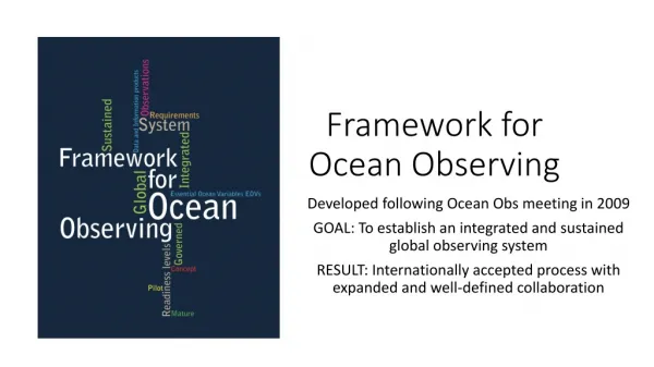
Eyes on the Oceans, Coasts and Great Lakes Observing Systems U.S. Integrated Ocean Observing System (IOOS)
Animal Telemetry: Why is it Significant? • Animals record the ocean environment and fine-scale behavior of individuals even in the most remote regions of the world’s oceans (polar oceans or remote atolls) • Provide vertical oceanographic profiles throughout the upper 1500 m of the water column and in some cases deeper (3000m) • Provide unique datasets for resource management, ecosystem health and ocean modelers Photo: NOAA Cross section of the eddy that the female elephant seal swan through. Showing its down welling nature. (Courtesy: Costa, UCSC)
BENEFITS OF AN US ANIMAL TELEMETRY NETWORK (ATN) THROUGH US IOOS
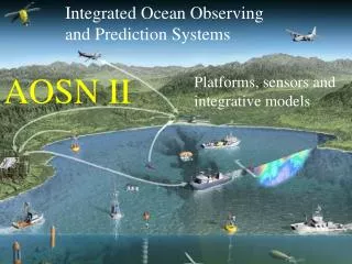
Building a New Generation of Animal Telemetry Data Portals : Ingest the Diverse Animal Tag Platforms NDBC Operational Forecasting Systems Research Modeling Systems e.g., EBM, MPA etc. Archival tags ATN DAC RDBMS ATN data & Products Tracking data Research education& training Satellite tags Other Users Acoustic Receivers Data OTN, GOOS Courtesy of Barbara Block, Stanford Univ.
GTS From Animals to GTS to Ocean Modelers Real-time data flow user In 2012 IOOS PO/ONR co-sponsored a collaboration with the Stanford Univ., NAVOCEANO and NOAA NCEP to improve data interoperability tools and assimilation of ocean observations from tagged animals into NAVO’s global (HYCOM) and region (NCOM) models. Courtesy: Dan Costa UCSC.
To Advance the Protection and Recovery of Great Lakes Fishes • Network of more than 400 Acoustic Receivers • More than 2300 fish have been tagged • Green Bay Lake Sturgeon, Walleye, Lake Trout, River Sea Lamprey) http://data.glos.us/glatos/explore
Animal Telemetry Supports Adaptive Management of Salmon and Steelhead Photo: NOAA Source: Vemco, inc Underwater Acoustic receivers Salmon tagged with Acoustic tags
Southern Ocean: Using all sources Animal Tagging Traditional Sources
Animal Telemetry for Assessing Ecosystem Health Figure from Guinet et al. 2013)
Reduce Bycatch of Loggerhead Turtles in Hawaii in Longline Fishery http://sos.noaa.gov/Datasets/dataset.php?id=181#
Fishing for Hurricanes • What Do Hurricanes and Tarpon Have in Common? • They all prefer SST greater than 26 oC = 78.8 oF. • Data collected by Sat Tags on Tarpon, i.e. could help meteorologists make more accurate hurricane forecasts. Migration track and vertical temperature profile of Tarpon 86 Courtesy: Jerry Ault and Nick Shay Migration track and vertical temperature profile of Tarpon 116 Daily average temperatures (black dots) and associated monthly frequency distribution (histogram bars).
Gulf of Mexico Habitat Restoration Effort Mapping Spawning Habitat of Bluefin Tuna in the Gulf of Mexico Critical Area Intersects Deepwater Horizon Oil Spill. Credit: NOAA Courtesy: Barbara Block, Stanford Univ.
Gliderpalooza • 17 deployments; 403 days in the water – 8140 kilometers covered • 14 Partners: • Ocean Tracking Network, Canada; • University of Maine; Woods Hole Oceanographic Institution, University of Massachusetts, Rutgers University, University of Delaware, University of Maryland, North Carolina State University, University of Georgia, Teledyne Webb Research Corporation • >25,000 profiles Dec 2013
IOOS ATN Contribute to MBON and GEO BON • IOOS ATN to provide data and information on Marine Biodiversity (Aquatic species presence and abundance) to meet: 1- National MBON and Biodiversity Targets 2- International Biodiversity effort such as GEO BON and CBD Aichi Biodiversity Targets 2020.
ATN in Apps Source: NOAA Shark Net Source: GTOPP, Stanford Univ.
Ocean Tracking Network Dalhousie University Halifax, Nova Scotia Canada otn@dal.ca +1 902.494.2357 oceantrackingnetwork.org @OceanTracking NAME: Zdenka Willis INSTITUTION: U.S. IOOS CONTACT: Zdenka.S.Willis @noaa.gov Please Visit the U.S. IOOS Website ioos.noaa.gov