Download
1 / 15
150 likes | 252 Vues
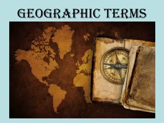
Geographic Terms. Geographic terms help us describe landforms and bodies of water. Here is a list of the geographic terms that we will learn! How many do you know?. ocean sea gulf lake river source mouth tributary. mountain range plains cape peninsula island valley delta.

E N D
Geographic Terms Geographic terms help us describe landforms and bodies of water.
Here is a list of the geographic terms that we will learn! How many do you know? • ocean • sea • gulf • lake • river • source • mouth • tributary • mountain range • plains • cape • peninsula • island • valley • delta
Sea-A sea is a body of salt water smaller than an ocean. • The Dead Sea is a sea that is located in Asia in a region called the Middle East. • It is a sea because it is smaller than an ocean, but is salt water. In fact, it is the saltiest body of water in the world. 8 times saltier than the ocean.
Gulf-A gulf is when a sea or an ocean cuts into land. • We have a gulf in North America, do you know where it is? • A bay is like a gulf, but usually is smaller. Has anyone heard of a bay in America?
Lake-A lake is a body of fresh water surrounded by land. This is a picture of a lake in Seattle, Washington called Lake Union.
Rivers • Every river has a source and a mouth. • The river source is where the river starts. • Rivers often start at the tops of mountains. Do you have an idea why?
River Mouth and Delta • The river mouth is where the river empties out into a larger body of water, usually at a lower elevation. • A delta is the land surrounding a river mouth.
Tributary-A tributary is a smaller stream that feeds into a river.
Mountain Range-A row of connected mountains. • The Rocky Mountain range spans many states in the Western U.S.
Plains-plains are land that is mostly flat • Here is a picture of plains in the state of Nebraska.
Peninsula-A peninsula is land that is surrounded by water on 3 sides • Does anyone recognize this peninsula?
Island-An island is completely surrounded by water. • In movies, pirates often bury their treasure here.
Valley-a valley is an area between hills or mountains.
The End • Now team up with a partner for another Geography Challenge on p. 4 of your ISN. • The map can be confusing, so use p. 16 in your textbook if you get stuck.