Download
1 / 44
440 likes | 546 Vues
Satellite Observation Usage for Global Biomass Burning Emission Monitoring in GMES. Johannes W. Kaiser contributions from: A. Hollingsworth , S. Serrar, R. Engelen, M.G. Schultz, C. Textor, M. Sofiev, J.-M. Gregoire Introduction Fire Observations Emission Monitoring Conclusions

E N D
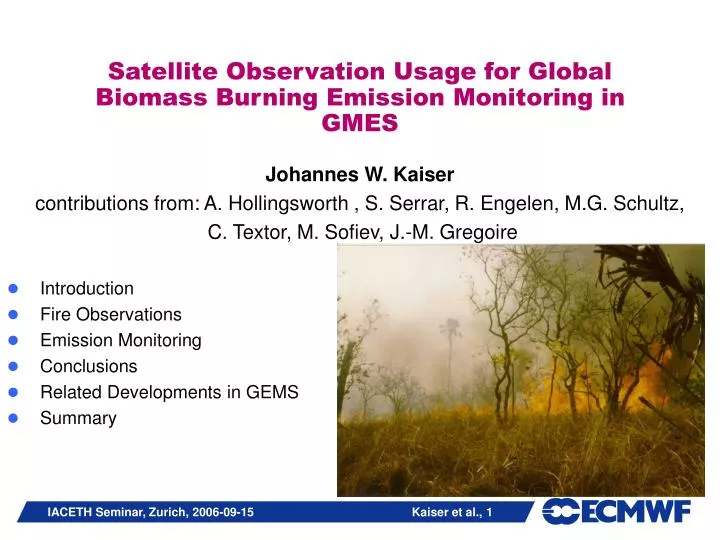
Satellite Observation Usage for Global Biomass Burning Emission Monitoring in GMES Johannes W. Kaiser contributions from: A. Hollingsworth , S. Serrar, R. Engelen, M.G. Schultz, C. Textor, M. Sofiev, J.-M. Gregoire Introduction Fire Observations Emission Monitoring Conclusions Related Developments in GEMS Summary
Total annual burned area estimated at 3.5 million km2 > 600,000 burn scars detected Global fire activity (GBA2000) Total annual burned area estimated at 3.5 106 km2 > 600,000 burn scars [Tansey et al., Climatic Change 2004]
Annual fire emissions, averaged over the 1997 – 2004 period Van der Werf et al. (ACPD 2006)
Diurnal Variability • need temporal resolution of a few hours TRMM MODIS Aqua MODIS Terra (Justice et al. 2002) fit to diurnal cycle
Biomass Burning (BB) Emissions … AIR QUALITY: • … can dominate regional air quality in “severe air pollution” events • … can elevate background of atmospheric pollutant after long range transport [Stohl et al. 2001, Forster et al. 2001, Andreae et al. 2001] POLLUTION CONTROL: • … significantly contributes to global budgets of several gases • Kyoto, CLRTAP, … WEATHER: (absorbing aerosols) • … influences the radiative energy budget [Konzelmann et al., JGR 1996] • … provides cloud condensation nuclei [Andreae et al., Science 2004] • Heat release accelerates deep convection. [Damoah et al., ACP 2006] REMOTE SENSING: • … affects essential a priori information for remote sensing (AOD, profiles) CHALLENGE: • … are highly variable on all time scales from hours to decades NOAA, 2005-12-11
Short-term Variability: CO, CO2 300 ppb 10 km CLAIRE 1998 – vôo sobre o Suriname e Guiana CO – CO2 (courtesy M. Andreae, MPI Mainz)
Short-term Variability: CO, O3 300 ppb 10 km CLAIRE 1998 – vôo sobre o Suriname e Guiana CO – CO2 (Andreae et al. 2001) (produced by INPE/CPTEC, courtesy of M. Andreae, MPI Mainz) [Freitas et al. 2005]
SIGNIFICANCE for Land Monitoring • Wildfires represent a significant sink for the terrestrial carbon pools. • Wildfire behaviour characterises land cover types with repeated fire events. • typical fire repeat period • typical fire intensity • typical fire seasonality • … • Wildfires can change the land cover type reversibly • tropical deforestation • …
HALO – GMES Specific Support Action (SSA) • Harmonised coordination of Atmosphere, Land and Ocean integrated projects of the GMES backbone (1/2/2004 – 1/1/2007) • geoland (1/1/2004 - 1/2/2007) • Global and regional observatories & core services • MERSEA (1/4/2004 – 1/4/2008) • Global to coastal scale models, EO and in-situ data assimilation and modelling • GEMS (1/3/2005 - 1/3/2009) • Global greenhouse and reactive gases, global aerosol and regional air pollution, EO-data assimilation and modelling • HALO aims at formulating agreed recommendations to GAC and IPs • Scientific thematic analysis of links: • Direct product exchange, unaccomplished data demands, common data • Coordinated solutions to infra-structure in operational mode • Candidate solutions by Alcatel and Astrium
Objectives of GEMS • Global operational systemcombining “all” available remotely sensed and in-situ data to monitor the 3D distributions of key atmospheric trace constituents • Regional Air Quality: initial & boundary conditions for operational regional air-quality models • Retrospective Analysis for the ENVISAT-EOS era • Estimation of sources, sinks and transports for greenhouse gases and aerosol
Reactive Gases Greenhouse Gases Aerosol Regional Air Quality GEMS organisation in 6 sub-projects reactive gases greenhouse gases Validation regional air quality aerosols
GEMS Fire Observation Requirements • Product Types: • amount emitted: aerosol, trace gases (~30% accuracy) • location • time • injection height profile • Availability: • global • ~25 km spatial resolution • several hours time resolution • near-real time and retrospectively covering many years (>8a)
Two types of fire products accessible from Earth obs. systems • - Active fire • - Hot spot • Fire pixel • Fire count ACTIVE FIRE product Fire front BURNT AREA product - Burnt area - Burnt pixel - Burnt scar Area burnt OBSERVATIONSYSTEM • thermal emission, MIR • only during fire • spectrally flat • BRDF flat • dark • only after fire
Available fire products from satellites ACTIVE FIRE Products + near-real time (NRT) + time (& location) – quantification BURNT AREA products + quantification + location –no info on time –not available in NRT LEO satellites: + global coverage and higher spatial resolution, – but sparse temporal coverage GEO satellites: + high temporal resolution, – low spatial coverage and spatial resolution
Inter-comparison of 3 global fire products • acitve fire: • World Fire Atlas (WFA) • burnt area: • GLOBSCAR • GBA2000 Large differences between products Boschetti et al., 2004
GLOBCARBON Global Burnt Area Estimate (courtesy of Olivier Arino)
“pixels” burnt per vegetation type Area burnt per vegetation type: ha Fuel: T. ha-1 ???? M (…) = Area . Biomass . Burning efficiency. Emission factor Globe: ~ 400 millions hectaresburnt in 2000 Med. Basin: ~ 500000 hectares Woodland & forests ~ 1600 g CO2 / kg biomass Grasslands ~ 1700 g CO2 / kg biomass Dry tropical grass savanna: ~ 2 tons/hectare Moist tropical savanna: ~ 10 tons/hectare Boreal forest: ~ 20 tons/hectare Moist tropical forest: ~ 40 tons/hectare ~ 25% forest -- ~ 80% savanna OBSERVATION SYSTEM:Calculating Emission Amounts • traditional: • Fire Radiative Power (FRP): • M(…) = FRP * time * scaling factor * emission factor(…)
Current NRT Fire Emission Monitoring Systems • RAMS model at INPE/CPTEC • Assimilation of WF_ABBA product from GEOS satellites • Delivers CO and aerosol emissions over the Americas • NRL/NAAPS aerosol model in the FLAMBE project • Additionally assimilates the MODIS active fire product • Delivers global aerosol emissions
Applications of the GOES Wildfire ABBA in Modeling Programs Real-time Assimilation into the Naval Research Laboratory Navy Aerosol Analysis and Prediction System (NAAPS) Real-time Assimilation at the University of Sao Paulo and CPTEC/INPE into the RAMS model RAMS CO Product RAMS PM2.5 Product GOES-8 WF_ABBA Fire Product GOES WF_ABBA Fire Product 22 August 2003 at 17:45 UTC NAAPS Smoke Optical Depth 22 August 2003 at 18:00 UTC Point Sources for 13 August 2002 GOES-8 ABBA Fire and MACADA Cloud Products Used in Study to Model and Predict Future Fire Activity at UNH Collaboration with Univ. of New Hampshire Inst. for Study of Earth, Oceans, and Space • Other Modeling Efforts and Collaborations • Climate Modeling at NASA/GSFC: Assimilation into the GOCART model • Real-time Air Quality Modeling at NASA/Langley:Real-time assimilation into the RAQMS model as part of IDEA (Infusing satellite Data into Environmental Applications) • Fire Emissions and Regional Air Quality Modeling at NCAR: Assimilation into the U.S. EPA Community Multiscale Air Quality model in support of the 2002 SMOCC campaign in Brazil Intermediate Deforestation Scenario Predicted increase in future regional fire activity: 22% Number of Fire Pixels Complete Deforestation Scenario Predicted increase in future regional fire activity: 123%
Fire Radiative Power (FRP) • produced from MODIS and SEVIRI • directly proportional to emission [Ichoku 2005] [Wooster 2005]
Some Conclusions on Existing Fire Emission Models • No global operational system exists. • (Some) severe events of pollution with aerosol and CO can be monitored and forecast with observations of fires only. • It is possible. • Fire EO input is essential. • High temporal frequency of fire observations is important.
Some Conclusions on Fire Products • No current product satisfies all requirements. • LEO spatial coverage/resolution complements GEO temporal resolution. • Hot spots (tropical forest) complement burnt area products. [C. Michel et al., JGR 2005] • need regionalised approach • Many existing products are inconsistent. [Boschetti et al. 2004] • Several new operational products are anticipated. • Fire Radiative Power from SEVIRI + global (M. Wooster) • WF_ABBA from global GEO system (E. Prins) • Burnt Area from MODIS (D. Roy) • Burnt Area from VEGETATION 2000-2006 (GDBAv1) • Burnt Area from GEOLAND (BAG)
GFAS Proposal • A Global Fire Assimilation System (GFAS) is needed to combine • several fire observations • land cover products • meteorological conditions • a numerical model of fire activity. • Such a system can provide the required fire input for the GMES atmosphere and land monitoring systems. • “Expression of Interest” formulated • supported by 30+ scientist from 30+ institutions • communicated to the EU in March
Preliminary Global Approach for Reanalysis • use fire emission inventory GFEDv2 as dummy for future GFAS. It combines [van der Werf et al., ACP 2006] • MODIS hot spot observations • CASA vegetation model driven by observed fPAR, PAR. • obtain custom version of GFEDv2 with 8-day time resolution • conversions to GRIB format • include fire emissions in IFS • compare forecasts with / without fire emissions • compare both to observed time series • compare the difference to fuel load changes in CASA
CO2 Fire Emission on 20 Aug 2003 12UTC [g/m2/month] (GFEDv3-8d)
Regional PM2.5 Emission by Fire Modelled in NRT from MODIS FRP (M. Sofiev, FMI)
SUMMARY • Wildfire, aka Biomass Burning (BB), emissions are needed globally in near-real time as well as in consistent multi-year time series. • No suitable BB emission product is available. Principal shortcomings are accuracy, delivery time, temporal resolution, geographical coverage. • Various fire observations complement each other. • The development of a Global Fire Assimilation System (GFAS) is needed to serve the GMES requirements. • Product generation needs to exploit existing observations more completely. • FRP is very promising due to accuracy of emitted amount calculation and temporal resolution. • Preliminary systems for fire emission modelling in GEMS are under development.
MORE INFORMATION • www.ecmwf.int/research/EU_projects/HALO • www.ecmwf.int/research/EU_projects/GEMS • www.gmes-geoland.info • j.kaiser@ecmwf.int This work has been funded by the European Commission through the FP6 projects HALO, GEMS, and GEOLAND. ACKNOWLEDGMENTS THANK YOU!