RADAR and Communications
610 likes | 1.76k Vues
RADAR and Communications. Overview. Radar Aircraft Equipment FAA Radar systems VFR services available Terminal information systems Radio Procedures Lost Communications Emergencies Lost procedures. References. Jeppesen Private Pilot Manual Ch. 5 AIM Chapter 4, Sections 1 and 2

RADAR and Communications
E N D
Presentation Transcript
Overview • Radar • Aircraft Equipment • FAA Radar systems • VFR services available • Terminal information systems • Radio Procedures • Lost Communications • Emergencies • Lost procedures
References • Jeppesen Private Pilot Manual • Ch. 5 • AIM • Chapter 4, Sections 1 and 2 • Pilots Handbook of Aeronautical Information • Chapter 12, section 8
Objectives • Know what equipment you need in your aircraft for two way communications and to be picked up by ATC Radar • Be familiar with the Radar, ATC and FSS services available to VFR Pilots • Be able to use proper phraseology on the radio • Understand proper radio procedures when operating around airports • Know where to find proper frequencies for use in certain areas • Know what to do and expect in the event of lost communications or another emergency in flight • Know what you would do if you were to find yourself lost
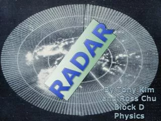
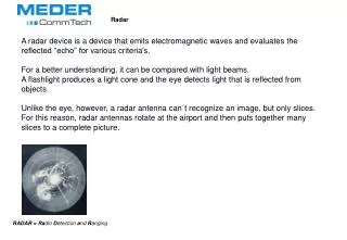
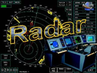
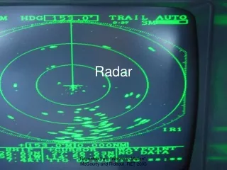
Radar • Radio Detection and Ranging • Uses synchronized radio transmitter and receiver to emit radio waves and process their reflections for display • Primary radar is a ground based system used by ATC which transmits radio waves in a narrow beam by a rotating antenna • When the radio waves strike your aircraft some of the waves are reflected back to the antenna and processed to provide a display, or echo, which shows your aircrafts location on a radarscope
Radar • Range: distance from antenna • Determined by measuring the time it takes for the radio waves to reach your aircraft and return to the receiving antenna • Azimuth: angle of your aircraft from radar site • Determined by the position of the rotation antenna and then reflected portion of the radio wave is received. • Measured clockwise from north on horizontal plane.
Transponder • Must be inspected every 24 calendar months (controlled airspace)
Transponder • Codes • 7700: Emergency • 7600: Communication Failure • 7500: Hijacking
FAA Radar Systems • Airport Surveillance Radar (ASR) • Direction and coordination of IFR traffic • Specific Terminal areas • Approach and Departure • Terminal Radar Approach Facilities (TRACON) • Radar and non radar services at major airports • Ensure safe operation of aircraft transitioning from departure to cruise flight or from cruise to a landing approach • Automated Radar Terminal Systems (ARTS) • Busiest terminals in the country • Various Configuration • Provides continuous display of position, altitude, groundspeed, and other pertinent information • Must have MODE C transponder and altitude encoding altimeter • Direct altitude readout allows for more traffic handling
Air Route Surveillance Radar • Air Route Surveillance Radar (ARSR) • Long range radar equipment used in controlled airspace to manage traffic • About 100 throughout the country • Detect aircraft within 200 – 600 miles • Air route traffic control centers (ARTCCs) • Direction and coordination of IFR traffic • Workload permitting, controllers can provide traffic advisories and course guidance if requested to VFR traffic • Can assist if lost or disoriented
VFR Radar Services • Radar traffic Information Service • Flight Following • Must have Mode C to know altitude
Safety Alerts • Safety Alert • ATC may issue safety alerts when they feel it is necessary • Terrain, other traffic, obstructions • Minimum safe altitude warning • MSAW • Alerts controller when an aircraft is in unsafe proximity to terrain or obstructions • May request if you have Mode C
Terminal VFR Radar Service • National program extending from terminal radar services for IFR to VFR aircraft • Services (Check AFD) • Basic radar service • Safety alerts, traffic advisories, limited radar vectoring • Terminal radar service area • Class C • Class B
Automatic Terminal Information Service • Automatic Terminal Information service (ATIS) • High activity terminal areas • Prerecorded and broadcast continually • May be one for departing and one for arriving • Labeled (Alpha, Bravo, etc) • Weather, frequency, runway, and other general airport information
Flight Service Stations • Flight Service Station (FSS) • ATC facilities • Weather briefings, enroute communication, VFR search and rescue services • Lost aircraft • Emergencies • Relay clearances • NOTAMs • Receive and Process flight plans
Radio Procedures • VHF Communication Equipment • Line of sight
Coordinated Universal Time • Zulu Time • Prime meridian/Greenwich, England • 24 hour clock plus your time zone difference • GFK: Add 6 hours or 5 hours during daylight savings time
Common Traffic Advisory Frequency • Uncontrolled airports • Traffic Information • Pilot-controlled lighting • A/FD, Sectional or FSS
Unicom • Aeronautical Advisory Frequency • Privately owned • CTAF may be Unicom at some airports • Services (FBO)
Airport Advisory Areas • Local Airport advisory service (LAA) provided at selected uncontrolled airports with FSS on field • CTAF frequency • Extends out to 10 statute miles • May provide • Wind direction • Favored runway • Altimeter • NOTAMS • Etc.
Self Announcing • MULTICOM for airports with no FSS, UNICOM or CTAF • 122.9
CTAF • Initial call 10 miles out from airport • Report entering downwind, base and final legs of traffic pattern • Exiting runway or environment • Monitor from taxi to 10 miles out
ATC • Initial call - up • Facility name • Full aircraft identification • Information (if applicable) • Always restate your identification and request • May be asked to “ident”
Radar Facilities • Departure • Clearance Delivery • Ground Control • Progressive taxi • Tower • Arrival
Lost Communication Procedures • squawk 7600 • Check: • Frequency • Volume • Switch position • Hand held mike • Alternate transceiver if available • Call last frequency you could talk to if still in range
Lost Communication Procedures • No Luck? • Remain Outside or above airspace until you have determined traffic flow • Maintain visual contact with tower
Emergency Procedures • Distress: Condition of being threatened by serious and or imminent danger and requiring immediate assistance • Emergency Frequency: 121.5 • “MAYDAY” Commands radio silence of frequency in use • “PAN-PAN” • Urgent situation in progress has priority over all other communications and warns other stations nto to interfere with transimissions
LOST • 5 C’s • Climb • Radio Reception/Radar coverage • Visibility • Communicate • Any available facility • Confess • Admit it, your lost • Comply • Assistance instructions • Conserve • Fuel
ELT • Emergency Locator Transmitter • Required for most general aviation airplanes • Transmit distinctive tone on 121.5 MHz (VHF) and 243.0 MHz (UHF) • Operate continuously for 48 hours • False Signals • Hard landings • Ground crew • Aircraft maintenance • Replace Batteries • 1 hour continuous use • 50%