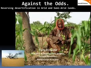
Download
1 / 17
170 likes | 549 Vues
Remote Sensing for substantive water management in arid and semi-arid areas The Brazilian Experience. Evlyn Novo Remote Sensing Division National Institute for Space Research-Brazil. Summary. Water management issues in the Brazilian arid and semi-arid region Institutional Setting

E N D
Remote Sensing for substantive water management in arid and semi-arid areasThe Brazilian Experience Evlyn Novo Remote Sensing Division National Institute for Space Research-Brazil 39th COPUOUS/SCT Symposium on Remote sensing for substantive water management - Viena - February 25-26, 2002
Summary • Water management issues in the Brazilian arid and semi-arid region • Institutional Setting • Brazilian agencies using RS for water management • Remote Sensing Applications • Desertification assessment • Crop irrigation monitoring • Aquaculture zoning • Cartography • Reservoir management 39th COPUOUS/SCT Symposium on Remote sensing for substantive water management - Viena - February 25-26, 2002
Brazilian arid and semi-arid region • 880 000 km2 to 1000 000 km2 • 10 states • 1257 municipalities • 20 million inhabitants • 18 650 artesian wells • 12 190 active artesian wells • 490 000 ha of irrigated land 39th COPUOUS/SCT Symposium on Remote sensing for substantive water management - Viena - February 25-26, 2002
Water management issues • Land degradation and desertification • Crop irrigation & salinization • Soil erosion & reservoir silting • Hydroelectric power generation • Urbanization & drinking water shortage 39th COPUOUS/SCT Symposium on Remote sensing for substantive water management - Viena - February 25-26, 2002
Institutional setting • Federal Agencies • Water Resources Secretariat at the Ministry of Environment,Water Resources and Legal Amazon (MMA) • National Desertification Plan • Semi-arid Research Unity (CPATSA) of the Brazilian Agricultural Research Corporation (EMBRAPA) • Crop irrigation, soil degradation • National Water Agency (ANA) • National Water Research Program • Brazilian Geological Survey (CPRM) at the Ministry of Mines and Energy (MME) • Ground water survey in the Brazilian semi-arid region • National Electric Energy Agency (ANEEL) - MME • Electric Energy Production and Consumption Legislation Enforcement 39th COPUOUS/SCT Symposium on Remote sensing for substantive water management - Viena - February 25-26, 2002
Institutional setting • Regional Agencies • S.Francisco River Basin Development Company (CODEVASF) • strategies for reducing water use conflict • State Agencies • Ceara Meteorology and Water Resources Institute (FUNCEME) • Weather forecast 39th COPUOUS/SCT Symposium on Remote sensing for substantive water management - Viena - February 25-26, 2002
Remote sensing applications • Desertification Regional Survey • MMA/UFPI • Vegetation cover information derived from remote sensing data + soil maps + meteorological data from ground stations 39th COPUOUS/SCT Symposium on Remote sensing for substantive water management - Viena - February 25-26, 2002
Irrigated crop monitoring 39th COPUOUS/SCT Symposium on Remote sensing for substantive water management - Viena - February 25-26, 2002
Xingo Reservoir Reservoir flooded area assessment 39th COPUOUS/SCT Symposium on Remote sensing for substantive water management - Viena - February 25-26, 2002
Remote sensing & aquaculture 39th COPUOUS/SCT Symposium on Remote sensing for substantive water management - Viena - February 25-26, 2002
Cartography • X Band SAR interferometry • S. Francisco transposition project • 420 Topographic charts at 1:5 000 scale • 2 m contour line • 1 m precision • 10 000 km2 • 2 year project – 1998/1999 39th COPUOUS/SCT Symposium on Remote sensing for substantive water management - Viena - February 25-26, 2002
X band SAR interferometry 39th COPUOUS/SCT Symposium on Remote sensing for substantive water management - Viena - February 25-26, 2002
Reservoir management S. Francisco Reservoirs • Ground sampling Reis, 2002 39th COPUOUS/SCT Symposium on Remote sensing for substantive water management - Viena - February 25-26, 2002
Reservoir silting assessment • Landsat - ETM+ concurrent to ground data acquisition • Empirical modeling 39th COPUOUS/SCT Symposium on Remote sensing for substantive water management - Viena - February 25-26, 2002
Legal enforcement Enforcement of the water conservation law 39th COPUOUS/SCT Symposium on Remote sensing for substantive water management - Viena - February 25-26, 2002
Surface water monitoring 39th COPUOUS/SCT Symposium on Remote sensing for substantive water management - Viena - February 25-26, 2002
Concluding remarks • The use of remote sensing techniques for water resources management in Brazil is far behind of other applications. • 1) lack of cloud free remote sensing data at a time frequency compatible to the water resource monitoring needs; • 2) lack of human resources capable of coupling with the complexity of remote sensing applications to water resources. 39th COPUOUS/SCT Symposium on Remote sensing for substantive water management - Viena - February 25-26, 2002