Georeferencing services India
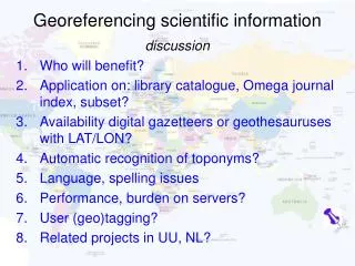
SBL GIS team provides reliable Georeferencing services for developing a common referencing system to determine the spatial location of various geographical features. SBL offers the following georeferencing services: 1. Aggregation and linking of data sets collated from different sources over different time periods 2. Georeferencing using surveyed output such as DGPS 3. Vector and rastor georeferencing using ground control points (GCP) from maps and surveys 4. Co-registration and sub-pixel correlation for aerial and satellite images

Georeferencing services India
E N D
Presentation Transcript
SBL GSS Division Georeferencing Service By Venugopalan Nair
Georeferencing SBL through its varied geo spatial services is in forefront to full fill the requirements of all of its clients. Geo referencing is one such service SBL provides. Geo referencing means bringing maps and images in to a real world coordinate system. Satellite and other kinds of images and scanned maps are devoid of any coordinate information in its raw form and hence cannot used for any of the geo spatial purpose. Some of the satellite images are loosely geo referenced when it is procured. Here also positional accuracy is a big issue. So geo referencing is the primary pre requisite for the creation of any kind of geo spatial data base creation. For scanned maps geo referencing means bringing to the geo spatial frame work. For satellite images geo referencing means applying geometric correction to the images. Assigning a suitable project is always an associated activity in geo referencing. So geo referencing is not only bringing the maps and images to the coordinate framework, it also involves with assigning a suitable projection so that maps and images will be of real world coordinates. A geo referenced map or image will open in its correct spatial location and can be used with similar other geo referenced maps for various overlay analysis. Hence geo referencing is a positional correction applied in x, y direction of the maps and images. Ortho rectification is a refined form of geo referencing where relief displacement will also be taken care so that images will be correct with respect to x, y and z planes.
Georeferencing Geo referencing is a basic function available in almost all geo spatial software platforms. The major activities involved are incorporation of ground control points, re projection and re sampling. Ground control points are those points whose coordinate information (latitude and longitude values) were known prior hand and is identifiable in maps and images. Ground control points can be taken from printed graticule values on maps, or can be surveyed using precision instruments such as DGPS and can be taken from a pre geo referenced map or image. A minimum number of 5 GCP values are required for geo referencing. Based on the accuracy requirement number of GCPs and type of GCPs can be determined. Once the ground control points are placed, using the software algorithms we can re project and re sample the maps or images. Various complex statistical methods and transformational equations were used for the re sampling the images to its real world coordinates. During the process each and every pixel of the maps and images will be re positioned with respect to the GCP and methods used for the purpose and finally a geo referenced maps or image can be generated. Accuracy of the geo referencing can always be obtained through RMSE error for the GCPs used in the process. Hence it is very much a quality controlled activity where very high positional accuracy can be obtained.SBL is capable of handling images and maps in huge numbers for geo referencing and allied acidities.
Carnival Infopark - Phase IIKakkanad, Cochin, India – 682030