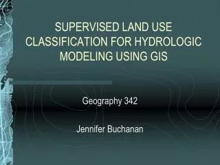
SUPERVISED LAND USE CLASSIFICATION FOR HYDROLOGIC MODELING USING GIS
SUPERVISED LAND USE CLASSIFICATION FOR HYDROLOGIC MODELING USING GIS. Geography 342 Jennifer Buchanan. Hydrologic Models: SAC-CALC/FLO-2D. Land use data is essential. Hydrology Standards Drainage Manual Recommendations. STUDY AREA. Watershed below Folsom Dam Urban Open Space

SUPERVISED LAND USE CLASSIFICATION FOR HYDROLOGIC MODELING USING GIS
E N D
Presentation Transcript
SUPERVISED LAND USE CLASSIFICATION FOR HYDROLOGIC MODELING USING GIS Geography 342 Jennifer Buchanan
Hydrologic Models: SAC-CALC/FLO-2D Land use data is essential. Hydrology Standards Drainage Manual Recommendations
STUDY AREA • Watershed below Folsom Dam • Urban • Open Space • Trees/Vegetation • American River • Low Ag Use
Download for Study Area • Cal-Atlas (http://atlas.ca.gov) • USGS (http://landsat.usgs.gov) LANDSAT 7 1 2 30-M resolution Satellite Mission - 1999 The Mediterranean Sea is one body of water that connects to the Atlantic Ocean through a narrow passage. COMPOSITE BANDS Using ArcGIS • Exclude Band 6 (Thermal) • Set output extent in • Environmental Settings
DETERMINE LAND USE CLASSES 3 WATER OPEN SPACE URBAN VEGETATION LANDSCAPE • Assign • Percent Impervious • n Value
MULTISPECTRAL TOOLS 4 • Reference Data Sources: • ArcGIS Online Service World Imagery • DWR Year 2000 Land Use Survey • Create Training Sites • Create Spectral Signatures • Review Dendrogram • Maximum Likelihood Classification *Iterative Process
FINAL PRODUCT COMPARISON DWR Year 2000 Land Use
ISSUES: AGRICULTURAL AREAS • MIXED OUTPUT: • VEGETATION • OPEN SPACE • LANDSCAPE
ACCURACY ASSESSMENTERROR MATRIX 92% SUCCESS!
CONCLUSION I am satisfied with the results and I am confident that one can successfully use LANDSAT imagery and ArcGIS to classify basic land use types for hydrologic modeling purposes. QUESTIONS/COMMENTS?