Community Mapping
AGRG Directed Studies Project Ashley Lawrence & Meredith Roik. Community Mapping. Outline. Introduction: What is community mapping? Who is involved in community mapping? Importance of community mapping Who we taught Methods of Instruction

Community Mapping
E N D
Presentation Transcript
AGRG Directed Studies Project Ashley Lawrence & Meredith Roik Community Mapping
Outline • Introduction: What is community mapping? • Who is involved in community mapping? • Importance of community mapping • Who we taught • Methods of Instruction • Reference materials for those who attended • Future workshops under development • Conclusion
What is Community Mapping? • Approaches a way to expand access to “local knowledge” • Visualizing community-based knowledge and perceptions encourages the exchange of information and equalizes opportunities for all members of the community to participate in processes that affect their neighbourhoods and lives. • Wansoo Im, Ph.D • Centre for Community Mapping, May 14, 2008 • http://www.centerforcommunitymapping.org/default.htm
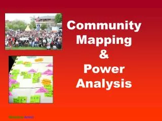
Who is involved in community mapping? • Community organizations • Citizen associations • Non-Profit Organizations • Other locally-situated civil institutions • Minority and specialized groups
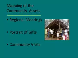
Importance of Community Mapping • Improve and increase public involvement • Allow the community and its members an opportunity to evaluate design and planning proposals and visualize the impacts that decisions may have on the future of a community • A significant contribution to geography • Process of collecting and improving geospatial data • Enhancing our knowledge of the Earth • Local focus • Engaging citizens
Importance of Community Mapping • A desire to fill gaps in available data • Especially in areas where data are not available • Or where access is denied for security • Help the average person advance with technology • Not just a select few (technical experts) who know ‘what to do’
An Example • Wikimapia • http://wikimapia.org
Coastal CURA LCS Who we taught • Kingstech NSCC Campus • As part of their Wellness Week, we introduced them to GeoCaching • Coastal CURA • Local community group concerned with Maritime water resources • Lawrencetown Consolidated School • Introduced Grade 4 students to GPS and how to map in Google Earth • Bridgetown High School • Demonstrated to grade 9’s how to collect GPS data and display in Google Earth • Bridgetown Elementary School • Introduced Grade 4 students to GPS and how to map in Google Earth
Methods of Instruction • Modified and created a variety of PowerPoint presentations • Hands-On learning with the GPS units and with the HP Tablets • Moodle for continued learning and access all presentations and reference material • Demonstrate to teachers ways to incorporate GPS/GIS into the academic curriculum
Lesson Plan • Outside to collect GPS points and tracks • Brief Introduction to GPS and how to use the GPS units (Garmin GPSmap 76x)
Lesson Plan • Download collected points and tracks • Demonstrate how to display collected data in Google Earth
Presentations / Tutorials we made that are available on Moodle
Reference Material http://www.gissandbox.net/moodle
Coastal CURA March 6 & 7 Lawrencetown Consolidated School May 13 & 15
Workshops under development • Coastal CURA: • Workshop focused more on GIS using various (free) available software with attention on each member’s personal GIS needs • School Groups • Visiting more classes and demonstrating how to use GPS and the HP Tablets • Find GIS software for teachers to use and show students (ArcVoyager, ArcExplorer Student Edition)
Conclusion • “ GPS and Google have changed how many people view and think about their ‘space’ ” • - Christopher J. Seeger • Assistant Professor and Extension Specialist • September 19, 2007 • (Santa Barbara conference on Volunteered Geographic Information)
Thank you to … • Bob Maher, Roger Mosher, Heather Stewart, Jeff Wentzell, and numerous other (behind the scenes) staff members from AGRG • David MacLean and Paul Illsley from COGS • Bill Whitman from Coastal CURA • Nick Baskwill and Lynn Roscoe from Lawrencetown Consolidated School • Patricia Thomas from Bridgetown High School • Mr. Saunders and Mrs. Rafuse from Bridgetown Elementary School