Community Mapping and Community Information Utility
210 likes | 409 Vues
Jeff Wentzell, Project Manager Bob Maher, Sr. Research Scientist Applied Geomatics Research Group (AGRG) Nova Scotia Community College (NSCC) Middleton, NS Trevor Robar, CEO Landmark Geographic Solutions Inc. Community Mapping and Community Information Utility. Outline.

Community Mapping and Community Information Utility
E N D
Presentation Transcript
Jeff Wentzell, Project Manager Bob Maher, Sr. Research Scientist Applied Geomatics Research Group (AGRG) Nova Scotia Community College (NSCC) Middleton, NS Trevor Robar, CEO Landmark Geographic Solutions Inc. Community Mapping and Community Information Utility
Outline • Definition of the two concepts • Status of Community Mapping Projects • Inverness County • Annapolis County • Southwest Nova • Status of CIU project • How can GeoNova help us • How can we help GeoNova • Questions • Contact
Community Mapping • Engaging the community to create maps of features in the landscape important to them • Communityincludes individual citizens, businesses, villages, RDA’s, government departments • Rural Secretariat Project
Community Information Utility • Assemble all available maps into a shareable spatial data warehouse • Make available through Internet • Allow private sector businesses to create applications based on CIU
Inverness Project • Objective: To develop Web GIS application to edit and view locations of the ICSP sustainability assets in Inverness County • Deliverables: • Database Design and implementation • Esri ArcGIS Server technology • Editor View • Public View • Widget development and implementation • Documentation and training
Annapolis County • Objective: To developing web based mapping applications to engage communities in Volunteered Geographic Information (VGI) • Deliverables: • Develop web applications to encourage VGI • Engage partners through PAR to determine needs • Creative Rural Economy, Culture and Heritage, Tourism, Buy Local, Businesses, etc… • Develop a sustainability model
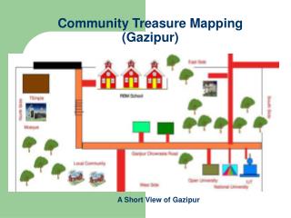
Annapolis - Middleton NSCC / AGRG Middleton Green Diamond Rotary Park Home of Baseball, Soccer, Football and Basketball Annapolis East School Exit 18A Brooklyn Market Petro Canada Soldiers Memorial Hospital Middleton High School Middleton Soccer Field Middleton Arena Tim Horton’s
Southwest Nova Biosphere Reserve • Objective: To develop a mapping application to promote activities of the SWNBR • Deliverables: • Database Design and implementation • Esri ArcGIS Server technology • Editor View / Public View • Sharing of content • i.e. photos, video, stories, etc…
How can GeoNova help us? • Access to base map layers • Access to imagery • Other thematic layers from line departments • Collaborate on web development and data access • Develop a Model for Governance and Business Sustainability (Partnerships)
How can we help GeoNova? • Creating awareness at the citizen and municipal levels • Engagement of local private sector (i.e. BIC) • Bring in new ideas e.g. CIU • Develop methods for sharing geographic information • Broaden technical expertise • Thematic maps from LiDAR, micro-climate network
Challenges • Need to develop access policies “open government” • Capacity building, especially in rural Nova Scotia • Create collaborative spirit • Rationale for CIU • Focus on regional geography • Focus on certain thematic layers • Develop understanding • Provide training
Challenges cont’d • Moving target: • New tools available • New programs e.g. ESRI Community Mapping Program • New platforms “cloud computing” • Changing view of government • e.g. CIO office, regional planning
Challenges cont’d • Retraining, retooling • Advanced diploma programs • GIS professional certification • Student Internships • Faculty/Government/Industry exchange • Technology Transfer
Collaboration RURAL SECRETARIAT PROJECT WWW.COMMUNITYMAPPING.CA Private Sector, Academia, Community and Government COMMUITY PARTNERS ANNAPOLIS COUNTY SNBR ADEDA FCDA ANNAPOLIS VALLEY COMPUTERS
Benefits Learn New Technologies Sharing Technologies Build New Ideas for Community Engagement Collect Data Once Use Many Times Build Community Information New Products or Tools For Market • Engage Communities • Inspire Communities Ownership of Local Data • Engage Government Organizations to Contribute • Create a Community Lead Geographic Information Tool GOALS
Contact Dr. Bob Maher, Senior Research Scientist Trevor Robar, CEO Applied Geomatics Research Group (AGRG) Landmark Geographic Solutions Inc. Email: robert.maher@nscc.ca Email: trobar@gissolutions.ca Phone: 825-5477 Phone: 825-5425 URL: http://www.gissolutions.ca Jeff Wentzell, Project Manager Twitter: @LGSINC Applied Geomatics Research Group (AGRG) Email: jeffrey.wentzell@nscc.ca Phone: 825-1053 http://agrg.cogs.nscc.ca/projects/community_mapping/ http://www.communitymapping.ca Follow Us on Twitter: @CommunityMapsNS