Download
1 / 36
360 likes | 521 Vues
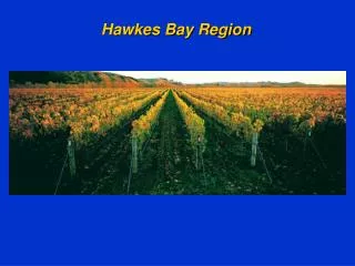
SMART Annual Report Hammamat 2004 Abo Qir Bay Region, Egypt. Mohamed El Raey CEDARE. Table of Contents. Executive summary Introduction Rosetta Study Region Hydrology of the study area Morphodynamic changes Water Quality Problems Socioeconomic Systems and conditions

E N D
SMART Annual ReportHammamat 2004Abo Qir Bay Region, Egypt Mohamed El Raey CEDARE
Table of Contents • Executive summary • Introduction • Rosetta Study Region • Hydrology of the study area • Morphodynamic changes • Water Quality Problems • Socioeconomic Systems and conditions • Problems and conflicts of the Region • Monitoring and Assessment • Land cover analysis using satellite images • Building Geographic Information System • Mathematical Modeling • Suitability analysis and Plan for development • Conclusion and future work • References
Data Availability 1. Satellite Images Six topographic maps were used in the study, they are produced by Military Survey Department; Ministry of Defense. They cover 1.Kafr El-Dawar, 2.Damanhour, 3.Dessouk 4.Abu Qir, 5.Rosetta, and 6.Edfina. The scale of the maps is 1:50,000. 2. Topographic Maps
Change Detection Conclusions • Recent results of the analysis of satellite images change detection as integrated with earlier results (El Raey et al, 1995) have revealed the following: • A strong component of erosion and accretion along the coast and particularly at the promontory has been in operation at a high rate until 1990. It is still in operation at a slower rate in 2000 • The loss of fruit and palm trees class has started earlier than 1990 and continued throughout the period and has reached its highest rate in 1995-2000. Socioeconomic consideration of such activity has to be thoroughly investigated. • The large increase in natural grass land in the area may be associated with the establishment of the international road and the drive of people to establish ownership of the land through fake cultivation. This has to be investigated through direct contacts. • A serious increase in the rate of changes in discontinuous urban fabric has also been observed over the same period indicating socioeconomic pressures and shortage of law enforcement capabilities.
Future Outlook of Change Detection • Cross association analysis is in progress to identify driving forces • Analysis of 1990 and 1985 images is in progress to assess whether these patterns are persistent over a long time period or it is transient pattern • A higher resolution analysis of satellite imagery for land use changes is also under investigation
Legal criteria • To meet the strict legal aspects and environmental guidelines, the following criteria are taken into consideration: • Location of any construction must be beyond 200 m of the shoreline (i.e setback distance) according to Environment Law no. 4/1994. • Site must be beyond 50 m of highways, railways, and major roads to avoid accidents, noise, and pollution hazards. • Locations of the proposed sites must be beyond 100 m minimum buffer zone of major industrial activities. • Sites must be beyond 100 m of towns, and residential areas. • Sites must be beyond 100 m of historical sites. • Sites must be beyond 100 m of lakes, water streams, and drainage canals. • Location of sites should be characterized by the ease of access through a good network of roads, and accessible from highways. • Locations of the proposed development areas are preferred to be centralized, and not to be distributed among existing urban settlements.
Planning criteria (1) The type of soil is the most important criteria. It is necessary to choose soil types suitable for development. Areas of fragile soils such as Sabkha and soft mud are not suitable for development, and therefore must be excluded. (2) Slope suitability is also an important criterion. Slopes must not exceed 30% to achieve common construction considerations. Areas of 5-10% slopes are acceptable, but they are not considered the most suitable. Areas of slopes between 10% and 15% are most suitable. Those areas having slopes of 15-30% will be considered if a viewing panorama is to be achieved. (3) The proposed areas should have a minimum elevation of 0.5 m above sea level. • The potential sites for development are preferred to be facing the prevailing wind direction. (5) Potential sites are preferred to be overlooking a panoramic view. This means that the sites are either overlooking sand dunes or the sea side.
Hydrology and Pollution Distribution Model • TELLEMAC Model analysis and interpretation is in progress. • Refinement of parameters for TELEMAC and comparison to results of AQUASEA model is planned. • Preliminary results indicate feasibility and need for more reliable data , calibration and verification
SMART options for development (To be explored) The following options should be explored through questionnaires of stakeholders from the point of view of potential impacts, duration, equity, cost,… • High quality water conservation and management programs (physical and/or economic). • Drastic changes and control of waste pattern through upgrading awareness and reducing pollution • Building wastewater treatment plants ( cost, location) • Considering other water resources such as groundwater and/or extension of fresh water from Alexandria (expenses) • No action
Indicators • Satellite time series of changes of land use • Coastal pollution parameters (monthly) • Sea level rise from tide gauges (monthly) • Fish catch speciation (monthly) • Water quality prone health parameters (monthly) • Socioeconomic parameters
Achievements so far • Water resources, geo-morphological conditions, pollution sources, socioeconomic conditions, have all been surveyed and explored. Problems of the region have been well identified and analyzed. • A Geographic Information System at a scale of 1:50,000 have been built. Data concerning important parameters such as land use, topography, transportation networks, administrative boundaries, have been encoded. • Satellite images of the years 1990, 1995 and 2000 have been classified and analysis of change detection indicates dramatic changes of land cover and land use in the region. • Indicators of the variability of physical, chemical and biological parameters of the bay have been collected and a time series analysis is in progress to identify and assess relationships among parameters. • A model for identification and assessment of future implications of water quality changes in the region has been developed and is under calibration and verification
Future Outlook and Work in Progress • Upgrading and validation of GIS database, improving map server site. • Continuation of LCLU change detection and analysis of satellite images of 1990 and compare to models of land use and check reasons for change. • Emphasize calibration and verification of TELLEMAC and AQUASEA Models for pollution distribution and control • Identification and analysis of indicators (physical, health and socio-economic) and investigation of water quality related impacts. • Dissemination of experience and results on the local and international scales.
Future Plans • Change detection analysis of satellite images over the last 15-20 years is planned in order to identify and assess detected changes of land use in the region • Collecting and analyzing long time series indicators of performance of the region such as marine pollution indicators, water quality parameters, sea level changes, fisheries and socioeconomic parameters • Questionnaire analysis will be designed for stakeholders and dissemination of output information on development of the region will be carried out. • Refinement and updating of GIS data base and analysis to identify best available sites for major important development projects of the region. • Carrying out a Strategic Environmental Assessment of the plan for sustainable development of the region based on principles of ICZM in view of scarce resources of water quality. • A program for dissemination of results obtained and integration will be carried out • Two girls registered for Ph.D. will join the team for working on change detection analysis and modeling.