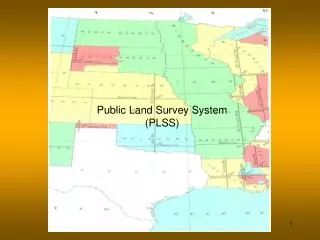
Public Land Survey System (PLSS)
440 likes | 711 Vues
Public Land Survey System (PLSS). Introduction. What is it? The Public Land Survey System (PLSS) is a way of subdividing and describing land in the United States.

Public Land Survey System (PLSS)
E N D
Presentation Transcript
Introduction • What is it? • The Public Land Survey System (PLSS) is a way of subdividing and describing land in the United States. • The PLSS is used to divide public domain lands, which are lands owned by the Federal government for the benefit of the citizens of the United States. • The original public domain included the land ceded to the Federal Government by the thirteen original States, supplemented with acquisitions from native Indians and foreign powers. http://nationalatlas.gov/articles/boundaries/a_plss.html
History • The history of the PLSS is rooted in the history of land rights. • Spanish • By 1550 the Spanish had explored most of the southern and eastern coast of North America. • The Spanish attitude was that ownership was based on discovery. • They felt they owned the land because they were the first ones (Europeans) to discover it.
History--cont. • English • Until the late 16th century England had not explored outside of New England and because they were political and religious allies with Spain they did contest or try to expand their land rights. • When England broke with Spain their attitude toward the new world changed. • To have a claim in the new world they adopted the attitude that ownership only came through occupancy and use. • If they followed this philosophy, the land belonged to the Indians. • They got around the Indian land rights by adopting the policy that the Indians were inferior; they were non-Christian savages and therefore had no rights in land tenure under English law and customs. • It was upon this basis that England claimed and took possession of the east cost between the 31 and 49 latitude (North Carolina through Maryland and west to the Allegheny mountains)
Land titles before the Revolutionary War • Three types of government • Royal Colonies • New Hampshire, New York, New Jersey, Virginia, North & South Carolina and Georgia. • The king of England appointed a governor who in conjunction with the local assembly determine local affairs. • Proprietary colonies • Delaware, Maryland and Pennsylvania • Similar to royal colonies • Corporate colonies • Connecticut, Massachusetts and Rhode Island • Each elected a colonial assembly, set up local and county governments, made laws and had local courts. • Each form of government handled the ownership and identification of land in a different manner.
Land Tenure Systems • Grants • Colonial lands were first granted to settlement agencies. • In order to hold the grant, settlers hand to be placed on the land. • Grants were revoked if no settlement was established. • The King also made direct grants to individuals • Head Rights • In southern states each man was granted 50, 100 or more acres. • To keep the land they were required to settle on it and convert it to a producing farm • Policy was changed to grand a headright to each person and an additional one for each individual they transported to the new world. • By giving the land to the landowning masters the indentured servants had little or no chance to procure their own land • Promoted large estates with indentured servants to operate them.
Land Tenure Systems--cont. • Land Sales • Direct land sales occurred in all colonies except New England • A man could request the right to purchase land and, if approved, would pay about $1 per acre. • New England towns • Because they were corporate colonies, Connecticut, Massachusetts and Rhode Island held land in common and the corporation dispersed it to individuals. • A group of people could petition land from the corporation, if approved, they would survey the town, establish boundaries, and divide up the land. • Grants were usually areas of 6 to 10 miles square. • The land could not be transferred without the permission of the corporation. • The division of the corporate land was the start of the current rectangular system.
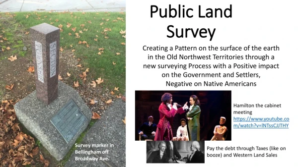
Locating Claims • Each colony, except New England, used a different method for locating land claims. • Conflicting means of granting land, conflicting means of locating claims lead to a system of confusion and conflict. • Western Lands • Many states claimed part of the western lands, land west of the Appalachian mountains. • No common reporting system or place lead to overlapping boundaries and claims. • Individuals wanted access to cheap, small parcels. • Land companies wanted access to cheap large parcels so they could sell the land to individuals. • The arguments and problems intensified after the war because solders were give land in lieu of payment. • Claim descriptions often used the metes and bounds system. • Led to the Land Ordinance of 1785.
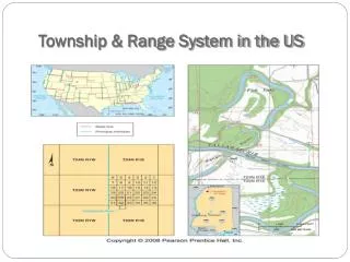
Land Ordinance of 1785 • Adopted in May 1785 • Congress did not have the power to raise revenue by direct taxation of the inhabitants of the United States. • The immediate goal of the ordinance was to raise money through the sale of land in the largely unmapped territory west of the original colonies acquired from Britain at the end of the Revolutionary War. • The Land Ordinance established the basis for the Public Land Survey System (PLSS). • Land was to be systematically surveyed into square townships, six miles on a side. • Each of these townships was sub-divided into thirty-six sections of one square mile or 640 acres (259 hectares). • These sections could then be further subdivided for sale to settlers and land speculators. • The ordinance was also significant for establishing a mechanism for funding public education. Section 16 in each township was reserved for the maintenance of public schools.
Metes and Bounds • The original colonies(including their derivatives Maine, Vermont, Tennessee, Kentucky and West Virginia) continued the British system of metes and bounds. • This system describes property lines based on local markers and bounds drawn by humans, often based on topography. • A typical, yet simple, description under this system might read: "From the point on the north Beginning at the mouth of a branch at an ash stump thence up the creek south 20 poles to 2 beach, thence east 41 poles to a small walnut in Arnett's line, thence north 50 east 80 poles to a linn hickory dogwood in said line, thence north 38 poles to an ash, thence west 296 poles with Potts's line till it intersects with Tolly's line, thence south 30 west 80 poles to a whiteoak and sugar, thence east 223 poles to beginning • The metes and bounds system was effective in Britain where boundaries were well established and stable. • It did not work in the colonies.
Metes and Bounds--cont. • The old English version of metes and bounds is not used, but modern lots are defined in a similar method. • In the current usage, angles and distances are used to describe the boundaries instead of visual artifacts.
Lot and Block System • Became popular during the 19th century. • Primarily used to subdivide a larger area of land into smaller units. • The owners of a large tract of land would create a plat and subdivide the tract into a series of smaller lots to be sold to buyers. • A subdivision survey is conducted to divide the original tract into smaller lots and a plat map is created. • Lots are described with a metes and bounds system using calls, courses and distances. • Call = boundary line • Course = direction of travel • Distance = Distance between course changes. Usually to 0.01 feet.
Lot and Block--cont. • This subdivision survey plan would then be recorded with an official government record keeper. • The officially recorded map then became the legal description of all the lots in the subdivision. • An example description: Lot 6 of Block 1 of the Swim addition plat as recorded in Map Book 21, Page 33
What is it? • The Public Land Survey System (PLSS) was developed to subdivide and describe land in the United States. • All lands in the public domain were divided by this rectangular system of surveys. • The PLSS is regulated by the U.S. Department of the Interior, Bureau of Land Management (BLM)
Public Land Survey System (PLSS)Terms • Initial point • Township • Section • Closing corners • Base line • Principle meridian • Parallels • Guide meridians • Quadrangle • Two additional terms: • Latitude • Longitude
PLSS Terms--Initial Point • A PLSS grid was started by establishing a initial point. • The recommended practice was to establish an initial point by astronomical observations. • The initial point was at the crossing of a principal meridian and a latitude. • The Oklahoma initial point was established in 1870 by E. N. Darling and Thomas H. Barrett They arbitrarily selected a point about one mile south of Fort Arbuckle (at a point approximately six miles west of present Davis, in Murray County) http://www.okhistory.org/enc/indianmeridan.htm Two understand the establishment of an initial point, base line and principle meridian, you must understand latitude and longitude.
Latitude • Latitude identifies the north to south location of a point on the Earth. • Latitude can be defined precisely as the angle, along a meridian, between the point and the equatorial plane of the Earth.
Latitude--cont. There are several equivalent ways to express latitude. • The most common has latitude 0o at the Equator, 90o N at the north pole, and 90o S at the south pole. • In several places in North America, signs mark the location of the 45th parallel or 45o N: halfway between the equator and the pole. • With the advent of computers, another common way to express this is from +90 (at the north pole) to -90 (at the south pole). • In programming, this allows the latitude to be simply expressed as a real number; and does not require a number and a character (N or S).
Latitude--cont. • Latitude ranges from 0o degrees at the equator to 90o at the poles. • Besides the equator, four other lines of latitude are named because of the role they play in the geometrical relationship with the Earth and the Sun: • Arctic Circle ム 66o 33′ 39″ N • Tropic of Cancer ム 23o 26′ 21″ N • Tropic of Capricorn ム 23o 26′ 21″ S • Antarctic Circle ム 66o 33′ 39″ S
Latitude Example • The earth is about 40,075.0 km, or 24,901.5 miles in circumference at the equator. • The earth is actually 24,859.82 miles (40,008 km) in circumference around the poles. • The miles per degree of latitude are: • The latitude of Stillwater is 36o 7’ 21” N • The distance from Stillwater to the equator is:
Longitude Longitude identifies the east to west location of a point on the Earth, by measuring the angular distance from the Greenwich meridian (or Prime meridian, where longitude is 0), along the equator to the meridian of the unknown point.
Longitude--cont. There are three equivalent ways to express longitude. • The most familiar is 0-180 East, and 0-180 West. • It can also be expressed as 0-360 East - or just 0-360. In this system, 270 East is equivalent to 90 West. • The third system arose in the computer era, when carrying both a number (0-180) and a character (East or West) was inconvenient. The new convention of -180 to +180 was then developed. • In this system, -90 is equivalent to 90 West.
Longitude--cont. Longitude divides the earth into north-south lines passing through the north and south pole. The equator is 40,075.0 km, or 24,901.5 miles in circumference, therefore: • The diameter of a horizontal circle decreases as you move away from the equator, therefore the 70 miles per degree is only accurate at the equator. • Each degree of longitude covers fewer miles as the latitude angle increases. Note: each latitude forms a horizontal circle, which decreases in diameter towards the poles.
Longitude example • As determined previously, there is approximately 70 miles per degree of longitude at the equator. • A longitude of 45o W would be approximately 3,150 miles west of the principle meridian, along the equator.
Longitude Example • The diameter of the earth on a parallel circle decreases as you move towards the poles. • If you assume the earth is a sphere, the radius of a parallel circle is equal to: Question: How many miles per degree of longitude will there be at a latitude of 36.0911o ? (Stillwater)
Longitude – cont. • The earth is not a sphere • A equation, called geodetic model, must be used to determine the miles/degree of longitude for each latitude.
Longitude Example-cont. • The location of Stillwater is: • 2,494 miles north of the equator • 5,422 miles west of Greenwich mean Note: these distances are based on the assumption the earth is a sphere. It isn’t, therefore these are numbers are not very precise.
PLSS Terms--cont. • Principal Meridian • A principal meridian was established that followed a longitude through the initial point. • Only one principal meridian was used for each survey. • The principal meridian is a continuous line • Base Line • A base line is an east-west line established through the initial point and at 90o to the principal meridian. • Base lines are curved because they are equal distance from the poles. • They are parallel to the equator.
PLSS Terms--cont. • Standard parallels • After the base line was established, parallel lines were established at 24 mile intervals north and south of the base line. These are called standard parallels. • In Oklahoma there are twenty-nine standard parallels north and nine south of the Base Line. • Guide meridians • Guide meridians are north-south boundary lines that are established at 24 mile intervals, perpendicular to the base line and each standard parallel. • Because the guide meridians were established perpendicular to a curved line, they are not parallel to the prime meridian or each other and therefore are not continuous.
PLSS Terms--cont. Because each guide meridian is established at 90o to the standard parallel, there is an offset where each guide meridian joins the next standard parallel. This is called the closing corner. As the survey moves North of the base line, the offset of the closing corner increases because the meridians converge at the north pole.
PLSS Terms--cont.Quadrangle PLSS grid • An area with the boundaries of two parallel and two meridians is called a quadrangle. • This term is not used in the description. • Each quadrangle contains 16 townships.
PLSS Terms-cont.Township • Each quadrangle is divided into 16 townships. • Each township is 6 miles square. • Townships contain 36 sections. • Each vertical column of townships is called a range. • Each horizontal row of townships is call a tier. • The identification of the township in the illustration is T5S, R6E.
PLSS Terms-contSection • The 36 sections in each township are numbered in serpentine fashion starting at the north east corner. • The section number is used in the description.
Section-cont. • Each section can be subdivided. • The subdivisions are limited to fractions of 1/4 and 1/2. • Irregular parcels can be identified by lot number.
PLSS Example Write the complete description for the labeled areas in the illustration. Answers next page
PLSS Sample Answers • A: N1/2, NW1/4, S27, T7S, R15W, IM, OT • B: E1/2, NE1/4, S27, T7S, R15W, IM, OT • C: NW1/4, NW1/4, SW1/4, S27, T7S, R15W, IM, OT • D: NE1/4, SW1/4 & N1/2, SE1/4, SW1/4, S27, T7S, R15W, IM, OT or: N1/2, SE1/4, SW1/4 & NE1/4, SW1/4, SW1/4, S27, T7S, R15W, IM, OT • E: SE1/4, SE1/4, SE1/4, S27, T7S, R15W, IM, OT • F: N1/2, NE1/4, SW1/4 & N1/2, NW14, SE1/4, S27, T7S, R15W, IM, OT or: N1/2, NW1/4, SE1/4 & N1/2,NE1/4, SW1/4, S27, T7S, R15W, IM OT • G: S9, T7S, R15W, IM, OT • H: T8S, R16W, IM, OT • I: N1/2, SW1/4, S20. T8N. R14E, IM, OT • J: SE1/4, NW1/4, NE1/4, S20, T8N, R14E, IM, OT • K: NE1/4, SE1/4, NE1/4, NE1/4, S20, T8N, R14E, IM. OT