The Public Land Survey System
110 likes | 525 Vues
The Public Land Survey System. Teacher Guide. This activity introduces students to the Public Land Survey System (PLSS). . Overview. NCGE Standards.

The Public Land Survey System
E N D
Presentation Transcript
The Public Land Survey System Teacher Guide This activity introduces students to the Public Land Survey System (PLSS). Overview NCGE Standards The World in Spatial Terms: STANDARD 1: How to use maps and other geographic representations, tools, and technologies to acquire, process, and report information. Places and Regions: STANDARD 3: How to analyze the spatial organization of people, places, and environments on Earth's surface. STANDARD 4: The physical and human characteristics of places. Human Systems: STANDARD 12: The process, patterns, and functions of human settlement. The Uses of Geography: STANDARD 17: How to apply geography to interpret the past. STANDARD 18: To apply geography to interpret the present and plan for the future. High School Oklahoma History STANDARD 1: The student will demonstrate process skills in social studies. STANDARD 8: The student will examine factors that contributed to the political, economic, and social history of Oklahoma during the twentieth century. High School World Geography STANDARD 1: The student will use maps and other geographic representations, tools and technologies to acquire, process, and report information from a spatial perspective. STANDARD 2: The student will use the concepts of places and regions as the basic units of geographic inquiry. STANDARD 4: The student will examine human cultures, populations and activities such as settlement, migration, commerce, conflict, and cooperation. STANDARD 6: The student will analyze problems and issues from a geographic perspective using the tools and skills of geography. PASS Objectives Grade Level Ninth Grade GIS Skill Level Beginner. No prior knowledge of GIS is necessary, although it may be conceptually beneficial. Time Two 50-minute class periods for completion of activity and discussion. Materials: This activity requires personal computers with high-speed internet connections. Sources: The National Atlas - www.nationalatlas.gov Oklahoma Data Warehouse Interactive Mapper - www.geo.ou.edu Public Land Survey System Teacher Guide
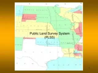
The Public Land Survey System The goal of this activity is to gain an understanding of the Public Land Survey System. The Public Land Survey System (PLSS) is a way of subdividing and describing land in the United States. All land in Oklahoma is part of the PLSS. Part 1 Learning more about the PLSS • To begin, start Internet Explorer. • Go to the national atlas at www.nationalatlas.gov • Be sure that pop-ups are allowed for this site. • Click on the Map Maker link. • Click on the Boundaries category in the Map Layers. • Click on the words Public Land Survey System. • Read the Background Information, and then answer the following questions. • What government agency is responsible for regulating and maintaining the PLSS? • What are two reasons the Federal government needed to divide its land and transfer it to private individuals? • 1. • 2. • The dimensions of townships are ___miles by ___ miles. • Scroll back up the Map Layer Info page and click on Public Land Survey System under the Map Maker Sample heading. • Why do you suppose that Texas is not part of the PLSS? • Zoom into northwestern Wyoming • Why do you think there are not any townships here? Public Land Survey System 1
Part 2 How the PLSS works The PLSS actually consists of a series of separate surveys. Most PLSS surveys begin at an initial point, and townships are surveyed north, south, east, and west from that point. The north-south line that runs through the initial point is a true meridian and is called the Principal Meridian. There are 34 Principal Meridians in the US, each is named, and these names are used to distinguish the various surveys. The east-west line that runs through the initial point is called a Base Line. This line is perpendicular to the Principal Meridian. Oklahoma Principal Meridians and Base Lines US Principal Meridians and Base Lines Oklahoma is one of several states that has multiple surveys. What are the names of Oklahoma’s two surveys/principal meridians? 1. 2. Each township is identified with a township and range designation. Township designations indicate the location north or south of the Base Line, and range designations indicate the location east or west of the Principal Meridian. For example, a township might be identified as Township 7 North, Range 2 West, which would mean that it was in the 7th tier of townships north of a Base Line, and in the 2nd column of townships west of a Base Line. Public Land Survey System 2
Part 2 continued How the PLSS works Using the information above, label the squares below with their correct township. Use this abbreviated format: T1N, R1W. Two of the squares have been labeled to help you. PRINCIPAL MERIDIAN T3N, R1W BASE LINE T1S, R2E INITIAL POINT Within the 6 mile by 6 mile townships, square miles are known as sections. There are 36 sections in each township. Sections are numbered in a boustrophedon fashion. Boustrophedon is an ancient way of writing manuscripts and other inscriptions in which, rather than going from left to right as in modern English, or right to left as in Arabic, alternate lines must be read in opposite directions. The name is borrowed from the Greek language. Its etymology is from βους, "ox" + στρεφειν, "to turn", because the hand of the writer goes back and forth, so that the resulting inscription resembles the path of an ox that draws a plow across a field and turns at the end of each row to return in the opposite direction. Sometimes this is referred to “ as the plow turns” (Source: Science Daily). Public Land Survey System 3
Part 2 continued How the PLSS works 24 Boustrophedon numbering The majority of Hennessey is located in section 24 of T17N, R7W. Use your new knowledge of the Boustrophedon numbering technique and the PLSS to answer the following questions: In what section is the far south part of the town located? Is this section in the same township (T&R) as the main part of Hennessey? In what section are the high school playing fields located? Is this section in the same township (T&R) as the main part of Hennessey? Land is subdivided and named based on its location within a section. Examine the following example of typical section subdivisions. Use it as a guide to help answer the questions on the following page. Remember to always begin your legal land description with the smallest known unit and work your way up to successively larger units. Take a close look at the example legal land description on the next page before you begin. Public Land Survey System 4
Part 2 continued How the PLSS works EX. E B A D C SECTION 24 Describe the locations of the plots: EX. NE ¼, NE ¼, SEC. 24 A. B. C. D. E. Part 3 The PLSS online • Now we will take a look at the Oklahoma Data Warehouse Interactive Mapper. This is another online GIS that operates in a similar fashion to the National Atlas. • In Internet Explorer go to www.geo.ou.edu • Be sure that pop-ups are allowed for this site. • Now click the Oklahoma Data Warehouse Interactive Mapper icon Public Land Survey System 5
Part 3 continued The PLSS online • As you can see, the different layers are listed on the right side of the screen. If you check the box to the left of the layer, it will add it to the view. If you check the box to the right of a layer it will add appropriate labels (if that layer has labels). • Many of the layers and their labels are scale-dependent. This means that some layers and labels only appear on the map at certain scales. Most of the time, this refers to layers and labels that will only appear when you get zoomed-in closely enough. • Check the label box for the County Boundary layer. • Then click the Refresh button on the left side of the screen. • Zoom-in to Kingfisher County. • Now add the following layers and their labels: Township/Range, SectionsHighways (TIGER), and Municipal and Refresh the view. Zoom-in to Hennessey. Notice that the townships are labeled with their township and range and many of the sections have labels. • Check the circle next to the Sections layer to make it the active identification layer. • Now try the Identify tool on a section in Hennessey. You should have an identify result that tells you the section, township, and range of where you clicked. Public Land Survey System 6
Part 3 continued The PLSS online • Let’s assume you wanted to drive across the Indian Meridian. • How would you know where the Indian Meridian is located just by looking at Township and/or Range numbers? • If you were leaving from Hennessey… • What direction would you need to drive? • What highway(s) would you take? • It may be helpful to use the Pan tool. • What county would you be in when you crossed the Indian Meridian? • Find the Initial Point of the Indian Survey. • What community is closest to the Initial Point? • Find the Initial Point of the Cimarron Survey. • Describe the location of this initial point. • Zoom-in to T12N R3W. • Turn on the USGS Urban Color Ortho 2002 layer. • Find the state capitol (Clue: It’s on 23rd Street). • What section is it located in? (Remember you can use the Identify tool). Part 4 Legal land descriptions A complete legal land description of a section includes the State, Principal Meridian name, Township and Range designations with directions, and the section number to the first quarter. For example: Nebraska, Sixth Principal Meridian, T7N, R2W, NW ¼ Sec. 5 Provide the legal land description to the quarter section for the center of the 50-yard line at either OU or OSU’s football stadium (You will need to use some different imagery layers to figure this out). Public Land Survey System 6
Part 4 continued Legal land descriptions Determine the full legal land description to the quarter-quarter section for Coach Esau’s classroom: Determine the full legal land description to the quarter-quarter section for your home: Determine the full legal land description to the section for the closest named airport/landing strip to Hennessey: Name: Legal: Determine the full legal land description to the section for the Dover Cemetery: Part 5 Review questions What is the Public Land Survey System? What is an Initial Point? What is a Principal Meridian? How many Principal Meridians does Oklahoma have? What is a Base Line? What does a complete legal land description include? How many square miles is a township? Public Land Survey System 7