Public Land Survey System
220 likes | 265 Vues
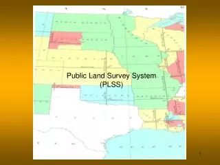
Learn about the Public Land Survey System (PLSS) that replaced older land description systems, covered vast amounts of land, and enabled westward migration. This system provided a uniform method to describe and convey land titles, making it easy for anyone to locate a parcel of land.

Public Land Survey System
E N D
Presentation Transcript
“Your observations are to be taken with great pains and accuracy, to be entered distinctly and intelligibly for others as well as yourself to comprehend all the elements necessary, with the aid of the usual tables, to fix the latitude and longitude of the places at which they were taken” – Letter from President Thomas Jefferson to Meriwether Lewis June 20, 1803
Why The Need For The PLSS • Replace older land description system • Cover vast amounts of land • Enable westward migration • Uniform method to describe and convey land titles • Easy for a lay person to locate a parcel of land
Land Ordinance Act • Land Ordinance Act on May 20, 1785, by the Continental Congress • Be it ordained by the United States in Congress assembled, that the territory ceded by individual states to the United States, which had been purchased of the Indians inhabitants, shall be disposed of in the following manner: A surveyor from each state shall be appointed by congress or a committee of the states, who shall take an oath for the faithful discharge of his duty, before the Geographer of the United States, who is hereby empowered and directed to administer the same; and the surveyor under whom he acts. • First Geographer of the United States “Thomas Hutchins”
Congressional Acts • 1812 • Created the General Land Office • 1849 • Congress established the Department of the Interior • 1946 • Abolished the General Land Office and Created the Bureau Of Land Management
Public Land States • Michigan • Minnesota • Mississippi • Missouri • Montana • Nebraska • Nevada • New Mexico • North Dakota • Oklahoma • Ohio • Oregon • South Dakota • Utah • Washington • Wisconsin • Wyoming • Alabama • Alaska • Arizona • Arkansas • California • Colorado • Florida • Idaho • Illinois • Indiana • Iowa • Kansas • Louisiana
Land Grants and Ranchos • As part of the settlement of the Mexican War of 1846-1848, "ranchos," or private land holdings established during Spanish and Mexican rule, were honored by the U.S. Government under the Treaty of Guadalupe Hidalgo with Mexico. • These ranchos, which were primarily along coastal areas of present-day California and in the San Joaquin and Sacramento Valleys, covered 9 million acres, or 14,000 square miles.
Land Grants and Ranchos • To delineate these private lands, the United States Deputy Surveyors were assigned to survey the rancho boundaries. • During the 1850s more than 30 government survey parties were deployed.
In the Field • Contracts for survey work were awarded to deputy surveyors by competitive bid. • The deputy surveyor, with a crew of chainmen, axemen, and a compassman, ran the survey lines in the field and was responsible for erecting survey monuments, marking “bearing trees,” and recording all measurements in his field notes. • The deputy surveyor’s work was verified by the surveyor general, and the field notes and plats submitted to the commissioner of the GLO for approval.
Initial Point • Surveying the public lands in California was no easy task. • Because of the size of the state and the steepness of terrain in many areas of California, the Surveyor General of the United States decided that three initial points were needed.
Initial Points for California & Nevada • Mt. Diablo • Contra Costa County • 1851 • San Bernardino Mountain • San Bernardino County • 1852 • Mt. Pierce • Humboldt County • 1853.
Base Line • Base line is extended east and west on a true parallel of latitude • Monuments are placed at intervals of40 chains (1/2 mile)
Principal Meridian • True meridian that is astronomically determined and is extended from the initial point, north and south. • Monuments are placed at intervals of 40 chains (1/2 mile)
Township and Ranges • 6 miles square
Sections • 1 mile square • 640 acres
School Section • Sections 16 and 36 of every township were usually deeded to the State. • Section 16, the school section, was leased to generate funds to support public schools. • Section 36 was leased to fund state government operations.
Homestead Act of 1862 • Allowed anyone to file for a quarter-section of free land. • The land was yours at the end of five years if… • you had built a house on it • dug a well • broken (plowed) 10 acres • fenced a specified amount • and actually lived there
Homestead Act of 1862 • Additionally, one could claim a quarter-section of land by "timber culture" (commonly called a "tree claim"). • This required that you plant and successfully cultivate 10 acres of timber.
Railroad Act of 1862 • As an incentive to get railroad track built, railroad companies were granted alternate odd numbered sections of land, to the amount of five alternate sections per mile, on either side of a completed rail line.
Roads, Fences & Monuments • In rural areas its is common for roads and fence lines to follow section or quarter section boundaries. • It is common to find physical “monuments” marking section and quarter section corners.