Download
1 / 16
180 likes | 1.16k Vues
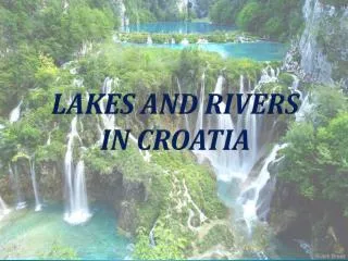
Northern Ireland Lakes and Rivers. Northern Ireland.

E N D
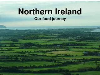
Northern Ireland Lakes and Rivers Preparing by Marius Pacevicius, 6c
Northern Ireland • Northern Ireland, province, part of the United Kingdom of Great Britain and Northern Ireland, situated in the north-eastern portion of the island of Ireland. Northern Ireland is bounded on the north and north-east by the North Channel, on the south-east by the Irish Sea; on the south and west it has a 488 km (303 mi) border with the Republic of Ireland. It includes Rathlin Island in the North Channel and several smaller offshore islands. Preparing by Marius Pacevicius, 6c
Northern Ireland Preparing by Marius Pacevicius, 6c
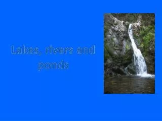
Rivers and Lakes The chief rivers of Northern Ireland are the Foyle, which forms part of the western boundary with County Donegal in the Republic of Ireland and flows into Lough Foyle at Londonderry (Derry), and the Upper Bann and Lower Bann rivers. The former rises in the Mourne Mountains and empties into Lough Neagh; the latter flows out of Lough Neagh to the North Channel. Among the many other rivers are the Main, the Blackwater, the Lagan, the Erne, and the Bush. Because of the generally flat terrain, drainage is poor, and there are extensive areas of bog and marshland. Preparing by Marius Pacevicius, 6c
Lough Neagh • Lough Neagh in Northern Ireland is the largest lough, or body of freshwater, in the British Isles, with an area of 388 square kilometres. Approximately 30 km (20 miles) long and 15 km (9 miles) wide, the lake is situated some 30 km to the west of Belfast. • The Lough is very shallow around the margins and has an average depth in the main body of the lake of about 9 metres (30 feet); although at its deepest the lough is about 25 metres (80 feet) deep. Preparing by Marius Pacevicius, 6c
Belfast Lough • Belfast Lough is an Belfast Lough, inlet of the North Channel of the Irish Sea, 20 km (12 mi) long and between 5 and 8 km (3 and 5 mi) wide. • Belfast Lough is the gateway for the City of Belfast to the Irish Sea. The River Lagan enters Belfast Lough at the City of Belfast. Preparing by Marius Pacevicius, 6c
Lough Foyle • Lough Foyle is the name given to the estuaryof the River Foyle. It starts where the Foyle leaves Londonderry. It separates the Malin peninsula from Northern Ireland. • In the summer time, a ferry service operates between County Donegal and County Londonderry over Lough Foyle. Preparing by Marius Pacevicius, 6c
Carlingford Lough • Carlingford Lough, inlet of the Irish Sea on the north-eastern coast of Ireland, situated between the Mourne Mountains in Northern Ireland. • Carlingford Lough(Cairlinn being shortened form of "Cathair Linn" literally translated as "City of the Pool") is a sea loch that forms part of the international border between Northern Ireland to the north and the Republic of Ireland to the south. Preparing by Marius Pacevicius, 6c
Strangford Lough • Strangford Lough is a lough in County Down, Northern Ireland, separated from the Irish Sea by the Ards peninsula. Strangford Lough inlet of the Irish Sea in County Down, Northern Ireland. About 25 km (16 mi) long and up to 8 km (5 mi) wide. • It is a popular tourist attraction noted for its fishing and the picturesque villages and townships which border its waters. Preparing by Marius Pacevicius, 6c
Lough Erne • Lough Erne refers to two lakes in Ireland, situated along the River Erne. This waterway is found in the North-west of Ireland, with the lakes located in County Fermanagh, Northern Ireland. The river flows in a north-westly direction, beginning by flowing north, and then curving west into the Atlantic. • Lower Lough Erne, lake in south-western Northern Ireland. Along with Upper Lough Erne and the River Erne, which links the two. Upper Lough Erne, freshwater lake in County Fermanagh, south-west Northern Ireland. About 21 km (13 mi) long and 6.4 km (4 mi) wide. Preparing by Marius Pacevicius, 6c
River Bann • The River Bann is a the largest river in Northern Ireland. The Upper Bann rises in the Mourne Mountains and flows into Lough Neagh, while the Lower Bann flows north from Lough Neagh to the sea at Coleraine. The total length is 80 miles (129km). Preparing by Marius Pacevicius, 6c
River Shannon • The River Shannon, Ireland's longest river, divides the West of Ireland (mostly the province of Connaught) from the east and south (Leinster and most of Munster). The river has been an important waterway since antiquity. First mapped by Ptolemy, the 259 km (161 mi) long river flows generally south from the Shannon Pot in County Cavan before turning west and empting into the Atlantic Ocean through the 113 km (70 mi) long Shannon Estuary. Limerick city stands watch at the point where the river water meets the sea water of the estuary. Only east of Limerick is the river no longer affected by the tides. Preparing by Marius Pacevicius, 6c
River Foyle • The River Foyle is a river in the northwest of Ireland, which flows from the confluence of the rivers Finn and Mourne at Strabane in County Londonderry, Northern Ireland, to the city of Derry, where it discharges into Lough Foyle and, ultimately, the Atlantic Ocean. Preparing by Marius Pacevicius, 6c
The End Preparing by Marius Pacevicius, 6c
River Erne • The Erne is an 120 km long river in the north of Ireland. Partially it’s lying in Fermanagh, a county in North Ireland. The river rises out of the Lough Gowna in the county Cavan in Ireland. It flews northern through Lough Oughter. Then it flews through Lough Oughter in North Ireland. This lake has got more than 90 islands. Further the erne flews through Lower Lough Erne, which has got a lot of fish. As well this lake has got more than 100 islands, the most famous is Devenish, where you can see an old abbey and a round tower. After Lower Lough Erne the river comes back to Ireland, in the county Donegal. In the end the Erne empties into the Atlantic. Preparing by Marius Pacevicius, 6c
River Lagan • The River Lagan is a major river in Northern Ireland which runs 40 miles (60 km) from the Slieve Croob mountain in County Down to Belfast where it enters Belfast Lough, an inlet of the Irish Sea. Preparing by Marius Pacevicius, 6c