
Uploaded by
abraham-clay
13 SLIDES
283 VUES
130LIKES
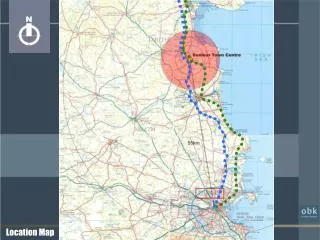
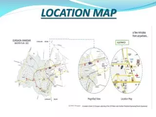
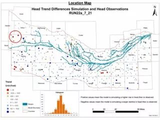
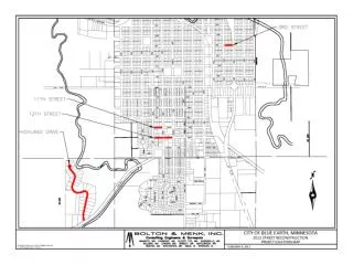
Location Map
DESCRIPTION
Location Map. C. A. B. Aerial Photo. C. A. B. OS Map. Plan. View of Station Road from bridge. View of Pedestrian Link across River. View of River Walk. New Public Square linking river walkway with Station Road. View of Station Road towards Anchor Store.
Download
1 / 13
Télécharger la présentation 
Location Map
An Image/Link below is provided (as is) to download presentation
Download Policy: Content on the Website is provided to you AS IS for your information and personal use and may not be sold / licensed / shared on other websites without getting consent from its author.
Content is provided to you AS IS for your information and personal use only.
Download presentation by click this link.
While downloading, if for some reason you are not able to download a presentation, the publisher may have deleted the file from their server.
During download, if you can't get a presentation, the file might be deleted by the publisher.
E N D
Presentation Transcript


More Related
Audio
Live Player