Download
1 / 36
370 likes | 661 Vues
NOAA Satellite and Information Service: Dissemination Systems Update. George Jungbluth Senior International Relations Specialist NOAA Satellite and Information Service. Topics. GOES Constellation Status EMWIN Broadcast pdate LRIT Broadcast Update GEONETCast Americas Broadcast

E N D
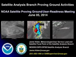
NOAA Satellite and Information Service: Dissemination Systems Update George Jungbluth Senior International Relations Specialist NOAA Satellite and Information Service
Topics • GOES Constellation Status • EMWIN Broadcast pdate • LRIT Broadcast Update • GEONETCast Americas Broadcast • DCP Program on GOES 11, transition to GOES 13 (14)
GOES-N/13 Status Launch Date: May 24, 2006 Orbital Location: 105°W longitude Designation: On-Orbit Spare Solar X-Ray Imager CCD detector partial damage during X9 solar flare and cosmic particle hit. N2 thruster anomalous thrust level. Thruster use restricted. No user impact. XRS capacitor short
GOES-M/12 Status Launch Date: July 23, 2001 Orbital Location: 75°W longitude Designation: Operational East Energetic Particle Sensor (EPS) channels noisy. X-ray positioner electronics failed. XRS cannot track Sun. Solar X-Ray Imager high voltage power supply failed. Thruster 2B oxidizer valve leak. “B” side thrusters isolated.
GOES-L/11 Status Launch Date: May 3, 2000 Orbital Location: 135°W longitude Designation: Operational West X-ray positioner electronics failed. XRS cannot track Sun. Reduced battery 1 capacity. Potential impact to user services during eclipse Imager/Sounder primary sensor data transmitter failed. Switched to redundant transmitter Command receiver B failed; Receiver A operating nominally
GOES-K/10 Status Launch Date: April 25, 1997 Orbital Location: 60°W longitude Designation: Operational Atlantic/South America Sounder Filter Wheel stalled Energetic Particle Sensor (EPS) channels noisy. No fuel remaining for stationkeeping Solar array forward mode failed. Spacecraft Inverted and solar array run in reverse. Data Collection Platform Interrogate (DCPI) Primary transmitter failed. Switched to Redundant transmitter.
South America Coverage • NOAA/NESDIS operating GOES-10 at 60 degrees West since December 2006. • Provides continuous GOES coverage of South America during GOES EAST rapid scan operations. • Positive impact to South American severe storm and flash flood forecast and warnings. • GOES-10 at end of fuel life and must be de-orbited. • NOAA has received requests to continue South American support through multiple international organizations. • NESDIS recommendation to utilize GOES-12 for South America coverage by June 2010 • Can provide dedicated South America coverage in time for the North Atlantic hurricane season • GOES-12 east-west fuel available for 3 years of operation • No fuel remaining for inclination control • Awaiting approval from NOAA Headquarters
GOES-13 replaces GOES-12 in April 2010 Minimum impact to GOES constellation fly-out scenarios Goal is to complete transition prior to 2010 hurricane season Similar sequence to GOES-8/12 transition Provides significant test period for OSDPD and direct users to evaluate ingest systems Does not require users to re-point antenna systems during drift period Incorporates a single GVAR switch from GOES-12 to GOES-13 If approved, GOES-12 would be available for South America coverage beginning in May 2010 GOES East Transition – Announced Nov 2009 GOES-12 Drift from 75 to 60 GOES-13 Drift from 105 to 75
1/19 GOES-13 Return to Normal Mode Imager, Sounder, SEM activated SXI remains off 1/21 Image Navigation Start-up (4 days) 1/25 Begin GOES-13 execution of GOES East Schedule 2/9 Perform GOES-13 Annual inclination maneuver 2/17 Conduct GOES-13 Operations Readiness Review 2/23 Start GOES-13 Eastward Drift from 105°W to 75°W 3/8 Near 99°W; Activate GOES-13 SXI/MDL 4/14 Near 81°W; GOES-13 becomes GOES-East Stop GOES-12 GVAR GOES-13 GVAR relayed through GOES-12 Users do not re-point antenna 4/26 Stop GOES-13 Drift at 75°W GOES-13 GVAR relayed through GOES-13 Switch ancillary COMM services from GOES-12 to GOES-13 GOES East Transition Timeline
What is Emergency Managers Weather Information Network (EMWIN) - Overview EMWIN is a reliable, low cost, weather warning and data broadcast system providing free and rapid dissemination of warnings, forecasts, graphics and imagery in the Americas, the Caribbean and Pacific Rim that has been in operation for over 14 years The Goal - to inform emergency managers and the public as quickly as possible of pending weather threats, increasing the likelihood of sparing lives and property EMWIN is a National Weather Service Network disseminated via GOES and the Internet 10/23/2014 12
What is Emergency Managers Weather Information Network (EMWIN) - Overview Ground systems $1800 to $2500 Receive antenna – approx. 1 meter GOES 11-12 at 9.6 Kbps / 1690.725 MHz / DFSK GOES 13-14 at 19.2 Kbps / 1692.725 MHz / OQPSK Data rate doubles Forward error correction (FEC) Enhanced data stream More information is available on the EMWIN website at http://www.weather.gov/emwin/index.htm 10/23/2014 13
LRIT (Low Resolution Information Transfer) Broadcast • Operational on GOES East and West Spacecraft • Broadcast currently consists of: • GOES GVAR Data (Derived Products) • U.S. NOAA NWS Environmental Products • U.S. NWS Emergency Manager’s Weather Information network (EMWIN) • Information from GOES Data Collection System (DCS) • Graphic images of MTSAT/MSG in JPEG, administrative text messages • GOES 11-14 at 128 Kbps / 1691.0 KHz / BPSK • Ground systems $10K and up • Receive antenna - Approximately 1 Meter
LRIT Broadcast • Baseline Products: • GOES Infrared full disk • GOES Water vapor full disk • GOES Visible full disk • GOES Infrared northern hemisphere • GOES Water vapor northern hemisphere • GOES Visible northern hemisphere • GOES Infrared continental U. S. • GOES Water vapor continental U. S • GOES Visible continental U. S. • GOES Infrared southern hemisphere • GOES Water vapor southern hemisphere • GOES Visible southern hemisphere • GOES Rapid Scan • Various National Weather Service charts • Various administrative ASCII messages
LRIT Broadcast Future Plans • Upgrade system reliability and monitoring activities • Advancesin LRIT system / Reliability increased • New DCS delivery application fm LRGS’s at Wallops Island • New Imagery Processing Hardware • New Domain 4 communications module hardware and updated application • Redundant system in place by Dec 09 • CDA Wallops Island • Expand product suite through additional imagery and environmental products • Evaluate system architecture and upgrade hardware and software in LRIT domains – future development of LRIT system will be defined through increased utilization and community outreach activities. • Integrate EMWIN product stream and NWS products into broadcast.
LRIT Broadcast Evolution GOES R Series • LRIT will transition to a combined HRIT/EMWIN service • Bandwidth will increase to approx. XXXkb/sec • NOAA DCS datastream will be integrated and offer two-way capability.
What is GOES Data Collection Service (DCS) - Overview • GOES data service for collection of environmental data in real-time from > 30,000 remote data collection platforms located across the GOES Footprint • GOES 11-14 • Uplink at 401.7-402.1 MHz at 100/300/1200 BPS • Downlink at 1694.5 MHz • Frequency Share/Time Share System • Approximately 200 Channels • Normal transmissions hourly for 5 to 10 seconds • Data available from NOAA or through direct broadcast • GOES Direct Broadcast (large antenna, by channel) • DOMSAT (commercial satellite, small antenna, one stream) • Internet connection • LRIT
What is GOES Data Collection Service (DCS) - Overview • Critical infrastructure for real-time data collection • Many Emergency warning systems in the U.S. and other countries rely on GOES DCS • Examples of GOES DCS User Community: • National Weather Service/National Ocean Service • USGS • U.S. Forest Service • International Hydrometeorological Offices • Examples of Applications of DCS Data • Tsunamis and other sea level information • Floods, earthquakes, volcanoes • Fire (fuel temperatures, wind directions and speed) • Meteorological observations
DCS System Improvements • New Transmitters use less time and frequency • High data rates already in use (300 and 1200 bps) • 100 bps transmitters must be replaced by June 2013 • Narrow band transmitters under development • Available in 2010 • Maybe software update • New data processing system to replace DAPS • DCS Administration and Data Delivery System (DADDS) • Self register at http://dcs1.noaa.gov • Internet access, browser based, 30 day archive • Beginning development for two way communication • Query and reprogram station remotely using GOES • (in 3 to 4 years)
GOES DCS Contact Information • Kay Metcalf • GOES DCS Program Manager • kay.metcalf@noaa.gov • 301-817-4558 • Letecia Reeves • GOES DCS Customer Service Representative • letecia.reeves@noaa.gov • 301-817-4563 • Email • goes.dcs@noaa.gov • URL • http://noaasis.noaa.gov/DCS NOAA GOES DCS
What is Search And RescueSatellite Aided Tracking (SARSAT) System - Overview 10/23/2014 23
Footprints of GOES 11 and GOES 12 satelliteswith Local User Terminal Locations http://www.sarsat.noaa.gov/ 10/23/2014 24
GEONETCast System Overview • Worldwide information dissemination system by which satellite and in situ data, products and services are transmitted to users through commercial communications satellites. • Receiving stations use low-cost, off the shelf DVB-S broadcast technology – Receive station cost ~ $2,000 - $3,000. • Information includes climate, weather, agriculture, air quality, disasters, and more, in support of GEOSS Societal Benefit Areas. • No internet connection required by users • No format restriction for providers or users.
GEONETCast Partners GEONETCast is a system uniting regional data dissemination systems: EUMETCast (EUMETSAT): Europe, Africa, and theAmericas FengYunCast (Chinese Meteorological Administration): Asia and parts of Pacific GEONETCast Americas (NOAA): North, Central and South America
GEONETCast Americas • NOAA-maintained portion of global GEONETCast system. • Operational in 2008 • DVB-S Standard on C-Band, bandwidth 2mb/sec. • Broadcasting over North, Central and South American and Caribbean. • Provides derived products (non L1 satellite data, warnings, alerts, geolocated imagery, etc) in 9 GEO Societal benefit areas: • Disasters - Weather • Health - Ecosystems • Energy - Agriculture • Climate - Biodiversity • Water
Publishing products to GEONETCast Connect to the broadcast server and upload files through FTP, either automatically or interactively. File transfers can be easily automated for routinely scheduled earth observation products. Products created on ad-hoc basis (such as emergency response maps and documents) can be uploaded at any time.
At the Receiving Station: Files from selected files are downloaded inmediately to the designated folder. User takes the files and uses them on his/her application
Example: Individual files received through GEONETCast are turned into an animation at the receiving station using additional tools. E.g.:c:\>gifsicle -l *.gif > animacion.gif
Using client software (like SERVIR Viz, Google Earth or ARC GIS) information downloaded from GEONETCast can be combined with other data sources for further analysis
GEONETCast User Interface • Software installed on the receiving workstation: • User friendly • Web based • Allows user to activate or deactivate “channels” as wished • Supports automation of tasks
GEONETCast and Pacific Coverage • Current broadcast areas do not cover all of Pacific Region • GEONETCast Americas covers continental North, Central and S America, contract option for additional beam to HI and AK • China Meteorological Administration (CMA) provides coverage through Asia and parts of Southwestern Pacific • Funding within NESDIS for expansion of GEONETCast Americas beyond current capability not foreseen. • Initial discussions with regional actors on potential expansion scenarios are underway
GNC Expansion into Pacific • Questions for Discussion: • Regional user requirements • Operations • Products • Capabilities • New broadcast node or extension of current regional broadcast (GNC-A or FENGYUNCast) • Funding, infrastructure, programmatic support. • Initial baseline estimates of expanding current broadcast capability to offer limited add’l Pacific coverage -
Direct Services Contact Information • Kay Metcalf • GOES DCS Program Manager • kay.metcalf@noaa.gov • 301-817-4558 • Paul Seymour • Broadcast Services Program Manager • Paul.Seymour@noaa.gov • 301-817-4521 • Marlin O. Perkins • Direct Readout Program Manager • Marlin.O.Perkins@noaa.gov • 301-817-4523 • William Johnson • EMWIN Program Manager • William.Johnson@noaa.gov • 301-713-0864 x133 • Chris O’Connors - SARSAT Program Manager • Christopher.O’Connors@noaa.gov • 301-817-3846